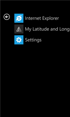
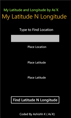
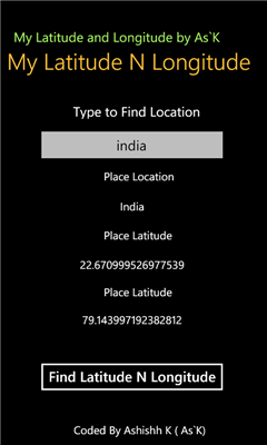
My Latitude and Longitude - MyLatitudeandLongitude app is for Find Latitude and Longitude of your desired Location
Like it? Share with your friends!
If you got an error while installing Themes, Software or Games, please, read FAQ.
Supported operating systems:
Windows 10 Mobile, Windows Phone 7, Windows Phone 8
Similar Software:
SpeedChecker SpeedChecker - Displays your current speed, as well as providing graphs for recent speed, acelleration and height. You can also plot your recent drive on a map. Supports speed display as kilometers per hour and miles per hour
Simple Altimeter Free Simple Altimeter Free - This app answers one simple question: What's my elevation, according to the phone's GPS chip?
Have you ever been hiking, skiing, boarding, or even just driving and wondered what your approximate elevation is? This is the app for you. The best part is that it's free!
Disclaimer: This app is only as accurate as the GPS chip in your phone
GPS Utility GPS Utility - GPS Utility helps you converts between all major geographical coordinate systems.
Helpful for excursionists, navigators users (TomTom, garmin, etc.), GeoCaching lovers, and Bing maps enthusiasts
Landmeter Landmeter - Call it inclinometer, call it clinometer, call it levels, call it whatever you like ... but you don't have enough of them ... There is still one missing ...
LandMeter is the official inclinometer for all off-roads enthusiasts, 4x4 cars, trucks, jeep, landrover, and trailers
Weekend Overdrive Weekend Overdrive shows many useful indicators for passengers on car drive.
Indicators such as compass, clinometer, reverse geo coder, altitude, temperature, twitter helps you recognize your situation
Coordinate Checker Check the latitude and longitude for a location on the world using this app. Just indicate a location in the world using your finger and the coordinates will be showed
Pocket Cockpit Pocket Cockpit simulates all six basic flight instruments, including airspeed indicator, attitude indicator, altimeter, variometer, turn indicator and heading indicator. It's ideal for aviation enthusiasts, both experienced and amateur, who want to feel like they're flying an airplane even while walking down the street
Speedo Speedo - Digital GPS Speedometer.
See your speed. This app shows GPS based accurate SPEED, heading, altitude and Latitude & Logitude in real time. It records your Top Speed and you can see it in a map where you were doing max speed. You would be able to email this location information to your friend. Shows speed in KMPH, MPH or m/s
GPS Distance GPS Distance - GPS Distance vous permet de calculer rapidement et facilement la distance i vol d'aoiseau qu'il y a entre deux coordonnees GPS.
Les coordonnees sont donnees de facon decimales representant la valeur de l'angle en degre et le resultat est donnee en kilometre
Other Software by developer «AshishhKhadse»:
NYSE World Home This is about New York Stock Exchange and all the live updates about NYSE
NDTV News Home NDTV News Home - NDTV is an acronym for the original name of the company, New Delhi Television. Its three national news channels NDTV 24x7, NDTV India (Hindi) and NDTV Profit (Business news) form the core of the company