Car Locator Car Locator keeps you close to your parking spot - no matter where you're headed to. This clever mobile parking application allows you to keep an eye on your parking spot without getting nervous about parking charge times or retrieving your car.
Pinpoint the exact location of your parking spot, both visually and by address
Dabble Locate Dabble Locate automatically creates and sends a Text or Email Message that contains a link to a map with your current location. This useful message allows your friends and family to open a map and see exactly where you are on the map. No more trying to explain that you are near the large green sign and the tall pine tree over by the north entrance of the west trail
My Footprints My Footprints helps you save your current location information so that you can reference the information later or share the information with friends
MyDistances MyDistances - Die App ermoglicht es, die Koordinaten mehrerer Orte zu speichern und die Entfernungen zum aktuellen Standpunkt zu berechnen. Auch Entfernungen von einem der Orte zu allen anderen gespeicherten Orten lassen sich schnell ermitteln. Alle Orte konnen schnell und einfach auf der Karte angezeigt werden
Around Me Around Me is a WP7 app which lets you to quickly find out information about your surroundings.
How many times have you found yourself in need of finding the closest coffee shop or gas station?
AroundMe lets you quickly identify your position and allows you to choose the nearest Bank, Bar, Gas Station, Hospital, Hotel, Movie Theatre, Restaurant, Supermarket..
Kinomap Logger Kinomap Logger - With its integrated GPS chip, your phone will act as data logger to record your track as an NMEA file, compatible with Kinomap.
Start recording and automatically, your location is recorded second by second (with your speed and altitude).
Then you'll be able to see the information on this track and export your NMEA file by email
A-to-B A-to-B is a Turn-by-Turn application built to demonstrate some of the capabilities of the ArcGIS API for Windows Phone.
Warning: The application is meant for demonstration purposes only! Do not rely solely on the suggested routes or instructions given by this application.
Features:
- Turn-by-turn routing. Sound notification when a turn is coming up
Mount Rainier National Park Mount Rainier National Park - Shows your location on the national park map. This app does not require a cellular or wireless connectivity, so it works in areas that don't have any network. It displays a map of the national park, with your GPS location on it
Other Software by developer «David J Kelley»:
Morse Code Lite Morse Code Lite is a code application for transmitting, receiving and transcoding morse code, via text/character based transcoding or light transmission using the screen and sound. Its like the professional version but designed more for the casual user
Wirestones Wirestones it the ultimate fanboy app for [Wire] stone showing the best in digital experience design and emerging experiences as done by [Wire] Stone. Stay in touch, get the latest screen shots and follow the most social wirestoners using this fan boy app
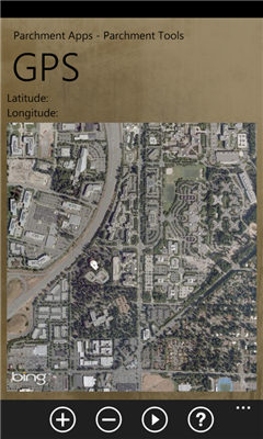
Light Light is a simple light tool that turns your screen into a light but also holds a secret. Light is also part of the parchment tools and tools for phone 7
Ruler Turns your phone into a ruler. requires you to calibrate to the system you want and screen size but is part of the parchment tools collection and tools for phone 7
Fire Ants Fire Ants - Inspired by a true story of squishing ants, fire ants helps you get your frustrations out on those evil little creatures just don't shake your phone while playing or they get mad
Simon Said Simon Said - Press the start button and follow the series of lights and sounds remembering the sequence. Simon Said is the original Silverlight Simon Says ported from WPF/Surface/Silverlight for doing programming demo's and is a codeplex project for demoing Composite codebase XAML development