GeoRecorder - The ONLY GPS logger app you'll ever need on the Android platform!
· Automatically log your location when you use Google Map, Foursquare or any other app that uses GPS information
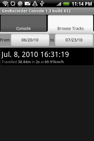
· Save logged data in KML, GPX or CSV format
· View logged tracks in built-in map view
Like it? Share with your friends!
Supported operating systems:
Google Android 1.5, Google Android 1.6, Google Android 10.x, Google Android 2.0, Google Android 2.1, Google Android 2.2, Google Android 2.3, Google Android 3.0, Google Android 3.1, Google Android 3.2, Google Android 4.0, Google Android 4.1, Google Android 4.2, Google Android 4.3, Google Android 4.4, Google Android 5.x, Google Android 6.x, Google Android 7.x, Google Android 8.x, Google Android 9.x
Similar Software:
Magellano Navigator GPS Magellano Navigator GPS - Magellan will lead you to your destination using the GPS of the smartphone and the engine of Google Maps (registered trademark from the rightful owner) or other application of road maps. You can set the destination by typing in the box or by speaking after activating the voice mode
Polaris Navigation System Polaris Navigation System - The Polaris Navigation System is a powerful navigation software for Android. It includes all the standard GPS functionality, including an odometer, altimeter, speedometer and directional compasses.
The app also allows you to record trails and view them on a map
wayg wayg - Create your trip, record your route, share your position. WhereAreYouGoing is able to record position, speed, altitude and time of your routes on your device. WhereAreYouGoing allow to share your route on the most important social network (Google+, Twitter, Facebook...), create file Kml for Google Maps or file GPX (OpenStreetMap)
EcoDrive Free Speedometer EcoDrive Free Speedometer - EcoDrive Free Speedometer - accurate and convenient GPS speedometer.
The app is designed to control the speed, economy, time, direction, etc.
Real-time economy calculations is based on the speed, acceleration and braking, descents and ascents
Current Location Finder Current Location Finder - Current Location finder which can be used to locate your location with the aid of a live satellite map you can dynamically (real time) determine ... Use the live satellite maps
BigTinCan Speed Proof Speed Proof logs your current speed, location and so on to a GPX file as fast as the GPS chip updates the system
Nav4All (Android) With Nav4All you can navigate worldwide on your own mobile phone.
You will never lose your way again and you will always know where you and your friends are located.
You get access to over 1 billion addresses on MyWorld, including Yellow Pages, phonebooks, etc.
While you're on the road you can easily save an interesting location by pressing one button
Osm2GpsMid GpsMid is a free, fully offline, vector based map application for your mobile phone. It displays your current position on a zoomable map and can be used to search for and navigate to roads or points of interest of your liking. As all data is stored in a compact binary format on your mobile phone you will incur no charges for extra data downloads
RMaps RMaps is a navigation tool. You can use RMaps as an online map viewer for some popular maps. And as an offline map viewer for your own maps created on the PC.
· Auto rotate map in driving direction.
· Auto rotate map in the northern direction.
· Compass on the map.
· Auto-follow function.
· Online search.
· Full screen mode
AndTripLog AndTripLog allows you to record your trip onto your device. The application displays the current GPS position, time and speed. You can export the trip by email and store it onto your sdcard in GPX format
Other Software by developer «Idea Matters»:
MemoDroid MemoDroid - Memory training tool for Android. Utilizes "spaced repetition" theory to manage intervals for every item based on your responses in previous repetitions in order to boost the efficiency of your learning.
Import SuperMemo data including learning progress
Surveyor Surveyor - Measure distances with a single click on your Android phone!
All you need to do is point your phone to the object you want to measure, and select the point where it touches ground from the screen.
What's New in This Release:
· Use gyroscope to improve accuracy and smoothness of Augmented Reality result
Sensor List Sensor List lists all sensors available on the device along with their current values and a plot to display their changes over time.
Including accelerometer, magnetic field, orientation, temperature, light...
Can be a handy tool for development or hardware testing purpose


")


