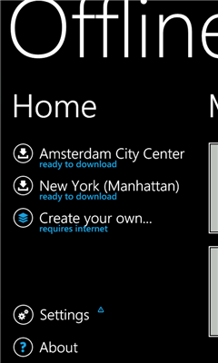
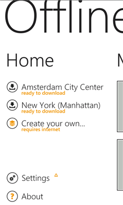
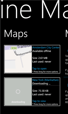
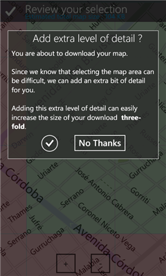
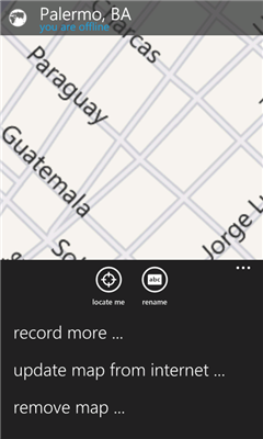
Offline Maps - Want to save money on your data plan and roaming fees abroad? Download maps and use them without having to use an internet connection!
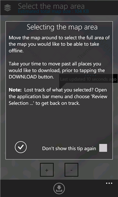
With this application you can download a map of any part in the world and take it with you when travelling.
Like it? Share with your friends!
If you got an error while installing Themes, Software or Games, please, read FAQ.
Supported operating systems:
Windows 10 Mobile, Windows Phone 7, Windows Phone 8
Similar Software:
Bochum Total Diese Anwendung ist eine ubersicht uber alle Acts bei Bochum Total und das Bermuda-Dreieck
MS Campus Maps MS Campus Maps - Need to quickly get to your next meeting? No matter if you are walking, driving, taking a shuttle, or trying to find a conference room inside a building, Microsoft Campus Maps is the solution.
Microsoft Campus Maps features:
* Walking directions to any building on the Redmond campus
Map Services This application let the user to view maps, trace routes between two places, find a place, query for the weather in the current map position
Chicago Maps Chicago Maps - Offline (no data connection necessary!) public transportation maps for the Chicago area. Click on the thumbnails and zoom in for a detailed look.
Includes:
1. an overview of the Chicago Transit Authority system with the ability to zoom into different sections using a map and/or a list
2. Night Owl bus map
Can be used in portrait or landscape view
SaraMap SaraMap is a Free Map Application that integrates with Google Map,Microsoft Bing Map and OpenStreetMap.it supports GPS Tracking either.
Main Features:
-Map Navigation with different layers support.
-Using Multi Scale Image control as map viewer core with Multi touch pan/zoom behavior.
-Switch easily between Google Map,Bing Map and OpenStreetMap
-GPS Tracking
ver 1
GeoBC Showcase GeoBC Showcase - This app takes advantage of geospatial layers provided by GeoBC. It will include Federal Electoral Districts and Local Health areas plus Primary Survey Parcels in British Columbia, Canada.
Select one of the layers from the list, then press a point on the map and hold to get information about that geographical point
ArcGIS ArcGIS is a great way to discover and use maps. Tap on the map or use your current location to discover information about what you see. Search and find interesting information in the map as well as measure distances and areas. Find community hosted maps from ArcGIS Online, ESRI's online GIS, or use the authoring tools on ArcGIS
Mymaps Mymaps - This is an extra odinary app which collaborates bing maps with gmaps or google maps...just browse on bing with the experience of google maps.
This application is a cross between gmaps and bing maps...
lets call it gingmaps :-p
Cheers and please do review