Pocket PC Geocaching Tools - Many tools in one program to help you while you are geocaching.
What's included?
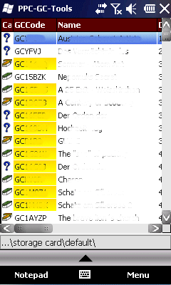
* Open GSAK databases directly
* HTML view
* Field Notes
* Hint decoder and decryption
* Several coordinate functions
* Solver
* Transformer (Text to Digits, etc.)
* Step counter
* Notepad
Like it? Share with your friends!
If you got an error while installing Themes, Software or Games, please, read FAQ.
Supported operating systems:
Windows Mobile 2003, Windows Mobile 5.0, Windows Mobile 6 Classic, Windows Mobile 6 Professional, Windows Mobile 6.1 Classic, Windows Mobile 6.1 Professional, Windows Mobile 6.5 Professional
Similar Software:
FON Access Points for Macedonia FON Access Points - FON offers you a new Points of Interest service (POIs). This allows you to download FONspots directly to your navigation device.
What does that mean? You can download a Points of Interest file directly to your navigation device
H1N1 Pandemy Flu Alert This program recognizes your current location, from GPS Receiver, download the registered flu cases from the Internet database, and in case the closest flu was near your location, it will alert you by red screen and special sounds
OpenStreetMap OpenStreetMap - Application similar to GoogleMaps but relies on OpenStreetMap.
OpenStreetMap an application similar to GoogleMaps but relies on OpenStreetMap.
It's finger friendly and showing the map on fullscreen.
GPS support and GSM triangulation (if no GPS device is present) is built in
Geo Track Geo Track- basically a software to emulate GPS, by using your nearest cell towers. It allows you to tag your location by providing you with the option for storing one or more descriptions of a location in terms of text and/or pictures.After this, your device will display these textual or image desciptions every time you visit these locations. Visit http://som4tress.blogspot
FON Access Points for Norway FON Access Points for Norway - FON offers you a new Points of Interest service (POIs). This allows you to download FONspots directly to your navigation device.
What does that mean? You can download a Points of Interest file directly to your navigation device
Gpx2bin Gpx2bin - Gpx2bin is a GPS track converter software for Windows Mobile.
It can be used to convert .gpx, .mps, .plt and .nmea formats to the tracks.bin file used by Navitel Navigator to see the track as "blue line."
What's New in This Release:
· A problem with large files opening was fixed
RulerPOIs RulerPOIs - RulerPOIs can be used to create named compact POI GPS point files. You can use the GPS on your PocketPC to create a file and view the other files via GPS distance. You can also select 2 GPS points and place them into the ruler to view the metric/imperial distance.
This program requires that you have both the 'BeanDLL
ExcelGPSer ExcelGPSer - ExcelGPSer allows you to make Pocket Excel files and attaches a GPS tag to the end of the file. You can also view the notes via GPS distance from your current GPS using "The Vincenty inverse formula for ellipsoids." (accuracy to within 0.5mm, or 0.000015")
This program requires that you have both the 'BeanDLL
FON Access Points for Spain FON Access Points for Spain - FON offers you a new Points of Interest service (POIs). This allows you to download FONspots directly to your navigation device.
What does that mean? You can download a Points of Interest file directly to your navigation device
NavIt NavIt is a car navigation system with routing engine.
It's modular design is capable of using vector maps of various formats for routing and rendering of the displayed map. It's even possible to use multiple maps at a time.
Modular, touch screen friendly car navigation system with GPS tracking, realtime routing engine and support for various vector map formats
Comments on Pocket PC Geocaching Tools:
Comments not found
If you noted an error or download link is broken, please, report it via this page or use comments.
Pocket PC Geocaching Tools is compatible with your device Airo A25