Geo Walk HD Concise Encyclopedia of Surprising Facts at Hand! Discover the world around you with simple and educational application that collects amazing and fun facts about all the most interesting things of our planet.
Geo Walk is a concise, easy-to-use and information packed encyclopedia for iPhone/iPod Touch that contains only the most interesting and valuable information about our multifaceted world. It suits both adults and children curious about far away places, great people, and the most amazing living creatures. Geo Walk can become a convenient companion for inveterate travelers who are always on the go.
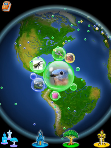
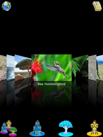
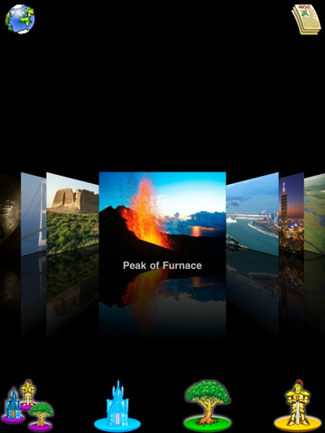
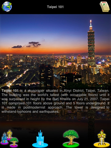
Geo Walk app features only the most amazing and unusual articles that are gathered in one place. Spin the globe to choose the most interesting place and read all there's worth to know about it! The application has 3 main categories to browse through: Places, Flora and Fauna, People. All entries are provided with colorful pictures that can be viewed in a cover-flow or chosen object mode.
· 300 UP-TO-DATE DESCRIPTIONS: Around 300 objects with up-to-date descriptions are available for your edutainment. Learn about interesting places, great people, unusual animals and plants around the world.
· SMOOTH & STYLISH INTERFACE: Intuitive, snazzy interface that allows you to smoothly scroll the photos is a real pleasure to learn from/to use.
· CATEGORY FILTER: With a category filter you can choose the category you are curious about.
· 2 SEARCHING MODES: Tap any icon on the globe to read more info about the subject of interest or use an object list for the same purpose.
· 2 VIEWING MODES: cover-flow or chosen object mode are available so you always have an option.
Like it? Share with your friends!
If you got an error while installing Themes, Software or Games, please, read FAQ.
Supported operating systems:
Apple iOS 10.x (iPad), Apple iOS 11.x (iPad), Apple iOS 12.x (iPad), Apple iOS 4.2.x (iPad), Apple iOS 4.3.x (iPad), Apple iOS 5.0 (iPad), Apple iOS 6.0 (iPad), Apple iOS 7.0 (iPad), Apple iOS 8.x (iPad), Apple iOS 9.x (iPad), Apple iPhone OS 3.2.x (iPad)
Other Software by developer «VITO Technology»:
Map of Oklahoma (US State) Map of Oklahoma (US State) - A map of the Oklahoma by VITO Technology. Good for intercity travels with SmartMap.
SmartMap is a mobile device application which uses vector and raster maps. It is compatible with any NMEA protocol GPS receiver (Compact Flash socket, serial port, BlueTooth or sleeve)
Map of Senegal Map of Senegal - A map of Senegal. Good for intercity travels with SmartMap.
Layers include:
Towns
Settlements
Airports
Roads
Railroads
Rivers
Inland water
Administrative borders
International borders
Trees
Map scale is 1:1 million.
Good for use with any version of SmartMap. SmartMap can be purchased here
Map of Oman Map of Oman - A map of Oman, divided into 8 smaller territories for the ease of use.
MUSANDAM
AL BATINAH
AL ZANIRAH
MASQAT
AD DAKHILIYAH
ASH SHARQIYAH
AL WUSTA
ZUFAR
Good for intercity travels with SmartMap
VITO SmartMap Smartphone VITO SmartMap for Smartphone is GPS moving map for your Smartphone.
It uses relatively small vector maps, which are perfect for driving or hiking with it. You can also use VITO SmartMap without maps for recording tracks to find your way back
Map of Tajikistan Map of Tajikistan - A map of Tajikistan. Good for intercity travels with SmartMap.
Layers include:
Towns
Settlements
Airports
Roads
Railroads
Rivers
Inland water
Administrative borders
International borders
Trees
Map scale is 1:1 million.
Good for use with any version of SmartMap
FunContact 3x FunContact 3x is a brand-new finger-friendly contact manager with great usability. Scrolling contacts with finger, favorite contacts with pictures, call log, 3 skins & more!
VITO SmartNavigator VITO SmartNavigator comprises benefits of two navigation products: VITO SmartMap and VITO Navigator II
Map of Tennessee (US State) Map of Tennessee (US State) - A map of the Tennessee by VITO Technology. Good for intercity travels with SmartMap.
SmartMap is a mobile device application which uses vector and raster maps. It is compatible with any NMEA protocol GPS receiver (Compact Flash socket, serial port, BlueTooth or sleeve)
Map of Western Sahara Map of Western Sahara - A map of Western Sahara. Good for intercity travels with SmartMap.
Layers include:
Towns
Settlements
Airports
Roads
Railroads
Rivers
Inland water
Administrative borders
International borders
Trees
Map scale is 1:1 million.
Good for use with any version of SmartMap


")


")
