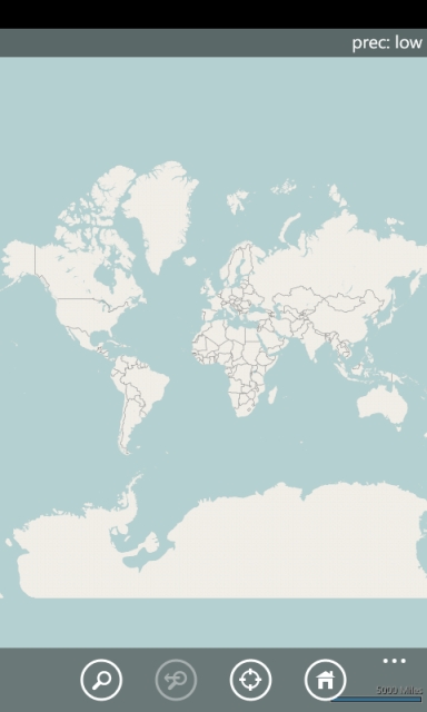
Simple OSM is a robust OpenStreetMap (OSM) client to browse and search in maps from the OpenStreetMap project (openstreetmap.org).
OpenStreetMap provides much more geographical and poi data than other well-known maps on the internet. Furthermore it is growing supremely fast. If you are looking for very detailed maps of the whole world, you will find this application most useful.
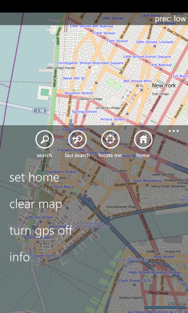
· Access to OpenStreetMap (OSM) data (Mapnik style)
· Fast zoom & pan using multitouch
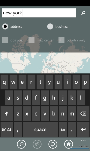
· Reliable address and business/poi search
· Customizable search
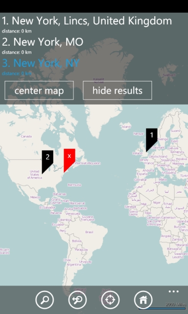
· Distance to own location is displayed with results
· Best map view is set automatically
· Fast map navigation to specified result
· Center map to own location with a single click
· Center map to a customizable "home view" with a single click
· Current altitude, speed, course and gps accuracy is displayed
· Map view follows own location if "locate me" is clicked
· Both portrait and landscape mode are supported
· Last map view is restored on application launch
The trial version includes all features, but you have to wait 1 minute before usage is allowed
Like it? Share with your friends!
If you got an error while installing Themes, Software or Games, please, read FAQ.
Supported operating systems:
Windows 10 Mobile, Windows Phone 7, Windows Phone 8
Similar Software:
Bingle Maps Bingle Maps is a full featured map application. Other than the commonly desired features like Search, Routing and Itineraries, it allows you to drop unlimited personal pins and synchronize them with your DropBox account, not to mention that it also integrates with Google Maps.
Highlights:
- You can choose to use either Bing Maps or Google Maps
redBANG Shenzhen Map-Guide NEW 2006 THE BEST MOBILE GRAPHICS YOU HAVE EVER SET YOUR EYES ON
This City map-Guide contains all THE TOP locations at your finger tips. Simple and easy to use, simply zoom in & out of this jpg map or move N, E, S or West
Map Creator for City Advisor Map Creator for City Advisor - Create public transportation maps for use with City Advisor.
What's New in This Release:
· Enable Special TimeTable editing.
· Enable customize peeks.
· Enable CAX format map generation.
· Enable Language-Code Selection for accent insensitive search.
· Accent insensitive station search
Map of Washington (US State) Map of Washington (US State) - A map of the Washington by VITO Technology. Good for intercity travels with SmartMap.
SmartMap is a mobile device application which uses vector and raster maps. It is compatible with any NMEA protocol GPS receiver (Compact Flash socket, serial port, BlueTooth or sleeve)
KingMAP2 USA-New Jersey Electronic Map KingMAP2 USA-New Jersey Electronic Map is an Electronic Map Navigation Software exclusively for Pocket PC use; besides powerful functions provided for car navigation, it also comprises integrated Electronic Map functions with an abundant information database
Travel Europe - A complete Guide, Road maps, and Phrasebook By Rick Steve Travel Europe - Rick Steves doesn't just list where to travel in Europe, he gives travelers inside information on where to stay, what to visit, and how to get there -- economically and hassle-free. With Rick Steves as their guide, travelers can delve into European culture, make friends with the locals, and experience everything Europe has to offer
MapsGo MapsGo - Simple GIS for Desktop and Pocket PC with export to MapMap for Palm
CartoType Demo (Windows Mobile) CartoType A simple map viewer using the CartoType library.
The program is installed in the folder My Device/Program Files/CartoType. Click on the CartoTypeDemo icon to run the program, then select Open Map.. from the menu to open a map. A map of Berlin is supplied as a sample.
Apart from the menu commands, you can zoom in by pressing the joystick or rolling ball
Other Software by developer «Till Fischer»:
not found
Comments on Simple OSM:
Comments not found
If you noted an error or download link is broken, please, report it via this page or use comments.
Please, select device to check if Simple OSM supports it


![USA-VT [Vermont] Map for EagleEye PDA Tracking System](https://static.mobyware.org/data/images/def_program_reduced.png "USA-VT [Vermont] Map for EagleEye PDA Tracking System")

")


