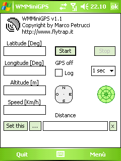
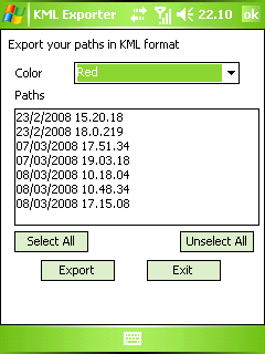
WMMiniGPSis a Windows Mobile 5/6 software which gets your GPS data in a really simple gui, showing you latitude, longitude, altitude and speed. It can log all to file and it can export your paths to Google Earth's kml and gpx format.
There's a compass, which shows your direction and you can set latitude and longitude of a point and the program will show you the way to reach it with a radar, telling you how many meters / kilometers there are to cover.
What's New in This Release:
· fixed export dialog box problem
Like it? Share with your friends!
If you got an error while installing Themes, Software or Games, please, read FAQ.
Supported operating systems:
Windows Mobile 5.0, Windows Mobile 6 Classic, Windows Mobile 6 Professional, Windows Mobile 6.1 Classic
Similar Software:
NoniGPSPlot Pocket PC NoniGPSPlot allows you to locate your position in relation with other GPS points, to see the journey you have traveled.
You can find back your place at harbour after a trip on boat, the starting point of an excursion or locate your car in a huge car park, A place of which you know the location, To see the excursion you made, Speed trap alert or lots of other things..
TaxGoogler TaxGoogler uses the GPS on your PocketPC to find the 50 closest tax services sorted via GPS distance. Tap the button to start the GPS and when you get a lock tap on it to view the list of tax services. You can also dial the shop. The GPS maps and tax search service is provided by Google
LocationSMS LocateSMS permit to include your GPS-coordinates into a SMS
FileGPSer FileGPSer - FileGPSer uses the GPS on your PocketPC to find your current GPS location and allows you to re-name files on your PocketPC with the GPS location tag. You can also explore the files in a folder in distance order based on your current GPS. Tap on the file to view the file in the associated application.
This program requires that you have both the 'BeanDLL
StoreGoogler StoreGoogler uses the GPS on your PocketPC to find the 50 closest local business from 2,238 type of Yellow Pages entry sorted via GPS distance. Tap the button to start the GPS and when you get a lock tap on it to view the list of local businesses. The GPS maps and business search service is provided by Google
FON Access Points for Kuwait FON Access Points for Kuwait - FON offers you a new Points of Interest service (POIs). This allows you to download FONspots directly to your navigation device.
What does that mean? You can download a Points of Interest file directly to your navigation device
FON Access Points for Guatemala FON Access Points for Guatemala - FON offers you a new Points of Interest service (POIs). This allows you to download FONspots directly to your navigation device.
What does that mean? You can download a Points of Interest file directly to your navigation device
VoicePOIer VoicePOIer - VoicePOIer is a full-featured named voice recorder with GPS location tagger. You can make named voice recordings and the GPS location is appended to the end of the file. You can browse the files via GPS distance. Tap on the wave file to play it back.
This program requires that you have both the 'BeanDLL
GPSWM65Twitter GPSWM65Twitter sends GPS-based tweets to Twitter
CellGPSer CellGPSer uses the cellular signal on your device to instantly find your approximate GPS. Tap the button while your phone is on and the program will send your cellular tower information to OpencCellID.org. The program will then display the approximate GPS. This service is provided by OpenCellID
Other Software by developer «Marco Petrucci»:
not found
Comments on WMMiniGPS:
Comments not found
If you noted an error or download link is broken, please, report it via this page or use comments.
Please, select device to check if WMMiniGPS supports it