NaviPOWM is a car navigation system capable of running on a variety of operating systems. Only OSM based map data is supported. Realtime routing engine is planned in a later version. Geocaching and city guide functionality are also planned. other:
· more POI types
· more way types
· support more targets at once
· switch between targets by clicking on target display
· coastlines bugfixing
What's New in This Release:
fixed bugs:
· crash under Windows XP when displaying areas with holes
· areas with holes not drawn properly on Windows mobile
implemented feature requests:
· Support for gpsd
What's New in 0.2.5:
fixed bugs:
· TrackLog must show real GPSCoor
implemented feature requests:
· No aygshell.dll on PNA systems
· Show oneway arrow on streets
· Visibility of speed-pos box adjustable
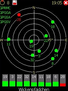
· Save received data also as GPX file
other:
· area display (sea) speedup
· reorganized directories
· support for CMake
Like it? Share with your friends!
If you got an error while installing Themes, Software or Games, please, read FAQ.
Supported operating systems:
Windows Mobile 2003, Windows Mobile 5.0, Windows Mobile 6 Classic, Windows Mobile 6 Professional, Windows Mobile 6.1 Classic, Windows Mobile 6.1 Professional, Windows Mobile 6.5 Professional
Similar Software:
GPSAltimeterer GPSAltimeterer uses the GPS on your PocketPC to find your altitude. You can view in Meters or Feet. This can be used on a plane that does not allow full GPS. Start the program to find your height via GPS on it. NOTE: Make sure you are allowed to use this program before starting the application
FON Access Points for Ireland FON Access Points for Ireland - FON offers you a new Points of Interest service (POIs). This allows you to download FONspots directly to your navigation device.
What does that mean? You can download a Points of Interest file directly to your navigation device
hdSpeedo hdSpeedo is a speedometer that is driven from a GPS signal.
· User configurable background colours
· Day/Night colour schemes (Choose by clicking on the top status bar)
· Rotatable (Portrait or Landscape)
· Gesture enabled (Move between screens)
· Point and Track logging now available as
MapNameds MapNameds allows you to download and name GEO tagged maps. When you get a GPS lock select 'New Map' to download a map of your current location and enter the location name. The maps are tagged with the GPS of the location. This service is provided by Google
amAze (Sony Ericsson) AmAze is a first of its kind free navigation and local search service. It is free to download and use and it contains wide coverage of maps including aerial photo in Europe, North America, Australia and parts of Asia and Africa
H1N1 Pandemy Flu Alert This program recognizes your current location, from GPS Receiver, download the registered flu cases from the Internet database, and in case the closest flu was near your location, it will alert you by red screen and special sounds
Astrolabe Astrolabe uses your PDA to acquire your GPS position and send it through an SMS.
The GPS position is update every 5 seconds (in order to conserve energy).
SMSs can be sent automatically at regular time intervals
Pocket Caddy Pocket Caddy - #1 Golf GPS app: 3D flyover of holes, yardage to greens, shot recording, stats, scorecard, hazard carry or lay up position. Positioning is shot to hole, not cart to hole. Free PC Analytics inc. 3D Google Earth replay with stats, and Free DIY Course Mapping software both available from website. No extra costs for courses
FON Access Points for Jersey FON Access Points for Jersey - FON offers you a new Points of Interest service (POIs). This allows you to download FONspots directly to your navigation device.
What does that mean? You can download a Points of Interest file directly to your navigation device
SMSLocationFrog - SMS your GPS Coordinates SMSLocationFrog sends the GPS coordinates of your location to a mobile number using SMS. Automatically updates your location when you are on the go. You may select the mobile number from your contacts or type in directly. Send the SMS using the menu or set the options to send the SMS automatically.
This handy program is simple to use and easy to setup
Other Software by developer «Julian Bugariu»:
not found
Comments on NaviPOWM:
Comments not found
If you noted an error or download link is broken, please, report it via this page or use comments.
NaviPOWM is compatible with your device Acer Ferrari Racing


")


