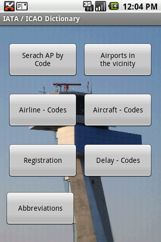
IATA / ICAO Dictionary -This application is an offline database for IATA / ICAO airport, airline, aircraft, delay codes and aircraft registration codes.
The airport database provides:
- Name
- Elevation
- Latitude and Longitude coordinates,
- timezone,
- runway and communication information (not every airport)
- Metar / TAF reports (not every airport)
- google map (not every airport)
- sunrise / set calculation
- find other airport in the vicinity of the selected airport or from your present position (GPS required)
- calculate the distance to the selected airport (GPS required)
The airline database provides:
- Name
- Country
- Callsign
- picture of the airline with airliners.net
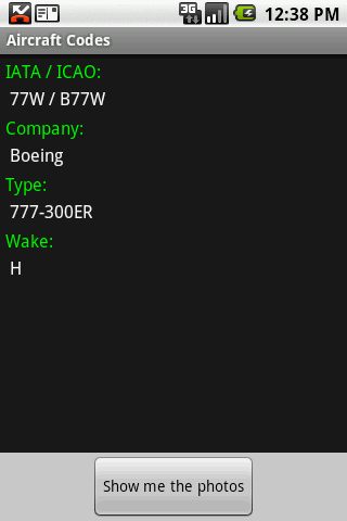
The aircraft database provides:
- Company
- Type
- wake category
- picture of the aircraft with airliners.net
Other functions are:
AC registrations; selection by
- country - registration
- registration - country
Delay codes
general aviation abbreviations
Like it? Share with your friends!
Supported operating systems:
Google Android 1.5, Google Android 1.6, Google Android 10.x, Google Android 2.0, Google Android 2.1, Google Android 2.2, Google Android 2.3, Google Android 3.0, Google Android 3.1, Google Android 3.2, Google Android 4.0, Google Android 4.1, Google Android 4.2, Google Android 4.3, Google Android 4.4, Google Android 5.x, Google Android 6.x, Google Android 7.x, Google Android 8.x, Google Android 9.x
Similar Software:
Paris Metro This application grants you fast access to the last Paris city metro map, no internet connection once the app has been installed. Zoom controls added for better control. Fast and simple
HotPads Map search apartments, houses for rent, real estate, vacation rentals and hotels Take your housing search on the road with HotPads map based housing search * Use GPS location or address * Search apartments, rental houses, real estate, vacation rentals, and hotels
Trip Journal for Android Trip Journal for Android - Trip Journal is a handy mobile application that allows travelers to record the details of their trip using their Android smartphones. The app uses the GPS receiver of your mobile device to record your route and shows the path you have taken on a map, making it easy to retrace your steps
Singapore Hotels Search Singapore Hotels Search Book Cheap Singapore Hotels. Save Up to 80% Singapore City Hotels The world's largest hotel search engine that combines all hotel deals from the best travel sites into one free, quick and easy search. Genius!
Beautiful Reasons to Visit Australia Beautiful Reasons to Visit Australia - The continent Down Under nestles within itself a plethora of wonders — both natural and man-made. Tourists from across the globe throng.Australia might be on the other side of the world, however, the country has some of the most The trip with a cruise will provide with the beautiful coast views
Subway Surfer Guide Subway Surfer Guide lets you for advanced game play. Lots of tricks, hide areas and so are available through this handy product
Kayak Flight and Hotel Search Kayak Flight and Hotel Search - Travel search by Kayak. Find Hotel Rates, Cheap Flights and Airline Tickets on Kayak.com. Get Hotel Deals, Cheap Airfare and Book Cheap Tickets without Fees. Free Track Flight Status from flightstats. Free itinerary management, and calendar integration for trips. Google maps integration for hotels, airports, and trips
Japanese Traffic You can check real time traffic info in Japan. Not only highways but also local! This application displays real time traffic conditions in Japan which are released by JARTIC. This has Japanese and English UI
Yurtdisi Gezi Rehberi Yurtdisi Gezi Rehberi - Yurtdışına çıkmadan önce nereye gideceğinizi seçmenize yardımcı olacak, güncel bilgilere ulaşabileceğiniz bir uygulama
Other Software by developer «Steve Dexter»:
Snowtam Decoder Snowtam Decoder - You have a snowtam in the metar report, you want to decode. Snowtam Decoder does it for you.
· Decoding of a snowtam in metar format
· Explanation of the items (A ,B , C, ..
Aviation Weather with Decoder Aviation Weather with Decoder - An easy way to receive metar and TAF reports from NOAA
Guess the X Guess the X - With this game you can guess a flag, a capital, a land and boundaries.
There are four input methods available to enter the answer: an autocomplete editbox, via a listview, multiple choice and a tap mode.
There are also options to change the color, size and font