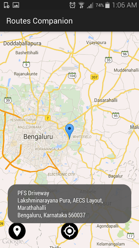
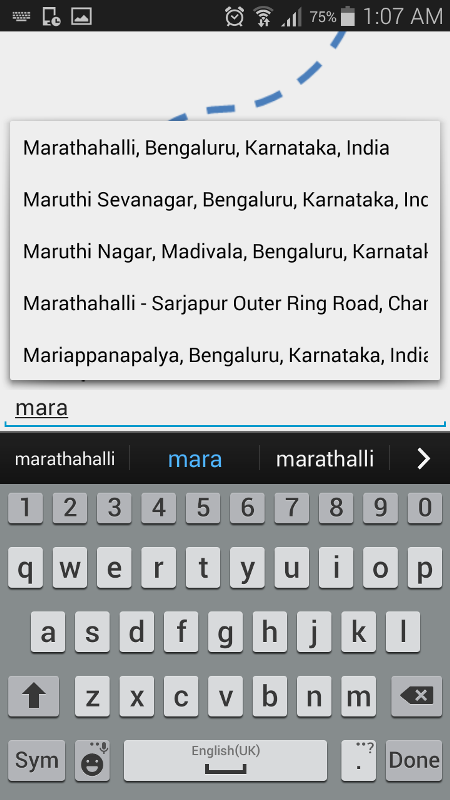
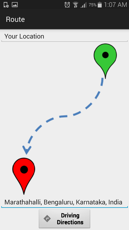
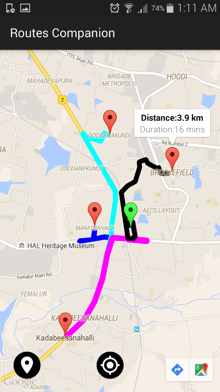
Routes Companion - Routes Companion is an app which helps users planning routes intelligently. The app introduces simultaneous search of multiple destinations feature from present as well as user defined source location where the contemporary apps lack in. The app uses multi-color display for different paths. Also it displays the common path covering present location and searched destinations in one color along with driving distance and duration. App also offers the facility to know present address of user. Other attractive feature includes one-tap availability of Navigation feature for searched location. Despite the presence of various route planner apps in market, we think no algorithm is as efficient as human brain and experience on road. Human mind is beautiful and invincible. Wish you a great route companion experience. Happy Routing!!!
Like it? Share with your friends!
Supported operating systems:
Google Android 3.0, Google Android 3.1, Google Android 3.2, Google Android 4.0, Google Android 4.1, Google Android 4.2, Google Android 4.3, Google Android 4.4
Similar Software:
Yelp: Food, shopping, services Yelp - is an application, which will let you find places you are interested in on the map within seconds. This wonderful guide on seraching for wonderful facilities to eat, drink, have rest or have fun. In this application you will find reviews on facilities, see pictures, get the location and even order delivery
Learn Google Maps Learn Google Maps - The reference has been prepared for the beginners to help them while using Google Maps JavaScript API. After completion of this tutorial you will be able to use JavaScript API in your web page. Google Maps is developed by Google, it is a free web mapping service which provides various types of geographical information
Bagf Maps This is the first Map Application developed by Bagf, Inc. and in cooperation with Google, Inc. It is a honor for us to work with Google.. Also is it a honor to can share an Application that comes from us and Google! Enjoy!
TripComputer TripComputer is a personal off-road GPS navigation utility software for Android phones, that has been created for active people, who love travel by hike or bike.
The application does not use Internet connection or Google Maps for navigation or track recording, but you can share your data to others, or store your data on server
Outdoor Offline Maps for Android Outdoor Offline Maps for Android - The Outdoor Navigation software is your best friend through your adventures in the wild.
Go into the outdoors with confidence and enjoy your activities without worrying about the tools to help you navigate. Your Outdoor Navigation app is made by the people who have been developing this software since 2003 across multiple platforms
Map Locate Ad This app is not created to replace Google Maps or other feature rich mapping apps. What this app does is to serve a simple need for certain group of users. Use case is you own jpg,png image files of tradeshow,house,store,apartment,garden etc floorplan and you want to draw pins on different location
amAze GPS light edition amAze GPS light edition provides access to worldwide street maps, full topographic map coverage of the USA and satellite imagery for 200 major cities around the world. It allows you to search in a worldwide rich POI database and you can upgrade to the full version that includes turn-by-turn voice guided navigation from within the application
Art Places Art Places is a software application for the Android mobile operating system.
The application gets our position through the GPS in the mobile device and shows us our current location in the maps application. of maps
ViewRanger GPS ViewRanger is a unique mapping, navigation, tracking, and information tool for mobile phones that provides fully featured outdoor gps and trail navigation through a natural and intuitive display. ViewRanger transforms a Nokia or other Symbian S60 smartphone into a fully featured trail navigation system
Street View on Google Maps Street View on Google Maps - New! Street View smart navigation -- move around by dragging "Pegman" where you want to go. Try Street View on Google Maps to view street-level imagery from your phone. To use Street View, open Google Maps, search for a place or long-press the map, and tap the Street View option
Comments on Routes Companion:
Comments not found
If you noted an error or download link is broken, please, report it via this page or use comments.
Routes Companion is compatible with your device Acer Liquid Jade Plus / Dual SIM S55