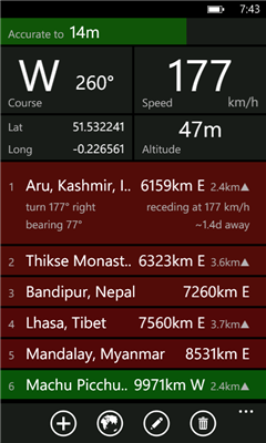
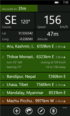
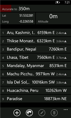
Distant tells you where places are in relation to where you are now. It lists your places in order of distance, and colour codes them so that it is easy to tell at a glance whether you are getting closer or further away. It also tells you how long it will take to get there if you keep moving at the current speed. Places can be entered visually using Bing Maps or directly by entering GPS co-ordinates.
Ever been on a long bus ride and wondered whether there are minutes or hours to go until you reach your destination? Ever had to negotiate with a cab driver who claimed that your destination was "very far away"? Once you got into the cab, did you wonder whether it was going in the right direction at all? Add a waypoint that represents your destination and track your progress in real time.
Going somewhere where you don't have mobile internet access or there is no coverage? Preload your waypoints while you still have access. Once this is done the app no longer requires data or even a signal. It works fine as long as you have a clear view of the sky and can get a GPS fix.
You can also use it to keep track of where you parked your car ...
Like it? Share with your friends!
If you got an error while installing Themes, Software or Games, please, read FAQ.
Supported operating systems:
Windows 10 Mobile, Windows Phone 7, Windows Phone 8
Similar Software:
TrackUrSelf This application only tracks the location and displays it on the viewer
Smartview24.com Smartview24.com - Englisch:
Realtime online tracking, social networking, free messenger...
smartview24.com a realtime Online Tracking Portal with various functions. Use smartview24.com for business and private. .No limits due to the unique combination of Web- and the Phone- application. The integrated messenger enables you to communicate via phone or PC / laptop
Geotagged List Geotagged List allows you to "tag" your current location and add photo, a short description, and position. You can keep a list of these items so you can navigate your way back to these places. The
A-to-B A-to-B is a Turn-by-Turn application built to demonstrate some of the capabilities of the ArcGIS API for Windows Phone.
Warning: The application is meant for demonstration purposes only! Do not rely solely on the suggested routes or instructions given by this application.
Features:
- Turn-by-turn routing. Sound notification when a turn is coming up
Yellow Pages (Windows Phone) Yellow Pages auto locates where you are and gives you relevant search results based on your location. It includes quick search shortcuts for the most commonly used terms. Similar apps make you type out everything you are searching for, and your location. Try the Yellow Pages once and you will wonder how you ever got along without it
Find My Car Find My Car - Did you ever park your car and not remember where it was parked? It can be hard to find your car again in this situation. With this application it allows navigate from your current location to your car. It is also possible to store the parking ticket expiry time with a countdown
SOS lite SOS lite - This program let you make calls or send text with your location when you are in a emergency,
and need for help.
*Lite version:
2 cases limit
no calls, text only
" - SOS lite - " mark at the bottom of message
advertisment
Follow this steps to complete setting:
1. You may define different cases that you may encounter
(Ex
GPS Tracker Lite GPS Tracker Lite is an application that tracks your route while you move (walk, run, drive) and shows two main things: statistics of the route, and a map
Velo en ville Localisation et disponibilite des velos en location dans differentes villes (Paris, Toulouse, Marseille).
Possibilite de gerer des favoris
Other Software by developer «dixiak»:
not found
Comments on Distant:
Comments not found
If you noted an error or download link is broken, please, report it via this page or use comments.
Distant is compatible with your device Acer Liquid Jade Primo LTE Dual SIM


")


