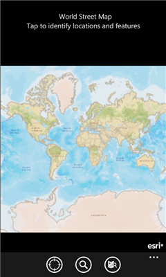
ArcGIS is a great way to discover and use maps. Tap on the map or use your current location to discover information about what you see. Search and find interesting information in the map as well as measure distances and areas. Find community hosted maps from ArcGIS Online, ESRI's online GIS, or use the authoring tools on ArcGIS.com to create your own maps that can be used in ArcGIS. Collect and edit data within a map and share your edits with others.
If you are an existing ESRI customer, this application is part of your ArcGIS system. You can share your corporate maps and extend the reach of your GIS to Windows Phone devices within your enterprise using ArcGIS Server.
Features
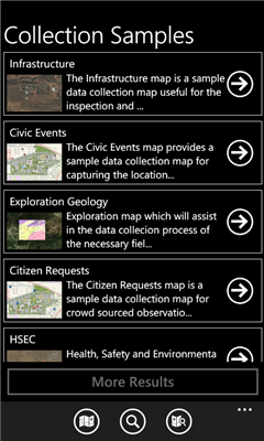
- Use maps authored in ArcGIS.com
- Navigate map galleries
- Access your own GIS data
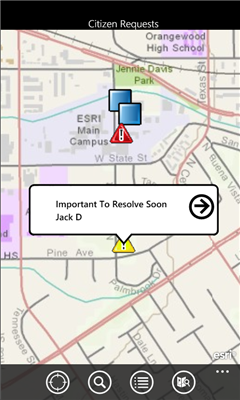
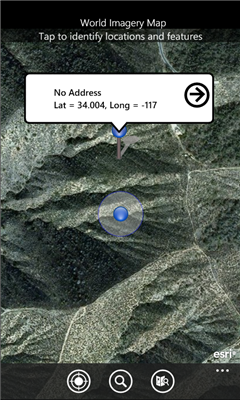
- Display and zoom to current location
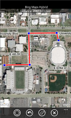
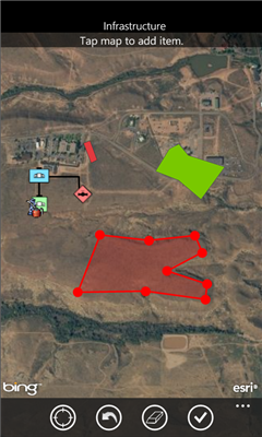
- Perform linear and area measurements
- Retrieve detailed map metadata
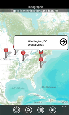
- View feature attribute information
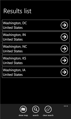
- Perform keyword search and get access to relevant information
- Change the visibility of layers
- Access popular maps faster by adding them to your favorites list
- Use your GPS or tap on the map to collect and update GIS data
- Attach photos to what you collect
Like it? Share with your friends!
If you got an error while installing Themes, Software or Games, please, read FAQ.
Supported operating systems:
Windows 10 Mobile, Windows Phone 7, Windows Phone 8
Similar Software:
Map_launcher Map_launcher - WP7 has a several built in launchers, but the map app does not have one. It's unfortunate because I think it's fairly common that you'd want to have a link to get directions in a mobile app since you are, you know, mobile
You Are Here You are lost and don't have a GPS? Don't worry, this application always shows you where you are, with a precision of 50 centimeters!
A-Z London Visitors A-Z London Visitors - Visiting London? Download A-Z's handy free London Visitors' Map. The map provides a quick and simple overview of the major places of interest in London.
For more detailed mapping covering a much greater area, please see our full A-Z of London app (search Marketplace for A-Z London)
Map Compare Map Compare - Map Compare allows you to compare 12 different maps from Bing, Google, Yahoo and Open Street Maps side by side on a single screen
Canada Topography Canada Topography - provides topographic information for the entire country of Canada. The maps provide details such as altitude, railways and numerous other layers. Using the GPS you can center on your current location and even zoom to specific areas of the country.
All maps are provided by Geocratis Canada (http://www.geogratis.gc.ca/geogratis/en/service/toporama
XMaps XMaps - With xMaps you have the possibility to use the worldwide map data from openstreetmaps.org on your phone. xMaps comes without any map data, you can download any maps in different zoom levels for free. You can zoom in / out and rotate and tilt the map.
Use xMaps to search a point by coordinate or to plan a travel route by car or by foot
MapStalt Mini MapStalt Mini is an application that is meant to bring the map to completeness. In the case of the open street map, many details are missing, and MapStalt puts to power to complete the map into the hands of the mobile user. With MapStalt, a user can add something as simple as a building address and latitude/longitude or complex details such as business hours of operation