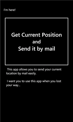
I'm here! - This app allows you to send your current location by mail easily.
I want you to use this app when you lost your way...
Application requires GPS in order to make e-mail body automatically. We don't store your location data.
Like it? Share with your friends!
If you got an error while installing Themes, Software or Games, please, read FAQ.
Supported operating systems:
Windows 10 Mobile, Windows Phone 7, Windows Phone 8
Similar Software:
Waypoints Waypoints - Waypoints is an application that provides information how to get to your destination based on your current location.
Lost? Waypoints can help you. Based on your current location and your destination, it will plot a course for you and provide a detail map and itinerary for you to follow.
Not sure where you want to go? Waypoints can help you
GPSInfo GPSInfo is a simple tool for displaying all the data from your Windows Phone 7 GPS receiver. It allows you to see: actual coordinates (Latitude and Longtitude), GPS date and time, speed, current course (relative to North), horizontal and vertical accuracy
WhereAmI This application simply shows you where you are by displaying your current latitude and longitude
Location Sender Location Sender lets you send your GPS location to multiple contacts in a variety of formats. It was developed as a case study for my MVP app framework found at http://pmvp.codeplex.com
Formats include: decimal lat/long/alt, Degrees/Minutes/Seconds, WP7 maps URL, Google Maps URL, or Bing Maps URL
Mount Rainier National Park Mount Rainier National Park - Shows your location on the national park map. This app does not require a cellular or wireless connectivity, so it works in areas that don't have any network. It displays a map of the national park, with your GPS location on it
Back Track Free Back Track Free allows you to easily view your current location and save your position. The saved location can be retrieved at a later time when you may need to find your way back. In addition, Back Track offers directions to help direct you back to the saved location along with a visual route and your current position
MyDistances MyDistances - Die App ermoglicht es, die Koordinaten mehrerer Orte zu speichern und die Entfernungen zum aktuellen Standpunkt zu berechnen. Auch Entfernungen von einem der Orte zu allen anderen gespeicherten Orten lassen sich schnell ermitteln. Alle Orte konnen schnell und einfach auf der Karte angezeigt werden
NOAA Buoy NOAA Buoy - The National Oceanic and Atmospheric Administration keeps a database of information retrieved from smart buoys. This app retrieves the data from the buoys surrounding your current location. You can also change your location to look for other buoys
Legoland California Find your way at Legoland California. This app shows your current location on the attractions map
Other Software by developer «hrontan»:
JPDictionary JPDictionary - This is Japanese dictionary app.
You can use many dictionaries from "イースト辞書webサービス".
It contain Japanese keyboard. So you can use Japanese for search.
※Some labels in it is displayed in Japanese