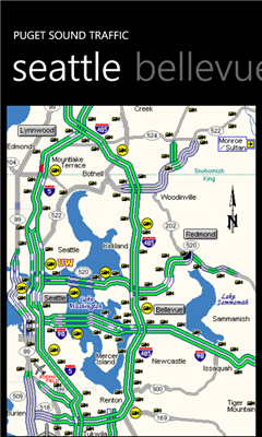
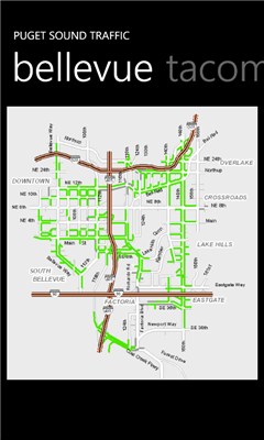
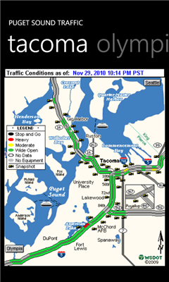
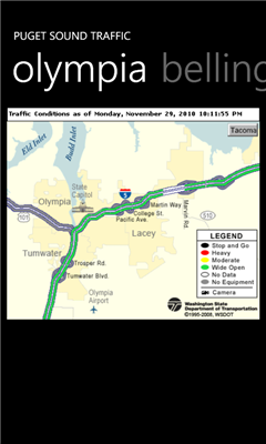
Puget Sound Traffic is a simple and quick way to view traffic conditions in the Puget Sound area.
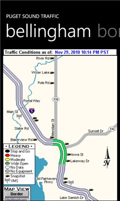
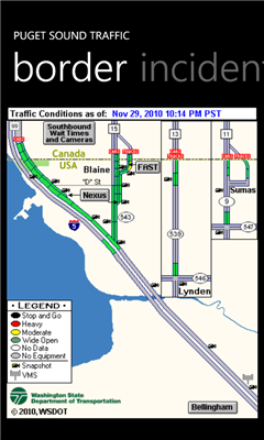
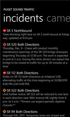
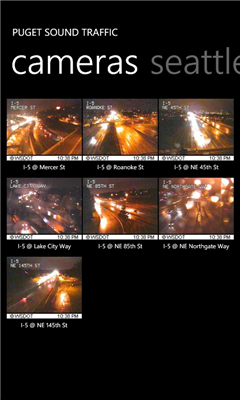
Maps are fetched from the Washington State Department of Transportation as well as other sites for Seattle, Bellevue, Tacoma, Olympia, Bellingham and the US/Canada border. Recent incidents from the WSDOT area also displayed.
Maps are not interactive. The maps are just the most recent images from the WSDOT.
Gently shake the phone to refresh the current view.
------
Version 1.2 makes adding cameras a bit easier. It also contains some bug fixes and performance enhancements.
Version 1.1 adds support for pinning your favorite traffic cameras to the cameras page. This version also adds a trial version which is ad supported. The paid version removes the ads.
Please visit http://www.straypixel.com for comments/suggestions.
Like it? Share with your friends!
If you got an error while installing Themes, Software or Games, please, read FAQ.
Supported operating systems:
Windows 10 Mobile, Windows Phone 7, Windows Phone 8
Similar Software:
WorldMaps Developed by Salman Shakeel
This application provides you total solution to navigation it is combinations of multiple maps at one place
Sun Locator Lite Sun Locator Lite - See a map of where the Sun is shining!
Sun Locator Lite displays a map showing the areas of night and day on the Earth. The map displays your current location and gives your current geographic coordinates.
No network coverage is needed to run this app
En Zaragoza En Zaragoza - Localiza cientos de lugares de interes de Zaragoza rapidamente a traves del mapa.
"En Zaragoza" es una aplicacion gratuita que permite localizar, mediante un mapa de la ciudad de Zaragoza, cientos de lugares de interes. Localiza centros de salud, estaciones Bizi, farmacias, parques, etc
Offline Maps Offline Maps - Want to save money on your data plan and roaming fees abroad? Download maps and use them without having to use an internet connection!
With this application you can download a map of any part in the world and take it with you when travelling
GMapPro GMapPro - Features:
1. Use Google Maps which is the most complete mapping solution available in the world
2. Download the maps of desired area, and use them while you are offline
3. Provide a list of downloads so you can delete them in future (if you don't wish to keep them anymore)
4. Use the phones internal GPS, to find you on the map
5. Markers:
5
GeoBC Showcase GeoBC Showcase - This app takes advantage of geospatial layers provided by GeoBC. It will include Federal Electoral Districts and Local Health areas plus Primary Survey Parcels in British Columbia, Canada.
Select one of the layers from the list, then press a point on the map and hold to get information about that geographical point
ArcGIS ArcGIS is a great way to discover and use maps. Tap on the map or use your current location to discover information about what you see. Search and find interesting information in the map as well as measure distances and areas. Find community hosted maps from ArcGIS Online, ESRI's online GIS, or use the authoring tools on ArcGIS
Tube Map Tube Map - Get round on the London tube like never before! Get LIVE train status updates on a map that you can scroll
Other Software by developer «Eric Davison»:
Leaderboard Leaderboard - Wondering who's leading at this week's tour stop? Fire up Leaderboard to get a quick view of the top 20 or so players. Tap the leaderboard to get a full, more detailed view.
Gently shake the phone to refresh.
http://www.straypixel