Locus - addon Contacts - This is simple addon for Locus mapping application (version 0.9.17 and higher).
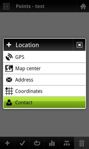
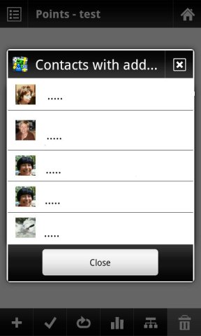
Allow to search contact location by address in Locus and add result into points, path or wherever is location needed.
This addon do not have any screen or widget.
Like it? Share with your friends!
Supported operating systems:
Google Android 1.5, Google Android 1.6, Google Android 2.0, Google Android 2.1, Google Android 2.2, Google Android 2.3, Google Android 3.0, Google Android 3.1
Similar Software:
Maps on free Maps on free - navigation maps which can be used in offline mode. All you need to do is to download the information to the memory card of your device. You can add files with ready routes and marked orienting points. You don't have to worry about constant Internet connection anymore while travelling
OSMTracker for Android OSMTracker stands for OpenStreetMap Tracker. It allows you to track your journey and mark significant way points. Way points can be marked with a tag using a button, with a quick voice record, a text note or by taking a picture. The various button pages and layouts can be customized to suit your OpenStreetMap activities
Sensorly Map Viewer Sensorly Map Viewer - How good is your cell/mobile network coverage where you need it?
Is your favorite WiFi network going to be available at your vacation spot?
See the answer with this application and join us to build worldwide coverage maps.
(Data collection is configurable and can be turned off
amAze (Samsung) AmAze is a first of its kind free navigation and local search service. It is free to download and use and it contains wide coverage of maps including aerial photo in Europe, North America, Australia and parts of Asia and Africa
UWM Mobile UWM Mobile is UWM's official iPhone and Android app. We built it from the ground-up to make your life on campus better. Get access to maps, directories, bus routes and more. ** If you run into problems, please email: uwm-mobile@uwm.edu **
Map Explorer Map Explorer is a prototype that tries to improve map browsing experience. It is basically Google maps with an overlay that shows POIs even if they are beyond the display. Use the preferences to test different visualizations
CopsAlarm No more tickets Show where the hiding police are on Google Map As well as speed cam,red light locations Lite shows police,red lights only
Disaster Alert Disaster Alert (by PDC) - Current global disaster info on an interactive map Disaster Alert (by PDC), Active Hazards on an interactive map and in a list as they are occurring around the globe. Additional hazard information can be viewed and shared
BreadCrumbz Because a picture is worth a thousand nav directions With BreadCrumbz, you can navigate using pictures and a map. Picture routes can take you off-road or inside buildings. Create your own picture routes and share them with your friends and the world. 1
Other Software by developer «menion.asamm»:
Locus - addon AR This is BETA version of simple addon for Locus mapping application (version 1.1.0 and higher). Allow to show actual POI's visible on map, in Augmented reality view. In Locus Free, usage is limited to 1 minute. This addon do not have any screen or widget


")


