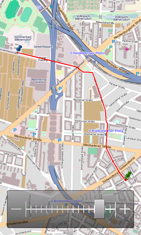
OpenMobileMaps - An application similar to Google Maps, but relying on OpenStreetMap
· showing map in fullscreen
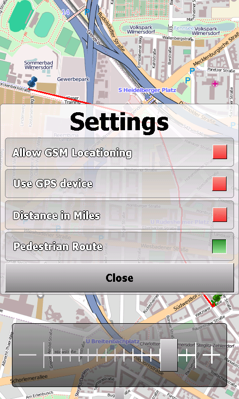
· finger friendly user interface
· map tiles are automatically downloaded if internet connection is available
· map tiles are stored locally for offline use
· GPS support and GSM triangulation
· show actual position on map
· follow-mode to automatically scroll the map
· search addresses
What's New in This Release:
· just a few bugfixes to prevent instabilities on certain phones
What's New in 1.4.3816.9028:
· WebServices updated to match the new OpenMobileMaps website.
Like it? Share with your friends!
If you got an error while installing Themes, Software or Games, please, read FAQ.
Supported operating systems:
Windows Mobile 5.0, Windows Mobile 6 Classic, Windows Mobile 6 Professional, Windows Mobile 6.1 Classic, Windows Mobile 6.1 Professional, Windows Mobile 6.5 Professional
Similar Software:
VITO SmartMap Pocket PC VITO SmartMap is GPS moving map for your smartphone.
It uses relatively small vector maps, which are perfect for driving or hiking with it. You can also use VITO SmartMap without maps for recording tracks to find your way back
FON Access Points for North Korea FON Access Points for North Korea - FON offers you a new Points of Interest service (POIs). This allows you to download FONspots directly to your navigation device.
What does that mean? You can download a Points of Interest file directly to your navigation device
FON Access Points for San Marino FON Access Points for San Marino - FON offers you a new Points of Interest service (POIs). This allows you to download FONspots directly to your navigation device.
What does that mean? You can download a Points of Interest file directly to your navigation device
FON Access Points for Equatorial Guinea FON Access Points for Equatorial Guinea - FON offers you a new Points of Interest service (POIs). This allows you to download FONspots directly to your navigation device.
What does that mean? You can download a Points of Interest file directly to your navigation device
RulerGPSed RulerGPSed - RulerGPSed uses the GPS on your PocketPC to calculate geodesic distance in 3 formats between two points specified by the latitude/longitude of your GPS using "The Vincenty inverse formula for ellipsoids" (accuracy to within 0.5mm, or 0.000015").
This program requires that you have both the 'BeanDLL
FON Access Points for France FON Access Points for France - FON offers you a new Points of Interest service (POIs). This allows you to download FONspots directly to your navigation device.
What does that mean? You can download a Points of Interest file directly to your navigation device
AIS2OZI AIS2OZI - AIS2OZI tracks ship positions. It is a logger/decoder/plotter for PocketPC.
Ship positions are plotted directly in OziExplorer Download AIS2OZI (Make backup of Shiplist.txt when reinstalling.)
Decodes AIVDM sentences of types 1, 2, 3 and 5, i.e. position reports for class A shipborne equipment plus vessel information
Where is... Where is... is a GPS tracking application for Windows Mobile devices. It gives you a free perception of distance and direction from your destination without any connection to the internet or an expensive program of navigation
VITO AstroNavigator II AstroNavigator takes all the beauty of the night sky and puts it right on the screen of your device
CalendarGPSed CalendarGPSed - CalendarGPSed uses the GPS network to find the UTC date and time and displays it on a calendar interface. You can customize the times via decimal numbers for under 1 hour. The time offsets are saved to a file.
This program requires that you have both the 'BeanDLL.dll' file ** and ** the runtime files for Visual Basic on your PocketPC computer
Other Software by developer «Cipher»:
not found
Comments on OpenMobileMaps:
vitor:
good
Date: 2 Mar 11
If you noted an error or download link is broken, please, report it via this page or use comments.
OpenMobileMaps is compatible with your device Acer Tempo M900