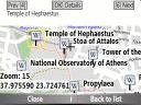
Bluemapia Mobile - View Maps, Search places and geotagged Wikipedia articles, GPS. Mobile Application for bluemapia, the new Web & Mobile Social Mapping for Boaters
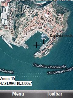
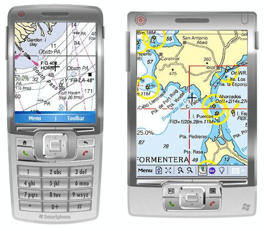
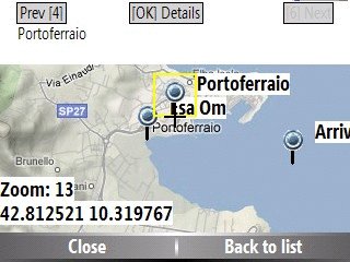
- View Maps (OpenStreetMap and other web map servers)
- Support BSB/NOAA Charts and raster, calibrated charts
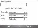
- Search places by name and bluemapia content from the web site
- View geotagged Wikipedia articles on the map
- Use a GPS to display your position on the map and set a terget destination
- Create tracks (gpx file)
- Shoot and upload photos and text to bluemapia for community sharing
Like it? Share with your friends!
If you got an error while installing Themes, Software or Games, please, read FAQ.
Supported operating systems:
Windows Mobile 2003, Windows Mobile 5.0, Windows Mobile 6 Classic, Windows Mobile 6 Professional, Windows Mobile 6.1 Classic, Windows Mobile 6.1 Professional, Windows Mobile 6.5 Professional
Similar Software:
GPSPicturer GPSPicture allows you to create GPS stamped JPEG files and displays them in an easy to use explorer interface. When you get a GPS lock the program will display the JPEG files in order of distance to your current GPS. To view the image file simply tap on it. The map service is provided by Google
FON Access Points for Finland FON Access Points for Finland - FON offers you a new Points of Interest service (POIs). This allows you to download FONspots directly to your navigation device.
What does that mean? You can download a Points of Interest file directly to your navigation device
PouchHiker Drivers see hitchhikers and carpoolers and their destination. Hitchhikers/carpoolers can make themselves visible to drivers
FON Access Points for Holy See (Vatican City State) FON Access Points for Holy See (Vatican City State) - FON offers you a new Points of Interest service (POIs). This allows you to download FONspots directly to your navigation device.
What does that mean? You can download a Points of Interest file directly to your navigation device
Xylon GPS Data Logging for the Pocket PC Xylon GPS Data Logging for the Pocket PC - Xylon captures and stores GPS information as required and configured by you. This is true low cost flexible data acquisition, the only requirements being a Pocket PC and GPS capture module. Depending upon your requirements you can use anything from a $60 GPS board to a real time kinetic system
Glympse Glympse is the easiest, most flexible way to safely share your location. Just a couple clicks, and you can decide who and for how long your friends can see your location on a map.
How it works:
Send a Glympse - Share your location from a mobile smartphone.
Receive a Glympse - View a shared location on either a computer or mobile smartphone
FON Access Points for Saudi Arabia FON Access Points for Saudi Arabia - FON offers you a new Points of Interest service (POIs). This allows you to download FONspots directly to your navigation device.
What does that mean? You can download a Points of Interest file directly to your navigation device
FON Access Points for Lithuania FON Access Points for Lithuania - FON offers you a new Points of Interest service (POIs). This allows you to download FONspots directly to your navigation device.
What does that mean? You can download a Points of Interest file directly to your navigation device
SpeedTracker SpeedTracker - Designed and tested by an experiment Marathoner, SpeedTracker is dedicated to on-road and off-road Sport practice.
Directly available from your finger tip, Cycler, Runner, Roller, ... find a set of selected options to plan,control and manage workout sessions
Other Software by developer «Bluemapia»:
not found
Comments on Bluemapia Mobile:
Comments not found
If you noted an error or download link is broken, please, report it via this page or use comments.
Bluemapia Mobile is compatible with your device Airis T483 / T483L


")


