GPS4PPC is an open source application, written with Basic4ppc that includes a set of tools for navigation and GPS data.
GPS4PPC supports:
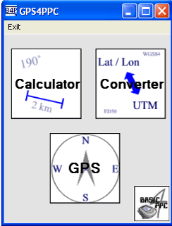
- Converting coordinates between UTM and Lat / Lon.
- Converting coordinates in different datums.
- Calculating the distance and course between two coordinates.
- Show GPS data.
- Animated compass.
- Built-in numpad for fast and easy input.
Like it? Share with your friends!
If you got an error while installing Themes, Software or Games, please, read FAQ.
Supported operating systems:
Windows Mobile 5.0, Windows Mobile 6 Classic, Windows Mobile 6 Professional, Windows Mobile 6.1 Classic, Windows Mobile 6.1 Professional, Windows Mobile 6.5 Professional
Similar Software:
VoiceGPSeds VoiceGPSeds - VoiceGPSeds is a full-featured voice recorder with GPS location tagger. You can make voice recordings and the GPS location is appended to the end of the file. You can browse the files via GPS distance. Tap on the wave file to play it back.
This program requires that you have both the 'BeanDLL
mySearch mySearch is a location-aware search application that uses Microsoft Bing to return results based on your current position. Just enter in your search term and press the search button to return location specific results!
If your device has HTC's G-Sensor service then simply orient the screen for landscape or portrait mode
GPS Tuner Essentials GPS Tuner Essentials is designed specifically for off-road use: its large buttons, selectable tool window size, multiple Compass views make it extremely user-friendly and reliable
MapsAligner MapsAligner - MapsAligner allows you to download large maps based on your GPS or with custom latitude and longitude points that you enter. You can use this to compose maps for your GPS applications. The program uses the Google.com maps server for the maps.
This program requires that you have both the 'BeanDLL
FON Access Points for Andorra FON Access Points for Andorra - FON offers you a new Points of Interest service (POIs). This allows you to download FONspots directly to your navigation device.
What does that mean? You can download a Points of Interest file directly to your navigation device
GPSEmailer GPSEmailer uses the GPS on your PocketPC to find your latitude/longitude/altitude and speed and creates a blank Email template. When the program gets its first lock then it creates an email with your GPS update location and a link to the Google.com mobile online street map
GPSMapings GPSMapings uses the GPS on your PocketPC to find your current location and allows you to view your position on a map from the Google.com maps service. You can customize the maps zoom, and type via the 'Options' in the toolbar. The maps service is provided by Google
RaceChrono RaceChrono is a GPS based lap timing software for Windows Mobile. It can be used to measure lap times on almost any vehicle and track. It can be used to measure laptimes for example for motorbikes, bicycles, cars, water jets and quadbikes.
What's New in This Release:
· Much better looking user interface.
· Better and simplified touchscreen usage
MapDrawerer MapDrawerer allows you to download a Google.com map of your current GPS and edit it with a full-featured drawing tool. You can draw on the map and also insert text into the maps as well as use the drawing tools. The JPEG libraries are from Independent JPEG Group. The map service is provided by Google
NaviPOWM NaviPOWM is a car navigation system capable of running on a variety of operating systems. Only OSM based map data is supported. Realtime routing engine is planned in a later version. Geocaching and city guide functionality are also planned
Comments on GPS4PPC:
Comments not found
If you noted an error or download link is broken, please, report it via this page or use comments.
Attention! GPS4PPC may be not compatible with your device Airis T483 / T483L