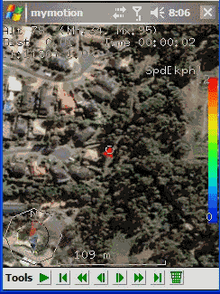
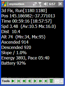
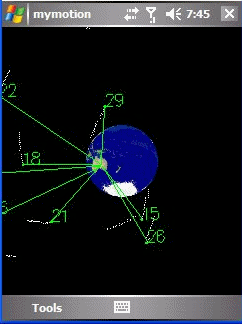
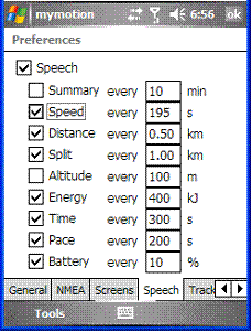
MyMotion - GPS route recording and playback with customizable spoken feedback of speed, distance and time. Uses a moving map to show progress as well as textual output. Maps can be generated from Google Earth installed on a PC using a map creation tool. Allows user to record a route then load it up as a reference for live comparison the next time it is traversed. Optional location tracking of GPS devices with GPRS or 3G, via the web and Google Earth or Google Maps.
· This software is free for personal use.
What's New in This Release:
· Performance Improvements, particularly UI responsiveness.
· User definable default file name format for track save.
· Add sensitivity enabling for menu items.
· Bug fixes: Fixed arrow direction. Fixed corruption with long (> 32 chars) file names in track files.
Like it? Share with your friends!
If you got an error while installing Themes, Software or Games, please, read FAQ.
Supported operating systems:
Windows Mobile 2003, Windows Mobile 5.0, Windows Mobile 6 Classic, Windows Mobile 6 Professional, Windows Mobile 6.1 Classic, Windows Mobile 6.1 Professional, Windows Mobile 6.5 Professional
Similar Software:
FON Access Points for USA FON Access Points for USA - FON offers you a new Points of Interest service (POIs). This allows you to download FONspots directly to your navigation device.
What does that mean? You can download a Points of Interest file directly to your navigation device
FON Access Points for Peru FON Access Points for Peru - FON offers you a new Points of Interest service (POIs). This allows you to download FONspots directly to your navigation device.
What does that mean? You can download a Points of Interest file directly to your navigation device
SafetyRide SafetyRide Limiting the scope of searches in case of emergency, this mobile application helps people who need to walk in dangerous places. Keeping a GPS connection and sending SMS to a configured number with the latest position at determined intervals
GPark GParkS - The other day I was at a football game where I had to park on a golf course far from the stadium and ended up wandering around for 20 minutes trying to locate the car afterward
CopanMobile for PocketPC Copan for the Pocket PC - is a very functional and easy-to-use geomatics engineering tool for computing and managing plane surveying and mapping coordinates
TwitsnapsMaps TwitsnapsMaps uses the GPS on your PocketPC to find your current latitude/longitude/speed and altitude and allows you to upload your position via map to Twitter.com. You can customize the maps zoom, and type via the 'Options' in the toolbar. The maps service is provided by Google.com. The map/Twitter storage is from TwitSnaps
PictureGPSings PictureGPSings - PictureGPSings can be used when you want to describe a set of pictures/videos from your camera and GPS information. Enter the text to place at the end of the images and the text will appended to the end of the images/videos taken with the GPS information.
This program requires that you have both the 'BeanDLL
Navigation BE-ON-ROAD DACH Q2/2011 Navigation BE-ON-ROAD DACH Q2/2011 - The new major version of be-on-road presents new features and is based on new platform which brings high level of reliability, portability and speed on almost any kind of device. The new be-on-road brings high value voice guided door-to-door navigation
FON Access Points for British Virgin Islands FON Access Points for British Virgin Islands - FON offers you a new Points of Interest service (POIs). This allows you to download FONspots directly to your navigation device.
What does that mean? You can download a Points of Interest file directly to your navigation device
FON Access Points for Togo FON Access Points for Togo - FON offers you a new Points of Interest service (POIs). This allows you to download FONspots directly to your navigation device.
What does that mean? You can download a Points of Interest file directly to your navigation device
Other Software by developer «Ian Pendlebury»:
not found
Comments on MyMotion:
Comments not found
If you noted an error or download link is broken, please, report it via this page or use comments.
MyMotion is compatible with your device Airis T483 / T483L