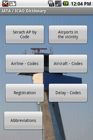
IATA / ICAO Dictionary -This application is an offline database for IATA / ICAO airport, airline, aircraft, delay codes and aircraft registration codes.
The airport database provides:
- Name
- Elevation
- Latitude and Longitude coordinates,
- timezone,
- runway and communication information (not every airport)
- Metar / TAF reports (not every airport)
- google map (not every airport)
- sunrise / set calculation
- find other airport in the vicinity of the selected airport or from your present position (GPS required)
- calculate the distance to the selected airport (GPS required)
The airline database provides:
- Name
- Country
- Callsign
- picture of the airline with airliners.net
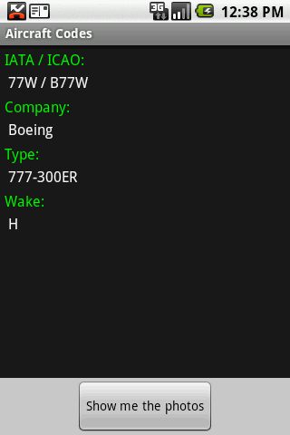
The aircraft database provides:
- Company
- Type
- wake category
- picture of the aircraft with airliners.net
Other functions are:
AC registrations; selection by
- country - registration
- registration - country
Delay codes
general aviation abbreviations
Like it? Share with your friends!
Supported operating systems:
Google Android 1.5, Google Android 1.6, Google Android 10.x, Google Android 2.0, Google Android 2.1, Google Android 2.2, Google Android 2.3, Google Android 3.0, Google Android 3.1, Google Android 3.2, Google Android 4.0, Google Android 4.1, Google Android 4.2, Google Android 4.3, Google Android 4.4, Google Android 5.x, Google Android 6.x, Google Android 7.x, Google Android 8.x, Google Android 9.x
Similar Software:
Egypt Top Attractions Egypt Top Attractions - Egypt is known for its ancient civilization and some of the world’s most famous monuments.
Most tourist visits remains of the great monuments along the Nile.
They also go snorkeling and diving along the Red Sea coast.
There are camel trips into the mountains of Sinai.
Drive to remote oases or visit the Coptic monasteries
Trafikanten Offisiell Trafikanten Offisiell - Trafikanten provides real-time departures deviation messages and travel planner for boats, bus, subway and trams in Oslo and Akershus. It also provides real-time departures and deviations for train in Eastern Norway. Stations can be found using the position of the phone or by search for the name of the station
Plane Finder for Android Plane Finder for Android - Plane Finder is a flight tracker that shows real-time air traffic on a 2D map.
Tap on a plane to view airline, flight number, route, speed and altitude, aircraft information, departure and arrival data, etc.
The app allows you to search for more than 12,000 aircraft, which are tracked in real-time using ADS-B data
Florence Hotels Search Florence Hotels Search - Florence Hotels Search
The world's largest hotel search engine that combines all hotel deals from the best travel sites into one free, quick and easy search
London Transist London Transist - All in one app for london transist system.
Manage your self with and save your precious time to travel using this app
Hillcrest Village Hillcrest Village - Hillcrest Village is a Business Improvement Area (or BIA) comprised of 100 businesses along St Clair Ave West, between Christie and Winona. The area has a wide mix of businesses serving both the local community and the GTA
Fast Route Planner Fast Route Planner - Fast Route Planner is a multiple stop route planner. It can be used by drivers and travelers or anyone else who has to call at multiple stops and needs a quick and easy planning tool to optimize the journey
Citybike Stationen Wien Zeigt eine Liste der Wiener Citybike Stationen nach der Entfernung vom aktuellen Standort geordnet an. Fur jede Station ist die Anzahl der freien Rader, die Anzahl der freien Boxen, sowie der Standort ersichtlich. Bitte Hinweise unter Menu / About beachten (Beta Version)!
CafeNavi "CafeNavi" is a useful gadget to search your nearby cafes in Japan. You can search cafes by current location or station name or center of the map. the cafes are displayed on a map and you can get more detail info such as address, TEL, business hours, Wi-Fi and more
Other Software by developer «Steve Dexter»:
Snowtam Decoder Snowtam Decoder - You have a snowtam in the metar report, you want to decode. Snowtam Decoder does it for you.
· Decoding of a snowtam in metar format
· Explanation of the items (A ,B , C, ..
Aviation Weather with Decoder Aviation Weather with Decoder - An easy way to receive metar and TAF reports from NOAA
Guess the X Guess the X - With this game you can guess a flag, a capital, a land and boundaries.
There are four input methods available to enter the answer: an autocomplete editbox, via a listview, multiple choice and a tap mode.
There are also options to change the color, size and font