Android Locationis your free, location-aware, mobile social network.
Meet real world friends. Reveal your location, befriend, and chat with people around you.
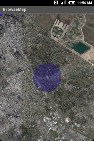
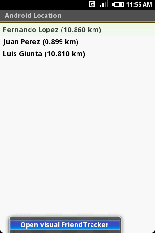
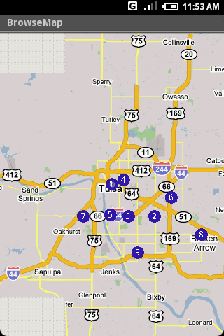
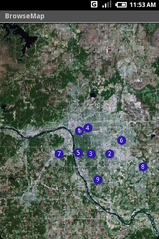
Using location-based technologies, Android Location lets you see where your friends are and what they are up to, in real time. Meet people around you. Discover who visits your favorite places. Join the community in real time.
· Know where you are without having a GPS
· Connect with friends and get alerted where they are nearby
· Explore places and events recommended by friends
· Recommend new places
· Search for stuff to buy in nearby stores
· It runs on any Cell Phone Provider
· It is FREE
Like it? Share with your friends!
Supported operating systems:
Google Android 1.0, Google Android 1.5, Google Android 1.6, Google Android 10.x, Google Android 2.0, Google Android 2.1, Google Android 2.2, Google Android 2.3, Google Android 3.0, Google Android 3.1, Google Android 3.2, Google Android 4.0, Google Android 4.1, Google Android 4.2, Google Android 4.3, Google Android 4.4, Google Android 5.x, Google Android 6.x, Google Android 7.x, Google Android 8.x, Google Android 9.x
Similar Software:
amAze (LG) AmAze is a first of its kind free navigation and local search service. It is free to download and use and it contains wide coverage of maps including aerial photo in Europe, North America, Australia and parts of Asia and Africa
Street View on Google Maps (Android) Street View on Google Maps (Android) - With Street View on Google Maps, explore the world at street level.
New! Street View smart navigation -- move around by dragging "Pegman" where you want to go.
Try Street View on Google Maps to view street-level imagery from your Android phone
Navigator Navigator - detailed maps with the support of satellite navigation. You need to specify two points to make a route. You can track your current location and set those coordinates as the route start. Thanks to marks on the map you can easily find a fuel station, restaurant or hotel
OpenStreetMapViewer OpenStreetMapViewer provides Tools / Views to interact with OpenStreetMap-Data
ViewRanger GPS ViewRanger is a unique mapping, navigation, tracking, and information tool for mobile phones that provides fully featured outdoor gps and trail navigation through a natural and intuitive display. ViewRanger transforms a Nokia or other Symbian S60 smartphone into a fully featured trail navigation system
Globus Mobile Globus Mobile - Program Globe-Mobile is becoming more known in category: Social. Today, more than 2082 people have already evaluated the software, putting an average rating of 4.3 stars
TrekBuddy Trekbuddy is a J2ME application to be used with a GPS receiver. It is designed to work with every Java-enabled device. It features capabilities such as: * GPS tracking and simple navigation * bitmap maps (without zoom, you can store bitmap maps with different resolution instead)
MapMakr MapMakr If you’re an aid worker responding to a humanitarian crisis, up to date, accurate, and easy to read maps are vital. Knowing whether a bridge has collapsed, a road is passable and where you can land planes bringing in aid is really important
CopsAlarm No more tickets Show where the hiding police are on Google Map As well as speed cam,red light locations Lite shows police,red lights only
Osmand: Maps and Navigation Osmand: Maps and Navigation - is a navigation utility. Support of electronic maps gives you a chance to get new updates all the time. The map has marks which will help tourists. Embedded satellite navigation allows you to make the shortest route fast
Other Software by developer «HS Group»:
not found
Comments on Android Location:
jhackdhanieligama:
Good
Date: 3 Nov 21
If you noted an error or download link is broken, please, report it via this page or use comments.
Android Location is compatible with your device Alcatel LX LTE NA / TracFone LX (TCL A502DL)

")


")
")


