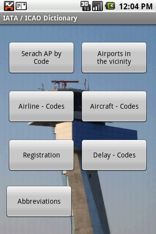
IATA / ICAO Dictionary -This application is an offline database for IATA / ICAO airport, airline, aircraft, delay codes and aircraft registration codes.
The airport database provides:
- Name
- Elevation
- Latitude and Longitude coordinates,
- timezone,
- runway and communication information (not every airport)
- Metar / TAF reports (not every airport)
- google map (not every airport)
- sunrise / set calculation
- find other airport in the vicinity of the selected airport or from your present position (GPS required)
- calculate the distance to the selected airport (GPS required)
The airline database provides:
- Name
- Country
- Callsign
- picture of the airline with airliners.net
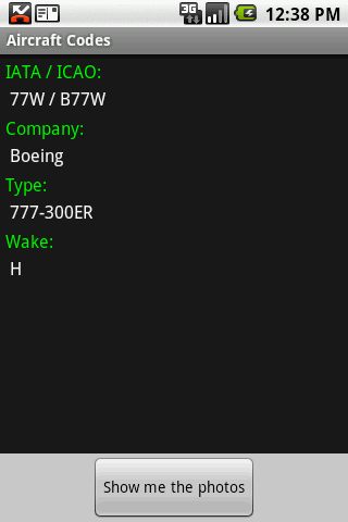
The aircraft database provides:
- Company
- Type
- wake category
- picture of the aircraft with airliners.net
Other functions are:
AC registrations; selection by
- country - registration
- registration - country
Delay codes
general aviation abbreviations
Like it? Share with your friends!
Supported operating systems:
Google Android 1.5, Google Android 1.6, Google Android 10.x, Google Android 2.0, Google Android 2.1, Google Android 2.2, Google Android 2.3, Google Android 3.0, Google Android 3.1, Google Android 3.2, Google Android 4.0, Google Android 4.1, Google Android 4.2, Google Android 4.3, Google Android 4.4, Google Android 5.x, Google Android 6.x, Google Android 7.x, Google Android 8.x, Google Android 9.x
Similar Software:
Airport Info Lite Airport Info Lite provides realtime airport status information (for USA only currently), including closures and weather delays.
Includes a widget for home screen rotating info on problem airports, as well as application for detailed viewing of individual airports
INRIX Traffic - Avoid Traffic Save time, gas and money by avoiding traffic. Winner of MacWorld 2010 Best of Show, INRIX Traffic puts the power of real-time incidents, traffic forecasting and comparative traffic in the palm of your hand
TrafikInfo Android application for showing Swedish traffic information
Kayak Free Travel Assistant Kayak Free Travel Assistant-KAYAK connects you to the best travel search engine in the world. Find the right flight. Get the perfect hotel. If your flight is canceled, find a new one in a minute. Compare hundreds of travel sites at once
DC Metro Transit - Free Realtime predictions for Washington DC MetroRail, MetroBus and other local buses Free (with ads) mobile interface for WMATA: -Tablet friendly layout (Honeycomb Compatibility) -Real-time predictions: DC Metrorail, Metro Bus, Circulator, PG County-The Bus, Fairfax CUE, UMD Shuttle
I Need A Lift I Need A Lift - I-Need-A-Lift is a platform to facilitate the process of offering lifts and taking lifts between public transport and private users. For public transport, one can register their trip, indication how many passengers (15) they want for the trip, e.g. from East London, South Africa to Bloemfontein, South Africa, indicating the amount required
Parking Buddy Parking Buddy - This app will allow its users to post available parking spaces before or during they are going to be vacated. Also allowing those looking for spaces to search the appfor available spaces. Once a spot has been occupied thanks to the tip from the person who gave up the space a point will added to increase this users ranking
Los Angeles Metro This app grants you fast acces to the last Los Angeles metro map, no internet connection needed once it has been installed. Full zoom controls. Fast, light and simple
Amsterdam Hotels Search Amsterdam Hotels Search The world's largest hotel search engine that combines all hotel deals from the best travel sites into one free, quick and easy search. Genius!
Otobüs Saatleri ve Takip Sistemi Bu uygulama sayesinde beklediğiniz otobüsün nerede olduğunu öğrenebileceksiniz! Ayrıca tüm seferlerin otobüs saatlerini kolayca takip ederek, hayatınızı kolaylaştırabilirsiniz.
Other Software by developer «Steve Dexter»:
Aviation Weather with Decoder Aviation Weather with Decoder - An easy way to receive metar and TAF reports from NOAA
Snowtam Decoder Snowtam Decoder - You have a snowtam in the metar report, you want to decode. Snowtam Decoder does it for you.
· Decoding of a snowtam in metar format
· Explanation of the items (A ,B , C, ..
Guess the X Guess the X - With this game you can guess a flag, a capital, a land and boundaries.
There are four input methods available to enter the answer: an autocomplete editbox, via a listview, multiple choice and a tap mode.
There are also options to change the color, size and font