VGPS (Vietnamese GPS) for Android was designed to use city street map on your ordinary mobile phone without the need of having GPS receiver or internet connection. VGPS does not require internal or external GPS receiver. However, if you have internal GPS receiver or external bluetooth GPS receiver, VGPS can work with your GPS receiver as well. VGPS does not require internet connection so you no need to worry about connection charge.
· Offline map (totally offline application. VGPS only uses internet to validate your purchase when you activate demo version become full version. Other than that the application will never use internet)
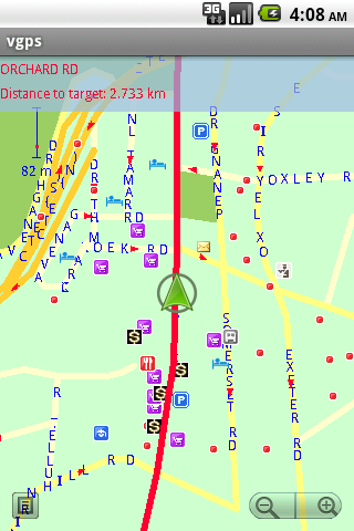
· Map data from Garmin and OpenStreetMap
· Zoom in/Zoom out/Pan
· Search point by name,type,distance or mix type+name, type+distance
· Can touch any object on the map
· GPS real-time tracking
· Routing point to point
· Rotate map so the driving direction (heading) is always up
· Voice guidance (turn left/turn right)
What's New in This Release:
· User can take screenshot and save to memory card
What's New in 7.0:
· Supports all android phones and tablets screen sizes and densities (android 1.5 to android 3.2+)
What's New in 6.9:
· pinch to zoom in/out
Like it? Share with your friends!
Supported operating systems:
Google Android 1.5, Google Android 1.6, Google Android 10.x, Google Android 2.0, Google Android 2.1, Google Android 2.2, Google Android 2.3, Google Android 3.0, Google Android 3.1, Google Android 3.2, Google Android 4.0, Google Android 4.1, Google Android 4.2, Google Android 4.3, Google Android 4.4, Google Android 5.x, Google Android 6.x, Google Android 7.x, Google Android 8.x, Google Android 9.x
Similar Software:
TripComputer TripComputer is a personal off-road GPS navigation utility software for Android phones, that has been created for active people, who love travel by hike or bike.
The application does not use Internet connection or Google Maps for navigation or track recording, but you can share your data to others, or store your data on server
Tricorder Tricorder - A simple tricorder simulator for Android powered phones, using real sensors to detect magnetic fields, gravity, etc. See the passing gravity wave from a distant collapsar on your phone screen (actual device sensitivity may be insufficient to detect gravity waves). Detect buried powerful magnets! Be a mega-geek! Etc
TomTom Russia-Baltics-Finland for Android TomTom Russia-Baltics-Finland for Android - TomTom Russia-Baltics-Finland is a turn-by-turn GPS navigator for Android devices. The app includes accurate offline maps, so you can find your way anywhere, even without an internet connection
Sygic: GPS Navigation Sygic: GPS Navigation - Sygic is the premium turn-by-turn GPS navigation app. Sygic boasts an intuitive interface: drag the map, pinch to zoom, change point of view using built-in compass and tap target square to choose action. Sygic is comfortable and safe: advanced routing is optimized for Real-Time Traffic
AndTripLog AndTripLog allows you to record your trip onto your device. The application displays the current GPS position, time and speed. You can export the trip by email and store it onto your sdcard in GPX format
AntipodalPoint AntipodalPoint retrieves you position from the network provider or GPS and calculates and shows you antipodal point - the place exact opposite of you on Earth.
AntipodalPoint Pro enables you to browse the entire world and find antipodal points
GPS Tracker GPS tracker for Android supporting KML export (Google Earth) and raw format export as txt data
amAze (Android) AmAze is a first of its kind free navigation and local search service. It is free to download and use and it contains wide coverage of maps including aerial photo in Europe, North America, Australia and parts of Asia and Africa
Android Photo GeoTag Android Photo GeoTag - Take pictures with your mobile phone and incorporate the data of the geographical location. The application allows you to include in the photographs, data from the GPS receiver, along with a brief note. If you know the coordinates, not having the GPS receiver, you can also handwrite geographic data
Run.GPS Trainer UV Run.GPS Trainer is the perfect tool for sports like running, skiing and walking. It uses the Global Positioning System (GPS) to record all of your training parameters like speed, distance and altitude.
Run.GPS Trainer UV is the successor of of the award-winning Run.GPS Trainer software and has tons of new features
Other Software by developer «Vietnamese GPS»:
VGPS (Vietnamese GPS) for Android VGPS was designed to use city street map on your ordinary mobile phone without the need of having GPS receiver or internet connection. VGPS does not require internal or external GPS receiver. However, if you have internal GPS receiver or external bluetooth GPS receiver, VGPS can work with your GPS receiver as well
VGPS (Vietnamese GPS) VGPS (Vietnamese GPS) - was designed to use city street map on your ordinary mobile phone without the need of having GPS receiver or internet connection. VGPS does not require internal or external GPS receiver. However, if you have internal GPS receiver or external bluetooth GPS receiver, VGPS can work with your GPS receiver as well


 for Android")
 for Android")


")


 for Android")
")