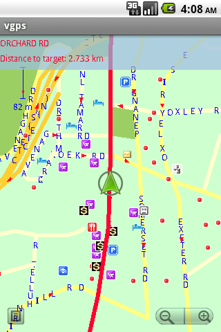
VGPS (Vietnamese GPS) for Android was designed to use city street map on your ordinary mobile phone without the need of having GPS receiver or internet connection. VGPS does not require internal or external GPS receiver. However, if you have internal GPS receiver or external bluetooth GPS receiver, VGPS can work with your GPS receiver as well. VGPS does not require internet connection so you no need to worry about connection charge.
· Offline map (totally offline application. VGPS only uses internet to validate your purchase when you activate demo version become full version. Other than that the application will never use internet)
· Map data from Garmin and OpenStreetMap
· Zoom in/Zoom out/Pan
· Search point by name,type,distance or mix type+name, type+distance
· Can touch any object on the map
· GPS real-time tracking
· Routing point to point
· Rotate map so the driving direction (heading) is always up
· Voice guidance (turn left/turn right)
What's New in This Release:
· User can take screenshot and save to memory card
What's New in 7.0:
· Supports all android phones and tablets screen sizes and densities (android 1.5 to android 3.2+)
What's New in 6.9:
· pinch to zoom in/out
Like it? Share with your friends!
Supported operating systems:
Google Android 1.5, Google Android 1.6, Google Android 10.x, Google Android 2.0, Google Android 2.1, Google Android 2.2, Google Android 2.3, Google Android 3.0, Google Android 3.1, Google Android 3.2, Google Android 4.0, Google Android 4.1, Google Android 4.2, Google Android 4.3, Google Android 4.4, Google Android 5.x, Google Android 6.x, Google Android 7.x, Google Android 8.x, Google Android 9.x
Similar Software:
OpenGPSTracker OpenGPSTracker adds the capability to store and review where you and your Android device have been. Basically you press record at the start of your trip and your phone stores the route you take. This route is drawn real-time on the Maps functionality of Android or in the background with an idle device. The route is stored on your phone for review and further use
Android Location Android Location is your free, location-aware, mobile social network.
Meet real world friends. Reveal your location, befriend, and chat with people around you.
Using location-based technologies, Android Location lets you see where your friends are and what they are up to, in real time. Meet people around you. Discover who visits your favorite places
Polaris Navigation System Polaris Navigation System - The Polaris Navigation System is a powerful navigation software for Android. It includes all the standard GPS functionality, including an odometer, altimeter, speedometer and directional compasses.
The app also allows you to record trails and view them on a map
Navizon for Android Navizon for Android is an on-demand location system based on push-technology. Once it is installed, Navizon will let you track the mobile device's location with a click of a button. This can be especially useful if you lost your phone or if you are trying to locate a friend
Location Logger Location Logger - Why do you need Location Logger application?
- Track, monitor and manage an individual or group of people for operational and safety security reasons.
How to start?
1. Install the application on your Android phone.
2. Create your account by providing your email id, phone number of the device, name, country and submit it.
3
MapMe MapMe allows mobile users to locate their position via GPS. If the users move beyond specific range or distance, the application will automatically display the location on a map
Gps Traveler Gps Traveler - Gps Traveler is a complete gps tools for android including compass,speedometer,gps Information such as speed,altitude,location address infromation
Run.GPS Trainer UV Run.GPS Trainer is the perfect tool for sports like running, skiing and walking. It uses the Global Positioning System (GPS) to record all of your training parameters like speed, distance and altitude.
Run.GPS Trainer UV is the successor of of the award-winning Run.GPS Trainer software and has tons of new features
OS Map OS Map is a tool to turn your Android phone into a handy Ordnance Survey map, with your GPS position pinpointed on it!
· Nearly all OS Map scales available (including 250,000 and 50,000).
· Touch-scrolling - simply use your finger to drag the map around.
· Fast resume from standby and fast position updates
EV Speedo EV Speedo is a GPS based speedometer with gadgets to provide g-force and other GPS information.
A built in map is also provided and any of the gauges provided can be overlayed upon the map, for example use the map to show your location with a speedometer to show your current speed
Other Software by developer «Vietnamese GPS»:
VGPS (Vietnamese GPS) VGPS (Vietnamese GPS) - was designed to use city street map on your ordinary mobile phone without the need of having GPS receiver or internet connection. VGPS does not require internal or external GPS receiver. However, if you have internal GPS receiver or external bluetooth GPS receiver, VGPS can work with your GPS receiver as well
VGPS (Vietnamese GPS) for Android VGPS was designed to use city street map on your ordinary mobile phone without the need of having GPS receiver or internet connection. VGPS does not require internal or external GPS receiver. However, if you have internal GPS receiver or external bluetooth GPS receiver, VGPS can work with your GPS receiver as well

 for Android")
 for Android")


")
 for Android")