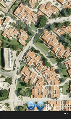
SaraMap is a Free Map Application that integrates with Google Map,Microsoft Bing Map and OpenStreetMap.it supports GPS Tracking either.
Main Features:
-Map Navigation with different layers support.
-Using Multi Scale Image control as map viewer core with Multi touch pan/zoom behavior.
-Switch easily between Google Map,Bing Map and OpenStreetMap
-GPS Tracking
ver 1.1:Fixing some minor bugs on the UI
Like it? Share with your friends!
If you got an error while installing Themes, Software or Games, please, read FAQ.
Supported operating systems:
Windows 10 Mobile, Windows Phone 7, Windows Phone 8
Similar Software:
Offline Maps Offline Maps - Want to save money on your data plan and roaming fees abroad? Download maps and use them without having to use an internet connection!
With this application you can download a map of any part in the world and take it with you when travelling
XMaps XMaps - With xMaps you have the possibility to use the worldwide map data from openstreetmaps.org on your phone. xMaps comes without any map data, you can download any maps in different zoom levels for free. You can zoom in / out and rotate and tilt the map.
Use xMaps to search a point by coordinate or to plan a travel route by car or by foot
Bing This app helps to use the bing map with just a click
ArcGIS ArcGIS is a great way to discover and use maps. Tap on the map or use your current location to discover information about what you see. Search and find interesting information in the map as well as measure distances and areas. Find community hosted maps from ArcGIS Online, ESRI's online GIS, or use the authoring tools on ArcGIS
A-Z London Visitors A-Z London Visitors - Visiting London? Download A-Z's handy free London Visitors' Map. The map provides a quick and simple overview of the major places of interest in London.
For more detailed mapping covering a much greater area, please see our full A-Z of London app (search Marketplace for A-Z London)
Bing Get Me There Bing Get Me There - Bing Get Me There is a London travel app that gets you from where you are right now to wherever you want to be. True door-to-door directions using Bing maps and live tube updates to ensure you get the best route for you
AGMapTime AGMapTime is a simple viewer with time slider features for "time-aware" layer data of ArcGIS services. Time slider lets you browse map features on specific time. You can view various kind of map layers from ArcGIS.com or your own ArcGIS server.
version 0.5 (First version)
- Only supports dynamic layer.
- Fixed base map.
- Slider auto detect time duration
Chicago Maps Chicago Maps - Offline (no data connection necessary!) public transportation maps for the Chicago area. Click on the thumbnails and zoom in for a detailed look.
Includes:
1. an overview of the Chicago Transit Authority system with the ability to zoom into different sections using a map and/or a list
2. Night Owl bus map
Can be used in portrait or landscape view
GeoBC Showcase GeoBC Showcase - This app takes advantage of geospatial layers provided by GeoBC. It will include Federal Electoral Districts and Local Health areas plus Primary Survey Parcels in British Columbia, Canada.
Select one of the layers from the list, then press a point on the map and hold to get information about that geographical point
Other Software by developer «SafaDev»:
not found
Comments on SaraMap:
Comments not found
If you noted an error or download link is broken, please, report it via this page or use comments.
SaraMap is compatible with your device Alcatel One Touch Idol 4S with Windows 10 6071w