View a large quick reference World Map on your Android today!
Contains Up-To-Date World Maps!
Did you know?
-------------
South Sudan became the world's 195th country following separation from Sudan on 9 July 2011
Features
---------
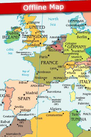
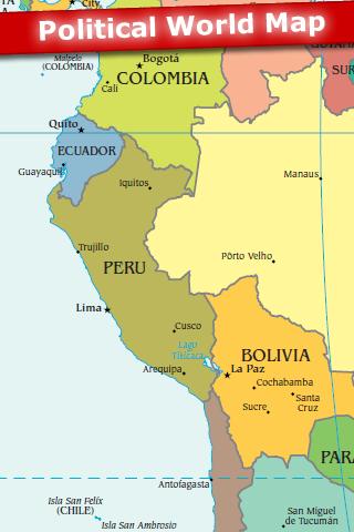
- Political World Map
- No internet connection is required. The map is stored on your Android and can be viewed Offline.
View the World Map quickly and easily on your Android today!
Keywords: Globe, Country, Countries, USA, Atlas, Ocean, Sea, Time Zone, Geography, Topographical, Topography, Island
Cities: Tokyo, Seoul, New York, Mumbai, Jakarta, Shanghai, Los Angeles, Cairo, London, Beijing, Dubai
Countries: Afghanistan, Albania, Algeria, Andorra, Angola, Antigua & Deps, Argentina, Armenia, Australia, Austria, Azerbaijan, Bahamas, Bahrain, Bangladesh, Barbados, Belarus, Belgium, Belize, Benin, Bhutan, Bolivia, Bosnia Herzegovina, Botswana, Brazil, Brunei, Bulgaria, Burkina, Burundi, Cambodia, Cameroon, Canada, Cape Verde, Central African Rep, Chad, Chile, China, Colombia, Comoros, Congo, Congo {Democratic Rep}, Costa Rica, Croatia, Cuba, Cyprus, Czech Republic, Denmark, Djibouti, Dominica, Dominican Republic, East Timor, Ecuador, Egypt, El Salvador, Equatorial Guinea, Eritrea, Estonia, Ethiopia, Fiji, Finland, France, Gabon, Gambia, Georgia, Germany, Ghana, Greece, Grenada, Guatemala, Guinea, Guinea-Bissau, Guyana, Haiti, Honduras, Hungary, Iceland, India, Indonesia, Iran, Iraq, Ireland {Republic}, Israel, Italy, Ivory Coast, Jamaica, Japan, Jordan, Kazakhstan, Kenya, Kiribati, Korea North, Korea South, Kosovo, Kuwait, Kyrgyzstan, Laos, Latvia, Lebanon, Lesotho, Liberia, Libya, Liechtenstein, Lithuania, Luxembourg, Macedonia, Madagascar, Malawi, Malaysia, Maldives, Mali, Malta, Marshall Islands, Mauritania, Mauritius, Mexico, Micronesia, Moldova, Monaco, Mongolia, Montenegro, Morocco, Mozambique, Myanmar, {Burma}, Namibia, Nauru, Nepal, Netherlands, New Zealand, Nicaragua, Niger, Nigeria, Norway, Oman, Pakistan, Palau, Panama, Papua New Guinea, Paraguay, Peru, Philippines, Poland, Portugal, Qatar, Romania, Russian Federation, Rwanda, St Kitts & Nevis, St Lucia, Saint Vincent & the Grenadines, Samoa, San Marino, Sao Tome & Principe, Saudi Arabia, Senegal, Serbia, Seychelles, Sierra Leone, Singapore, Slovakia, Slovenia, Solomon Islands, Somalia, South Africa, Spain, Sri Lanka, Sudan, Suriname, Swaziland, Sweden, Switzerland, Syria, Taiwan, Tajikistan, Tanzania, Thailand, Togo, Tonga, Trinidad & Tobago, Tunisia, Turkey, Turkmenistan, Tuvalu, Uganda, Ukraine, United Arab Emirates, United Kingdom, United States, Uruguay, Uzbekistan, Vanuatu, Vatican City, Venezuela, Vietnam, Yemen, Zambia, Zimbabwe
Like it? Share with your friends!
Supported operating systems:
Google Android 1.5, Google Android 1.6, Google Android 10.x, Google Android 2.0, Google Android 2.1, Google Android 2.2, Google Android 2.3, Google Android 3.0, Google Android 3.1, Google Android 3.2, Google Android 4.0, Google Android 4.1, Google Android 4.2, Google Android 4.3, Google Android 4.4, Google Android 5.x, Google Android 6.x, Google Android 7.x, Google Android 8.x, Google Android 9.x
AugSatNav Walk AugSatNav is an augmented reality navigation system which overlays walking directions upon a live video feed of the path or road ahead.
With AugSatNav there is no need to follow instructions or interpret maps - you can simply find your way by walking along the route highlighted by a bright white line
BostonBusMap BostonBusMap is an application for Android phones. It uses GPS data provided by the MBTA to plot the real-time location of buses on a map.
What's New in This Release:
· GPS now turns on when you start the app to allow quicker location lookup times
InstaMapper (Android) InstaMapper is a free service that allows you to track a person or vehicle online in real time using a GPS-enabled mobile phone.
To use InstaMapper, you create a free account. Registration takes only a minute or two. All it is asked for is a username, password, and a valid email address.
Next, you install a small application on your GPS-enabled phone
yozi yozi is a navigation software for the Android platform. It uses digital topographic maps in well-known Ozi Explorer formats for navigation and doesn't require network access like built-in Maps application on Android
London DK Eyewitness Top 10 Travel Guide & Map (BlackBerry) London DK Eyewitness Top 10 Travel Guide & Map (BlackBerry)- From the top 10 ways to experience Royal London to the top 10 shops, pubs and hotels - this guide features the insider knowledge that every visitor needs, plus London maps and metro maps.
Capture the essence of London, from shopping in Harrods to the Changing of the Guard at Buckingham Palace
Maps on free Maps on free - navigation maps which can be used in offline mode. All you need to do is to download the information to the memory card of your device. You can add files with ready routes and marked orienting points. You don't have to worry about constant Internet connection anymore while travelling
Big Planet TW Solution to Offline Google Maps on Android Phones
Osm2GpsMid GpsMid is a free, fully offline, vector based map application for your mobile phone. It displays your current position on a zoomable map and can be used to search for and navigate to roads or points of interest of your liking. As all data is stored in a compact binary format on your mobile phone you will incur no charges for extra data downloads
Bagf Maps This is the first Map Application developed by Bagf, Inc. and in cooperation with Google, Inc. It is a honor for us to work with Google.. Also is it a honor to can share an Application that comes from us and Google! Enjoy!
Other Software by developer «Appventions»:
not found
Comments on World Map 2011 FREE:
mohsenbahmani53:
map world
Date: 13 Feb 12
If you noted an error or download link is broken, please, report it via this page or use comments.
World Map 2011 FREE is compatible with your device Alcatel One Touch OT-985N / OT-985D


")


")

")


