JTrip - Create your own trip in Thailand. JTrip recommends attractions and directions that you need. Let's get to know Thailand together.
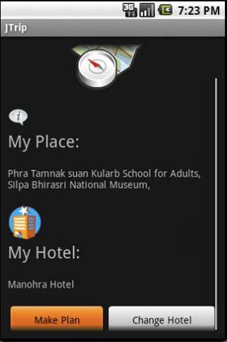
· select places.
· select hotel.
· show map location.
· route path form src to dest.
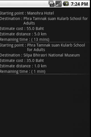
· taxi, time remaining.
· suggest bus number.
· suggest mrt/bts stations with gps current location.
· open facebook.
Like it? Share with your friends!
Supported operating systems:
Google Android 1.0, Google Android 1.5, Google Android 1.6, Google Android 10.x, Google Android 2.0, Google Android 2.1, Google Android 2.2, Google Android 2.3, Google Android 3.0, Google Android 3.1, Google Android 3.2, Google Android 4.0, Google Android 4.1, Google Android 4.2, Google Android 4.3, Google Android 4.4, Google Android 5.x, Google Android 6.x, Google Android 7.x, Google Android 8.x, Google Android 9.x
Similar Software:
Modern Compass Modern Compass this compass does what the compass always was intended to do, it helps you locate the destination of your choice.
Using GPS technology and Google maps, this application lets you mark a destination of choice and then shows in what direction that destination lies, as well as how far away it is from your current location
AugSatNav Walk AugSatNav is an augmented reality navigation system which overlays walking directions upon a live video feed of the path or road ahead.
With AugSatNav there is no need to follow instructions or interpret maps - you can simply find your way by walking along the route highlighted by a bright white line
Wi-Fi Map Maker - Free Wi-Fi Map Maker is application makes a map of Wi-Fi access points as you walk around.
· Maps out the actual coverage of each access point!
· Access point names are displayed on the map
· See street address and area of access points
· You can select the criteria for inclusion on your map
Yandex. Metro Yandex. Metro - is a useful application for those who often goes by subway. The application will make exact calculation of time, offer the best route and give the switch points. Select the destination and departure stations according to the scheme and easily plan your subway trips
amAze (Motorola) AmAze is a first of its kind free navigation and local search service. It is free to download and use and it contains wide coverage of maps including aerial photo in Europe, North America, Australia and parts of Asia and Africa
Outdoor Offline Maps for Android Outdoor Offline Maps for Android - The Outdoor Navigation software is your best friend through your adventures in the wild.
Go into the outdoors with confidence and enjoy your activities without worrying about the tools to help you navigate. Your Outdoor Navigation app is made by the people who have been developing this software since 2003 across multiple platforms
CoPilot Live Australia & NZ (Android) CoPilot Live Australia & NZ (Android) - Get a CoPilot! The onboard GPS navigation app that makes every journey better
TTC Subway Rider Efficiency Guide TTC Subway Rider Efficiency Guide - This application has maps of all TTC (Toronto Transit Commission) subway stations so you can see where the stairs/etc are... and plan where to stand on the platform.
Based on ttcrider.ca
Useful for handicapped people too
")


")

")

