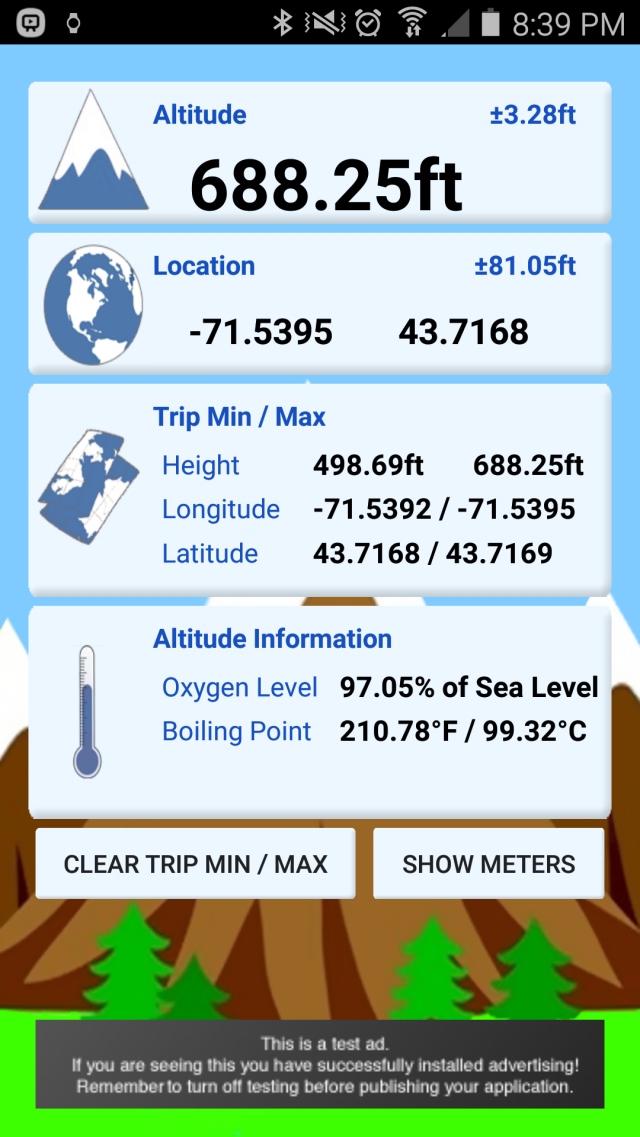
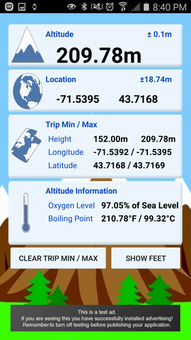
myAltitude - See your Altitude, and details of your trip, including Minimum and Maximum Altitudes, Oxygen levels and more! Full Android Wear support!
Includes improved & tested support for:
Moto 360
ASUS ZenWatch and
Samsung Gear
Like it? Share with your friends!
Supported operating systems:
Google Android 10.x, Google Android 4.0, Google Android 4.1, Google Android 4.2, Google Android 4.3, Google Android 4.4, Google Android 5.x, Google Android 6.x, Google Android 7.x, Google Android 8.x, Google Android 9.x
Similar Software:
GPS Speed GPS Speed - Turn your Android phone into a digital speedometer! Nice Compass view + big digital speed view. You can use menu to switch m/s, MPH, KPH and Knot.
What's New in This Release:
· minor fix
What's New in 5.4:
· support APP2SD
What's New in 4
SpeedView An advanced speedometer application that offers lots of useful features.SpeedView uses the phone's built-in GPS system to show your current, maximum and average speed, as well as direction, total distance and time traveled. Suitable for running, car driving, biking or hiking
Altimeter Altimeter - Check your altitude wherever you are with Altimeter. The app uses GPS to find your altitude. You can also check your location using google maps
GPS Map Search Compass & Track An app for all the purpose so what you're waiting for....!!! Yes.... creatiosoft proudly introduced an awesome GPS Toolbox where you can do anything whatever you desired. Lets track all the locations of yourself via GPS where you are expedition
GPS Compass GPS Compass - Title: GPS Compass
Version: 1.0.2
Intro:
A utility tool with user-friendly interface. With this, you can share location where you are with friends instantaneously
Talking Compass Talking Compass speaks your current heading and provides haptic feedback as your cross over any of the cardinal directions.
Touch the screen to hear your heading. Stroke the screen up/down to adjust verbosity
Point Where Ad This app does not aim to replace a compass. What it does is to serve a simple need using the accelerator and magnetic sensors in Android phone to point direction. For some people, you need to know the direction of a place/city reference to your own location
MUUDS MUUDS - Our Patented, color-coded, UV resistant PVC MUUDS Markers are a new and unique way to mark the exact depth of underground utilities. They are excellent way to prevent future excavation disasters
Smart compass Smart compass - turn your device into a smart compass which will easily define your direction and location. This compass will be useful while travelling. Send current coordinates of your location via sms or email
GeoLog GeoLog saves the sensors data (gps, accelerometer, magnetometer data, etc.) of your device to a log file and calculates the coverage of the site. The coverage is a ratio of the track covering area to the area of the site (expressed in percents)
Other Software by developer «Rovingsquid»:
not found
Comments on myAltitude:
Comments not found
If you noted an error or download link is broken, please, report it via this page or use comments.
myAltitude is compatible with your device Alcatel One Touch POP S3 OT-5050X