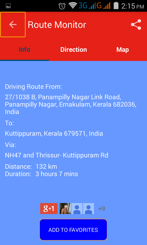
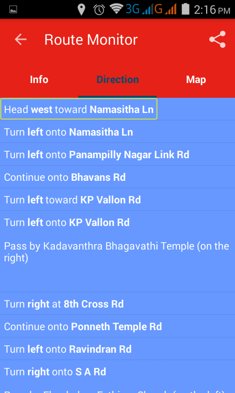
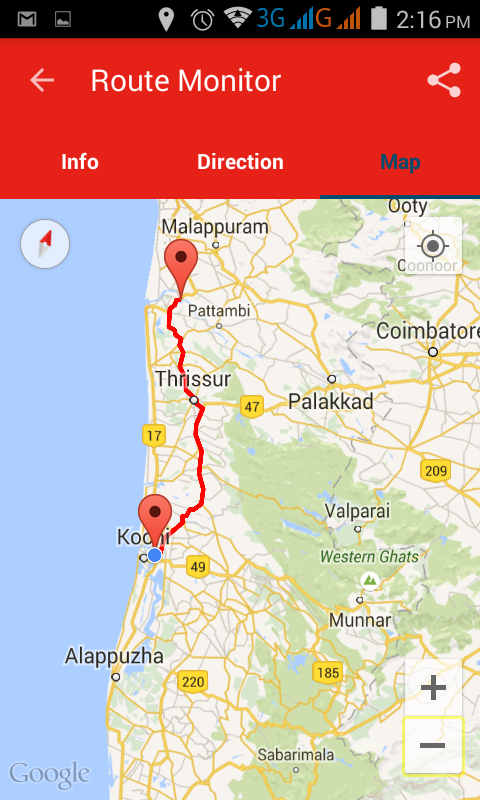
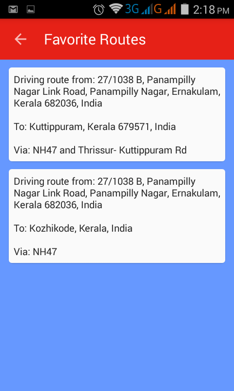
Route Monitor - This application helps you to find the driving route between any start and end location which would have been set by you. It is very simple to use. Just search/select your source / destination location and press the submit button! The route between those two locations will be shown on the map. You can view the route in text format too. In addition to the route, you can view your traveling duration and travel distance. You can save the route to favorites list and show anytime without internet connection. Also share the route with friends and family! Features: * Travel Modes: Shows the route for driving mode and for walking mode. * Duration and Distance: It gives very accurate driving/walking duration and distance. * Alternative Route: you will get alternative routes if available. * Route on the map: you can see the route on the map. * Route in text format: you will get the route in text format, useful for our visually challenged community.
Like it? Share with your friends!
Supported operating systems:
Google Android 3.0, Google Android 3.1, Google Android 3.2, Google Android 4.0, Google Android 4.1, Google Android 4.2, Google Android 4.3, Google Android 4.4
Similar Software:
Location Sharing Location Sharing - Location Sharing app enables you to send your current location to anyone you want and receiver not only gets your current location but also ETA (Estimated Time of Arrival) and distance
MySpeed MySpeed will record your speed and location to a log file and show it on a map.
It can use a database of speed camera locations to alert you when you're near a speed camera.
There is no speed camera database included. You'll need to download the data from a site such as scdb.info, flitspaal.nl, pocketgpsworld.com, maparadar.com, etc
Art Places Art Places is a software application for the Android mobile operating system.
The application gets our position through the GPS in the mobile device and shows us our current location in the maps application. of maps
GPS Dashboard GPS Dashboard - View the status of the GPS on your phone with this cool Dashboard
GPS status & toolbox GPS status & toolbox - is a very useful program for working with GPS. This utility is aimed at viewing GPS condition and settings. It can display all data of a sensor and GPS: positions and satellite signal power, accuracy, speed, acceleration, height, step and even battery status
Hunting the Snark Hunting the Snark - Inspired by Lewis Carrol's poem, The Hunting of the Snark, Hunting the Snark is an action game played on both your GPS-enabled Android device and in the real world. In it, you hunt a Snark (the creature on the map in blue.) If you invade its physical location before the game time has expired, you win. Otherwise, you lose
amAze (LG) AmAze is a first of its kind free navigation and local search service. It is free to download and use and it contains wide coverage of maps including aerial photo in Europe, North America, Australia and parts of Asia and Africa
amAze (Motorola) AmAze is a first of its kind free navigation and local search service. It is free to download and use and it contains wide coverage of maps including aerial photo in Europe, North America, Australia and parts of Asia and Africa
MMNearBy MMNearBy - MMNearBy You can use MMNearby on the web and on mobile, just like the tens of thousands who use it every day. Want to find the nearest ATM, DrugStore, Cafe & Tea? You will get it literally at your fingertips! With MMNearby, you can find points of interest near you
Polaris Navigation System Polaris Navigation System - The Polaris Navigation System is a powerful navigation software for Android. It includes all the standard GPS functionality, including an odometer, altimeter, speedometer and directional compasses.
The app also allows you to record trails and view them on a map
Comments on Route Monitor:
Comments not found
If you noted an error or download link is broken, please, report it via this page or use comments.
Route Monitor is compatible with your device Alcatel One Touch Snap LTE 7030Y/R


")
")

