Terracrosser is a free GPS navigation software for Windows Mobile Pocket PC.
· Terracrosser works in Map and Photo modes
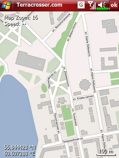
· Terracrosser uses zoomable maps
· Terracrosser is completely compatible with Google Maps service. With included Mapper module you can download maps from the Internet. All maps are automatically calibrated (geo-referenced)
What's New in This Release:
Terracrosser:
· POI system
· enhanced scrolling
· multiple options in settings menu
· maps correction to improve default maps calibration
Mapper:
· limited region to download non-square part of map
Like it? Share with your friends!
If you got an error while installing Themes, Software or Games, please, read FAQ.
Supported operating systems:
Windows Mobile 5.0, Windows Mobile 5.0 Smartphone, Windows Mobile 6 Classic, Windows Mobile 6 Professional, Windows Mobile 6 Standard, Windows Mobile 6.1 Classic, Windows Mobile 6.1 Professional, Windows Mobile 6.1 Standard, Windows Mobile 6.5 Professional, Windows Mobile 6.5 Standard
Similar Software:
SIGLOG SIGLOG - A Windows Mobile application that logs latitude, longitude, signal strength, mobile country code, mobile network code, location area code, CellID.
Written in Win32 C++ it's lean, mean, rather basic, but it does the job. It requires a phone with GPS, as it calls the Microsoft intermediate GPS driver
GPSSpeedometerer GPSSpeedometerer uses the GPS on your PocketPC to find your speed based on the NMEA RMC sentence
FON Access Points for Mayotte FON Access Points for Mayotte - FON offers you a new Points of Interest service (POIs). This allows you to download FONspots directly to your navigation device.
What does that mean? You can download a Points of Interest file directly to your navigation device
FON Access Points for Fiji FON Access Points for Fiji - FON offers you a new Points of Interest service (POIs). This allows you to download FONspots directly to your navigation device.
What does that mean? You can download a Points of Interest file directly to your navigation device
PoliceGPSings PoliceGPSings - PoliceGPSings can be used by a Police officer to create dated GPS POI based note logs. For each GPS area you can create a log of reports from the area. The program uses the GPS on the PocketPC to find the distance of each GPS POI point and you can view or download the map the points on Google.com map service
FON Access Points for Thailand FON Access Points for Thailand - FON offers you a new Points of Interest service (POIs). This allows you to download FONspots directly to your navigation device.
What does that mean? You can download a Points of Interest file directly to your navigation device
GudenSoft GPS Info GudenSoft GPS Info An application which shows information from the GPS receiver
TextMapperer TextMapperer - TextMapperer allows you to create named text based GPS maps. When you get a GPS lock then you can create a new map and enter text for the area. When you save the text the map is downloaded and the text and GPS is appended to the end of the map with current GPS
SportsGPSes SportsGPSes - SportsGPSes can be used to view all of the players using the PocketPC SportsGPSer. The program downloads the GPS of all players and displays them on a customized map from Google.com.
This program requires that you have both the 'BeanDLL.dll' file ** and ** the runtime files for Visual Basic on your PocketPC computer
KidsGPSs KidsGPSs - KidsGPSs can be used to get an update of your kids' GPS location using the PocketPC KidsGPSer. The program downloads the GPS location for each child and stores it into the database. You can view a map of all your kids' current GPS locations on the Google.com maps.
This program requires that you have both the 'BeanDLL
Other Software by developer «Nitisara»:
not found
Comments on Terracrosser:
Comments not found
If you noted an error or download link is broken, please, report it via this page or use comments.
Terracrosser is compatible with your device Alcatel OT-S988W