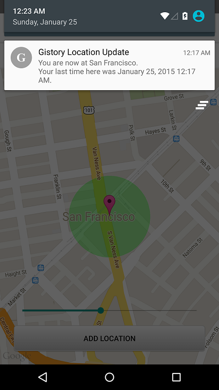
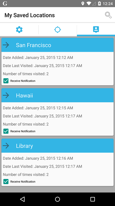
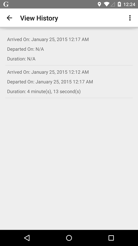
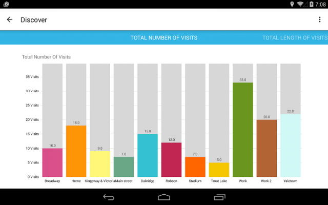
Gistory Analytics - Gistory is a powerful app that allows you to record the places you have been. In addition, you can also use the built-in analytics tool to allow you to discover how often and where you spend your time the most. Just save your current location in the app, and Gistory will take care of the rest. The next time you come back to this place, Gistory will let you know when the last time you were here and how long you stayed. In addition, Gistory will also allow you to take pictures and tag it to the place so you can remember exactly where you took them. Gistory can help answer questions like… - When was the last time I went to Hawaii? - How long do I spend at the gym every week? - Where was this picture taken? - Did I spend more time at work or at home last month? - How often did I go shopping two months ago?
Like it? Share with your friends!
Supported operating systems:
Google Android 10.x, Google Android 3.0, Google Android 3.1, Google Android 3.2, Google Android 4.0, Google Android 4.1, Google Android 4.2, Google Android 4.3, Google Android 4.4, Google Android 5.x, Google Android 6.x, Google Android 7.x, Google Android 8.x, Google Android 9.x
Similar Software:
GPS Tools GPS Tools - is an application for calibration of a satellite module of your smartphone. The utility uses a magnetic compass, makes changes to the route, speed and accuracy of the displayed data. As soon as the calibration is completed you can track your location with maximum accuracy
GPS Tracker GPS tracker for Android supporting KML export (Google Earth) and raw format export as txt data
Redpin The aim of the Redpin project is to create an open source system that allows indoor positioning up to room-level description using mobile phones
GPS Tweet GPS Tweet - Share your location with a Tweet, it's easy... download and install this app, after opening it, write a message, press the Twitter logo for sharing your position on Twitter, your friend sees a link, when he clicks the link he sees your position and your message on Google Maps
amAze (LG) AmAze is a first of its kind free navigation and local search service. It is free to download and use and it contains wide coverage of maps including aerial photo in Europe, North America, Australia and parts of Asia and Africa
amAze (Samsung) AmAze is a first of its kind free navigation and local search service. It is free to download and use and it contains wide coverage of maps including aerial photo in Europe, North America, Australia and parts of Asia and Africa
Redpin The aim of the Redpin project is to create an open source system that allows indoor positioning up to room-level description using mobile phones
InstaMapper (Android) InstaMapper is a free service that allows you to track a person or vehicle online in real time using a GPS-enabled mobile phone.
To use InstaMapper, you create a free account. Registration takes only a minute or two. All it is asked for is a username, password, and a valid email address.
Next, you install a small application on your GPS-enabled phone
wheredroid wheredroid is a simple application to display your coordinates from the GPS receiver: latitude, longitude, heading, speed, number of satellites used and (it's its peculiarity) altitude and accuracy. It is quite usable as an altimeter and a compass.
What's New in This Release:
· fixes a bug inverting East with West on some displays
What's New in 1.4
GoPenS GoPenS is an OpenSource GPS application for Android phones, based on OpenStreetMap (OSM). OpenStreetMap is a collaborative map of the world. Therefore, one of the main functions of the application is to be able to record a trace and send it as a GPX to the OSM servers, and so edit the OSM Map
Comments on Gistory Analytics:
Comments not found
If you noted an error or download link is broken, please, report it via this page or use comments.
Gistory Analytics is compatible with your device AllCall Bro Dual SIM 3G


")
")
")

