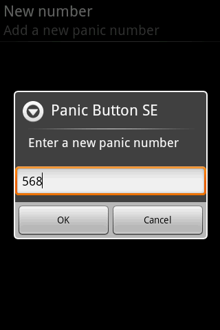
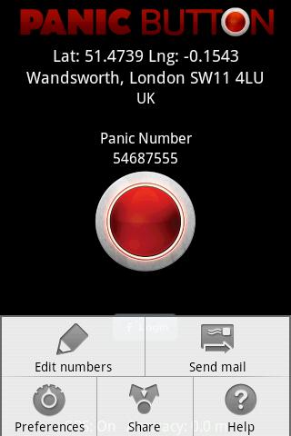
Red Panic Button - When you are in trouble press the Red Panic Button! You just have to set a panic number and the mobile phone will send a sms which contains a link to Google Maps with your fine GPS based or coarse GSM based coordinates.
What's New in This Release:
· New Feedback button!
· QVGA and WVGA screen layout improvements!
What's New in 2.1.0:
· Post Twitter Panic
Like it? Share with your friends!
Supported operating systems:
Google Android 1.6, Google Android 10.x, Google Android 2.0, Google Android 2.1, Google Android 2.2, Google Android 2.3, Google Android 3.0, Google Android 3.1, Google Android 3.2, Google Android 4.0, Google Android 4.1, Google Android 4.2, Google Android 4.3, Google Android 4.4, Google Android 5.x, Google Android 6.x, Google Android 7.x, Google Android 8.x, Google Android 9.x
Similar Software:
Location Finder Place Search Location Finder Place Search - This Free place finder application automatically detect your current location and shows best places around you. This app will show you all available ATM, Bus Stands, Service centers, Airport, Food Services etc. around the current location. Download this free app on your smartphone and just simplified your place search
CoPilot Premium Europe (Android) CoPilot Premium Europe (Android) - CoPilot Premium is a powerful GPS navigation solution for Android smartphones and tablets. The app comes with downloadable maps of more than 40 European countries, which can be used offline, allowing you to find your way even when you don't have an internet connection
TomTom Europe for Android TomTom Europe for Android - TomTom Europe is a turn-by-turn GPS navigator for Android devices. The app includes accurate offline maps, so you can find your way anywhere, even without an internet connection
SportsTracker (by STL) SportsTracker (by STL) - Share, compare, train and compete in your sport on
http://sportstracklive.com
Live sports tracking from your android phone
http://sportstracklive.com
Beat your personal bests!
Superior GPS sports tracking app. Running, cycling, mountain biking, skiing, snowboarding, sailing, biking, flying, gliding
yozi yozi is a navigation software for the Android platform. It uses digital topographic maps in well-known Ozi Explorer formats for navigation and doesn't require network access like built-in Maps application on Android
TomTom Mexico for Android TomTom Mexico for Android - TomTom Mexico is a turn-by-turn GPS navigator for Android devices. The app includes accurate offline maps, so you can find your way anywhere, even without an internet connection
Outdoor Share for Android Outdoor Share for Android - The Outdoor Navigation software is your best friend through your adventures in the wild.
Go into the outdoors with confidence and enjoy your activities without worrying about the tools to help you navigate. Your Outdoor Navigation app is made by the people who have been developing this software since 2003 across multiple platforms
Share Path Share Path - Although e-maps and GPS can provide accurate navigation, we are confined on the basis of the existing database. Many times we may go to a place which cannot be found on the e-map. For example, go to a club with friends; on a vacation to the countryside near the lake where we have never been to
Geocast A location and multimedia enabled file sharing application
GPS Tracker GPS tracker for Android supporting KML export (Google Earth) and raw format export as txt data
Other Software by developer «Ultimate Communication Software»:
Red Panic Button (iPhone) Red Panic Button (iPhone) - When you are in trouble press the Red Panic Button! You just have to set a panic number or mail address and the mobile phone will send a message which contains your address and location, determined using the fine GPS based or coarse GSM based coordinates
Red Panic Button (iPhone/iPad) Red Panic Button (iPhone/iPad) - When you are in trouble press the Red Panic Button! You just have to set a panic number or mail address and the mobile phone will send a message which contains your address and location, determined using the fine GPS based or coarse GSM based coordinates


")
")

")

")


")
")