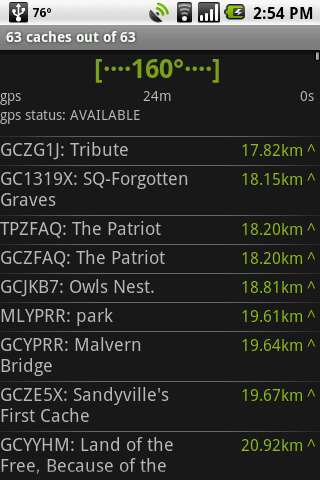
GeoBeagle is a free, open source application for the Android platform to aid users in finding geocaches and letterboxes. It enables the user to do paperless geocaching.
Geocaches and letterboxes are objects that have been hidden in the real world; the game of geocaching/letterboxing is finding these objects around you.
What's New in This Release:
· Fix crash on hc view menu, fix compass jitter, fix sync resume
What's New in 1.4.14:
· Added link on details page to go to web page
What's New in 1.4.12:
· fix for map button on
What's New in 1.4.11:
· fix for pre-HC crash on delete all
What's New in 1.4.10:
· honeycomb, configurable bcaching host
What's New in 1.3.10:
· Fixes for cupcake *and* honeycomb. Another bcaching message fix.
What's New in 1.3.8:
· fix crash leaving radar/compass view
What's New in 1.3.0:
· Fix display on tablet devices. Add summary at the end of sync What's New in 1.2.10:
· parse description in LOC files
Like it? Share with your friends!
Supported operating systems:
Google Android 1.5, Google Android 1.6, Google Android 10.x, Google Android 2.0, Google Android 2.1, Google Android 2.2, Google Android 2.3, Google Android 3.0, Google Android 3.1, Google Android 3.2, Google Android 4.0, Google Android 4.1, Google Android 4.2, Google Android 4.3, Google Android 4.4, Google Android 5.x, Google Android 6.x, Google Android 7.x, Google Android 8.x, Google Android 9.x
Similar Software:
GPS Tracker GPS tracker for Android supporting KML export (Google Earth) and raw format export as txt data
Mobile Tracker Pro Mobile Tracker Pro - Mobile Tracker apps is focused to Android Mobile which can be Tracked after it get lost. When the Android phone get stolen/lost and When the new SIM card is inserted in the mobile, this app begins and automatically sends SMS from the SIM card which is inserted
MozStumbler MozStumbler - Mozilla Location Service is an experimental project that aims to provide location-based services using data collected from users. The objective is to create a database of cell towers and WiFi access points that mobile devices can use to retrieve their location instead of having to rely on GPS
Mapacha Mapacha - What you can do with Mapacha? You can localize your friends and family in a map. See where they are if your are meet with them and know how much they last for arrive. If you are worried about your sons or couple and see / track where they are. Also you can localize people from your country if you are abroad. What about privacy? Use it as you want
TomTom Italy for Android TomTom Italy for Android - TomTom Italy is a turn-by-turn GPS navigator for Android devices. The app includes accurate offline maps, so you can find your way anywhere, even without an internet connection
MileageLedger 2.0 MileageLedger 2.0 - New features include resume trip, filtered reports, auto data export, data export via e-mail or SD card, improved GUI, increased reliability & accuracy, fault tolerance, & trip categories
Mileage Ledger is a GPS powered mileage logging application designed for Android enabled smart phones
Sygic: GPS Navigation Sygic: GPS Navigation - Sygic is the premium turn-by-turn GPS navigation app. Sygic boasts an intuitive interface: drag the map, pinch to zoom, change point of view using built-in compass and tap target square to choose action. Sygic is comfortable and safe: advanced routing is optimized for Real-Time Traffic
OSMTracker for Android OSMTracker stands for OpenStreetMap Tracker. It allows you to track your journey and mark significant way points. Way points can be marked with a tag using a button, with a quick voice record, a text note or by taking a picture. The various button pages and layouts can be customized to suit your OpenStreetMap activities
Mobile Spy Track EVERY move your child or employee makes using our POWERFUL cell phone monitoring technology to expose the TRUTH!Mobile Spy is a hybrid software/service which allows you to monitor our child or employee's smartphone in real time
GPS Status GPS Status is an application which displays the information received from the phone's GPS receiver. In addition to the basic location information it can extract and display the state and location of each visible GPS satellite which is displayed on a simple sky view. The outer circle represents the horizon while the center corresponds to the zenith right above your head
Other Software by developer «GeoBeagle Team»:
not found
Comments on GeoBeagle:
Lucas:
Cool
Date: 6 Jun 11
If you noted an error or download link is broken, please, report it via this page or use comments.
GeoBeagle is compatible with your device Allview Viva H10 3G