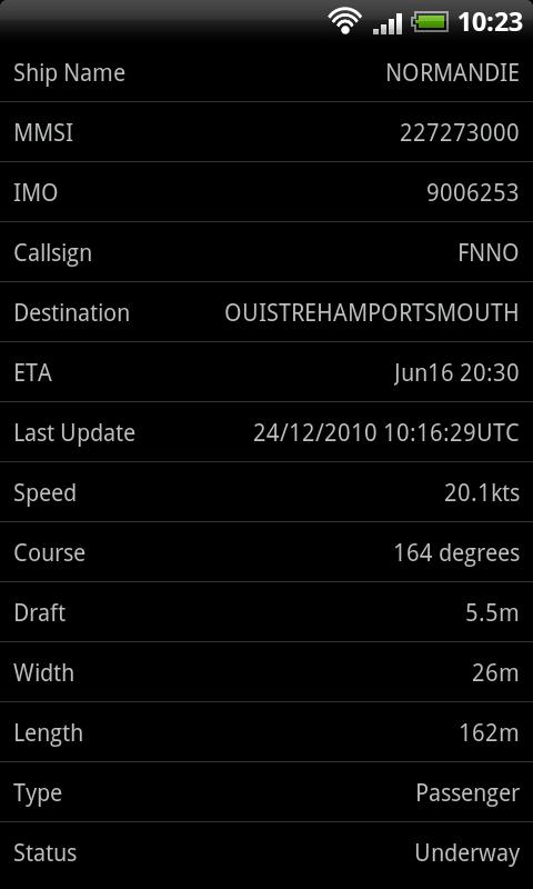
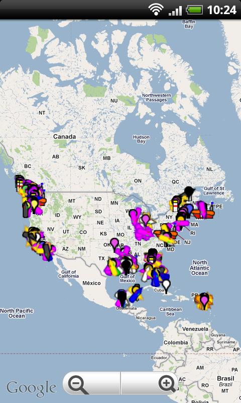
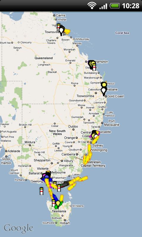
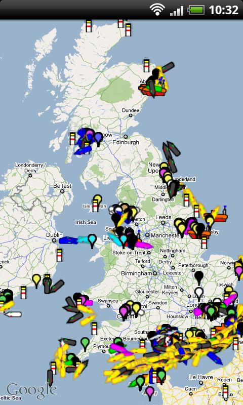
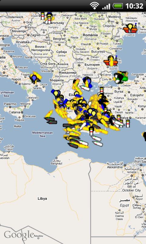
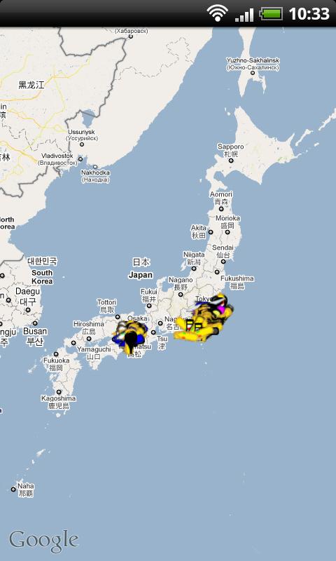
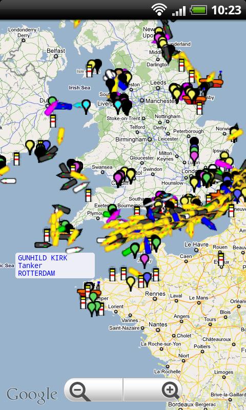
Ship Finder for Android - Ship Finder is a useful application that allows you to track ships in near real-time on a 2D map.
Tap on a ship to view its name, port of registration, destination, ETA, location, MMSI, IMO, callsign , heading, length, width, draft, etc.
The app works by picking up AIS feeds used by the ships for safety and navigation purposes.
What's New in This Release:
· Fixed the crashing when low/no signal
Like it? Share with your friends!
Supported operating systems:
Google Android 1.6, Google Android 10.x, Google Android 2.0, Google Android 2.1, Google Android 2.2, Google Android 2.3, Google Android 3.0, Google Android 3.1, Google Android 3.2, Google Android 4.0, Google Android 4.1, Google Android 4.2, Google Android 4.3, Google Android 4.4, Google Android 5.x, Google Android 6.x, Google Android 7.x, Google Android 8.x, Google Android 9.x
Similar Software:
Geopaparazzi Geopaparazzi is a tool developed to do fast qualitative technical and scientific surveys. Its strength is its direct connection to the BeeGIS GIS, that can be used to further process the collected data.
Even if the main aim is in the field of surveying, it contains tools that can be of great use also to tourists that want to keep a geo-diary
amAze (Android) AmAze is a first of its kind free navigation and local search service. It is free to download and use and it contains wide coverage of maps including aerial photo in Europe, North America, Australia and parts of Asia and Africa
TomTom Poland for Android TomTom Poland for Android - TomTom Poland is a turn-by-turn GPS navigator for Android devices. The app includes accurate offline maps, so you can find your way anywhere, even without an internet connection
GPS Signal Widget GPS Signal Widget - Do you get tired waiting for the GPS location to be available? With this tool you can check out the GPS satellites and the signal strength in just a nice 1X1 widget.
The spokes in the widget represents the satellites and the length of the spokes is a measure of the signal strength.
Enable or disable the widget by tapping on the widget
AugSatNav Walk AugSatNav is an augmented reality navigation system which overlays walking directions upon a live video feed of the path or road ahead.
With AugSatNav there is no need to follow instructions or interpret maps - you can simply find your way by walking along the route highlighted by a bright white line
WAY - Where are you? WAY - Where are you? - Share you location and find your friends easily.
Wanna find your friends?
Wanna share your location with friends?
Congratulations: YOU FOUND THE APPLICATION WHICH ALLOWS YOU THAT AND EVEN MORE.
"WAY - Where are you?" allows you to find your friends' locations in real time and/or send them free messages
Find my location Find my location - Sparar din plats och ger dig möjlighet att även få vägbeskrivning till den platsen.
Du kan även skicka din Position via sms i appen..
CoPilot Live Europe (Android) CoPilot Live Europe (Android) - CoPilot Live is full-featured voice-guided GPS navigation with Western and Eastern Europe street maps stored on your phone. Includes 3D guidance, lane assist, speed limit warnings, safety camera alerts, planning mode.
Download maps via WiFi after purchase. Unlimited use after 10 days once Google order verified
MapMyRun+ for Android MapMyRun+ for Android - MapMyRun is a fitness assistant designed to allow runners, joggers and walkers to track their workouts using their phone's built-in GPS.
With the app you can view your route on a map and record your workout details, including duration, distance, pace, speed, elevation and calories burned
CopsAlarm No more tickets Show where the hiding police are on Google Map As well as speed cam,red light locations Lite shows police,red lights only
Other Software by developer «pinkfroot»:
Plane Finder for iPhone Plane Finder for iPhone - Plane Finder is a flight tracker that shows real-time air traffic on a 2D map.
Tap on a plane to view airline, flight number, route, speed and altitude, aircraft information, departure and arrival data, etc.
The app allows you to search for more than 12,000 aircraft, which are tracked in real-time using ADS-B data
Plane Finder for Android Plane Finder for Android - Plane Finder is a flight tracker that shows real-time air traffic on a 2D map.
Tap on a plane to view airline, flight number, route, speed and altitude, aircraft information, departure and arrival data, etc.
The app allows you to search for more than 12,000 aircraft, which are tracked in real-time using ADS-B data
Plane Finder 3D for Android Plane Finder 3D for Android - Plane Finder 3D is a flight tracker that shows live air traffic in beautiful 3D.
With simple touch controls you can pan and zoom to fly around the planes, and can even get on board a plane for a captain's eye view from the cockpit.
The app allows you to search for more than 12,000 aircraft, which are tracked in real-time using ADS-B data
Plane Finder Free for iPhone Plane Finder Free for iPhone - Plane Finder Free is a flight tracker that shows real-time air traffic on a 2D map.
Tap on any plane to view flight number and plane registration / tail number.
The app can show the location of more than 12,000 aircraft, which are tracked in real-time using ADS-B data
Plane Finder HD for iPad Plane Finder HD for iPad - Plane Finder is a flight tracker that shows real-time air traffic on a 2D map.
Tap on a plane to view airline, flight number, route, speed and altitude, aircraft information, departure and arrival data, etc.
The app allows you to search for more than 12,000 aircraft, which are tracked in real-time using ADS-B data
Plane Finder 3D for iPhone/iPad Plane Finder 3D for iPhone/iPad - Plane Finder 3D is a flight tracker that shows live air traffic in beautiful 3D.
With simple touch controls you can pan and zoom to fly around the planes, and can even get on board a plane for a captain's eye view from the cockpit
Ship Finder HD for iPad Ship Finder HD for iPad - Ship Finder is a useful application that allows you to track ships in near real-time on a 2D map.
Tap on a ship to view its name, port of registration, destination, ETA, location, MMSI, IMO, callsign , heading, length, width, draft, etc.
The app works by picking up AIS feeds used by the ships for safety and navigation purposes


")


")


