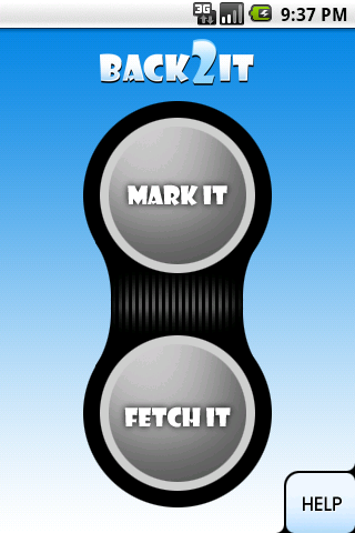
With one click, you may mark places like:
- parking lots
- favorite restaurants
- museums
- theaters
- public park
...
and 1 click to go back with GPS navigation on Google Map.
Switch to Google Map for route.
Like it? Share with your friends!
Supported operating systems:
Google Android 1.5, Google Android 1.6, Google Android 10.x, Google Android 2.0, Google Android 2.1, Google Android 2.2, Google Android 2.3, Google Android 3.0, Google Android 3.1, Google Android 3.2, Google Android 4.0, Google Android 4.1, Google Android 4.2, Google Android 4.3, Google Android 4.4, Google Android 5.x, Google Android 6.x, Google Android 7.x, Google Android 8.x, Google Android 9.x
Similar Software:
GPS Map Camera use GoogleMap GPS Map Camera use GoogleMap - The main feature of the 'GPS Map Camera':
When you take a piture with GPS enabled, it will paste the google map, address and weather to picture. (GPS latitue/longitude also include in the information)
Please enable your network and GPS function before using this application
Pocket Caddy Pocket Caddy - #1 Golf GPS app: 3D flyover of holes, yardage to greens, shot recording, stats, scorecard, hazard carry or lay up position. Positioning is shot to hole, not cart to hole. Free PC Analytics inc. 3D Google Earth replay with stats, and Free DIY Course Mapping software both available from www.satsportsna
TomTom North America for Android TomTom North America for Android - TomTom North America is a turn-by-turn GPS navigator for Android devices. The app includes accurate offline maps, so you can find your way anywhere, even without an internet connection
Navizon for Android Navizon for Android is an on-demand location system based on push-technology. Once it is installed, Navizon will let you track the mobile device's location with a click of a button. This can be especially useful if you lost your phone or if you are trying to locate a friend
amAze (LG) AmAze is a first of its kind free navigation and local search service. It is free to download and use and it contains wide coverage of maps including aerial photo in Europe, North America, Australia and parts of Asia and Africa
TomTom Southern Africa for Android TomTom Southern Africa for Android - TomTom Southern Africa is a turn-by-turn GPS navigator for Android devices. The app includes accurate offline maps, so you can find your way anywhere, even without an internet connection
GeoSense GeoSense - Ever wondered how you would know if you have reached a destination you've never been before? GPS is great .
JTrip JTrip - Create your own trip in Thailand. JTrip recommends attractions and directions that you need. Let's get to know Thailand together.
· select places.
· select hotel.
· show map location.
· route path form src to dest.
· taxi, time remaining.
· suggest bus number
TomTom Poland for Android TomTom Poland for Android - TomTom Poland is a turn-by-turn GPS navigator for Android devices. The app includes accurate offline maps, so you can find your way anywhere, even without an internet connection
Cell Tower Locator This application attempts to find the cellular tower location the mobile is connected to
Other Software by developer «Macrosoft»:
PlaceMemo Lite PlaceMemo Lite - One click to mark your favorite place like:
- parking lot to find your car
- restaurants
- theaters
- public park
...
One click to view locations in Google Map & get direction to it by GPS.
Email place(s), Weather of recorded place(s)..
PhotoSpot Lite PhotoSpot gets you rich information about all the pictures you take
PhoneQ Lite PhoneQ saves lives!
The most dangerous time in the car is when you are looking up a contact and dialing the phone.
PhoneQ lets you build a list of phone calls you need to make before you get in the car. When the time comes, the phone will prompt for you to make the call
HostEye Lite HostEye Lite - Check service status on your servers on the road, in a meeting or on vacation. Monitor your critical hosts and know what services are up and running or down
MonsterSpider MonsterSpider - This is the application that gets you connected to people and businesses.
MonsterSpider helps you find rich information about people, businesses and contacts. The information includes email addresses, telephone numbers, locations / addresses, company names, Job Titles and names, etc
Contact:Finder Lite Contact:Finder gets you connected to people as contacts!
This is not a people finder through people's names, it finds people through their employers, titles, locations. The basic idea is to find contacts for certain purposes, say, try to find a job? You may search for HR Manager


")


