Supported operating systems:
Windows Mobile 5.0, Windows Mobile 6 Classic, Windows Mobile 6 Professional, Windows Mobile 6.1 Classic, Windows Mobile 6.1 Professional
Similar Software:
FON Access Points for Estonia FON Access Points for Estonia - FON offers you a new Points of Interest service (POIs). This allows you to download FONspots directly to your navigation device.
What does that mean? You can download a Points of Interest file directly to your navigation device
GPSPicturer GPSPicture allows you to create GPS stamped JPEG files and displays them in an easy to use explorer interface. When you get a GPS lock the program will display the JPEG files in order of distance to your current GPS. To view the image file simply tap on it. The map service is provided by Google
TerraTrack Recorder 7 Route guidance in 3D view, makes navigation processes very simple and intuitive
SmartProtect SmartProtect helps you track and recover your phone once stolen or lost.
Features includes:
1. A Thief or Lost Prevention Software with SMS Auto-Responder and GPS Capability created for Windows Mobile Devices.
2
FON Access Points for Finland FON Access Points for Finland - FON offers you a new Points of Interest service (POIs). This allows you to download FONspots directly to your navigation device.
What does that mean? You can download a Points of Interest file directly to your navigation device
FON Access Points for Moldova FON Access Points for Moldova - FON offers you a new Points of Interest service (POIs). This allows you to download FONspots directly to your navigation device.
What does that mean? You can download a Points of Interest file directly to your navigation device
SportsGPSer SportsGPSer - SportsGPSer can be used in a sports game to track the GPS of the players in real time via FTP server. Every second the program re-FTP's the players position to the FTP server.
This program requires that you have both the 'BeanDLL.dll' file ** and ** the runtime files for Visual Basic on your PocketPC computer
FindMe by SMS FindMe by SMS - This one works in background and does not alert user that their location is queried. Restarts automatically if phone is power cycled
GPSBot GPSBot - This small application seems to solve the problem with TomTom navigator 7, iGO8 and other navigation programs, that shows a position of several meters back from the real one in some new devices.
Simply copy the file to the folder where the navigation program executable resides and launch this application instead of the real program
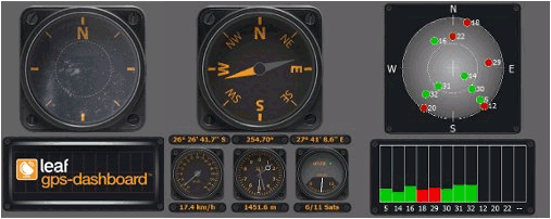
Comments on GPS Dashboard:
Comments not found
If you noted an error or download link is broken, please, report it via this page or use comments.
GPS Dashboard is compatible with your device AnyDATA ASP-500GA