| |
FON Access Points for Aruba

|
Version: 1.0
Platforms: Symbian OS, Pocket PC, Palm, Series 60, BlackBerry, Linux, Smartphone, Maemo, JavaCategories: Travel & NavigationUpload date: 18 Sep 11Developer: FON License: Freeware
Downloads: 750
File Size: 1 Kb
|
FON Access Points for Aruba - FON offers you a new Points of Interest service (POIs). This allows you to download FONspots directly to your navigation device.
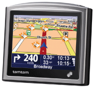
What does that mean? You can download a Points of Interest file directly to your navigation device. Then you can have your Tom Tom in your passenger seat guiding you directly to the nearest FONspot!
Download the POIs to the most common navigation devices: For GPS Exchange Format (.gpx), for Garmin and Navman (.csv), for Tom Tom (.ov2) or even for Google Earth (.kml)
Most GPSs, PDAs and other navigation devices allow you to store POI data. A Point of Interest shows the location of a restaurant, Gas Station, and now a FONspot on your navigation device's maps. Finding a FONspot was never this easy!
|
|
Like it? Share with your friends! |
|
If you got an error while installing Themes, Software or Games, please, read FAQ.
|
| Requirements: navigation device supporting .gpx (GPS Exchange Format), .csv (for Garmin and Navman), .ov2 (for Tom Tom) or .kml (Google Earth) |
| |
Supported operating systems:
Java ME, Java Nokia 240x320, Java SE 240x320, Nokia Internet Tablet OS 2006 Maemo 2.1, Nokia Internet Tablet OS 2007 Maemo 3.0, Nokia Internet Tablet OS 2008 Maemo 4.0, Nokia Internet Tablet OS 2008 Maemo 4.1, Nokia Internet Tablet OS Maemo 5.0, Palm OS 3.x, Palm OS 4.x, Palm OS 5.x, Pocket PC 2002, RIM BlackBerry OS 4.2, RIM BlackBerry OS 4.3, RIM BlackBerry OS 4.5, RIM BlackBerry OS 4.6, RIM BlackBerry OS 4.7, RIM BlackBerry OS 5.0, RIM BlackBerry OS 6.0, S60 1st Edition, S60 2nd Edition, S60 3rd Edition, S60 3rd Edition FP1, S60 3rd Edition FP2, S60 5th Edition, Windows Mobile 2003, Windows Mobile 2003 Smartphone, Windows Mobile 5.0, Windows Mobile 5.0 Smartphone, Windows Mobile 6 Classic, Windows Mobile 6 Professional, Windows Mobile 6 Standard, Windows Mobile 6.1 Classic, Windows Mobile 6.1 Professional, Windows Mobile 6.1 Standard, Windows Mobile 6.5 Professional, Windows Mobile 6.5 Standard
| | |
Similar Software:
|
 | myRadar
myRadar is a location aware radar application that makes use of Wunderground and Accuweather US web services to show real-time, animated Radar Images of your local area regardless of where in the US you might be. This application requires myLocation services to function automatically.
The program will install to /Program Files/myRadar |  | LiteTrack
LiteTrack is the right tool to record your route, save off-road paths, retrace a way, get your position on the map with detailed gps data (satellite charts, speed and much more) |  | Navigation BE-ON-ROAD Central Europe Q2/2011
Navigation BE-ON-ROAD Central Europe Q2/2011 - The new major version of be-on-road presents new features and is based on new platform which brings high level of reliability, portability and speed on almost any kind of device. The new be-on-road brings high value voice guided door-to-door navigation |  | GPS Speedometer
GPS Speedometer is an attractive speed meter on the car dash for Windows Mobile phones.
Make sure you have .net framework installed. The setings.exe included in the attachment is from the Microsoft SDK samples, which can be used to set the COM port if you dont' have any other application.
This has been tested in HTC P3300 (Artemis) and HTC TyTN |  | GParkS
The other day I was at a football game where I had to park on a golf course far from the stadium and ended up wandering around for 20 minutes trying to locate the car afterward |
|
 | ppc FindMyCar
ppc FindMyCar - Innovative software for Windows Mobile devices that uses the GPS signal to show signs that allow to reach a geographic location.
Suitable for various uses (eg. find car parked in a parking area or in an unknown city, finding a person (who has sent their coordinates) in a lovely beach, in a fair, in another boat, find an area of sea fishing, etc..) |  | FON Access Points for Gabon
FON Access Points for Gabon - FON offers you a new Points of Interest service (POIs). This allows you to download FONspots directly to your navigation device.
What does that mean? You can download a Points of Interest file directly to your navigation device |  | TwitterGPSer
TwitterGPSer uses the GPS on your PocketPC to find your current latitude/longitude/speed and allows you to update Twitter.com. Tap the button to get the GPS lock and when the program gets the lock it will create a Tweet with a Google.com map link. This service is provided by Twitter |  | TravelCompasses
TravelCompasses - TravelCompasses uses the GPS on your PocketPC to find a "Home" position. Then the program displays a compass that rotates to your current GPS. The program also displays your current compass degrees.
This program requires that you have both the 'BeanDLL.dll' file ** and ** the runtime files for Visual Basic on your PocketPC computer |  | gigNavigator
Navigation system for raster maps |
|
|
| |
|
| |
Comments on FON Access Points for Aruba:
Comments not found
|
|
| |
If you noted an error or download link is broken, please, report it via this page or use comments. |
| |
FON Access Points for Aruba is compatible with your device AnyDATA ASP-500GA |
|
|
|
