Where is my son? He did not answer my phone call !!! Don't worry, GpsU will answer.
GpsU is a GPS Tracker, GPS Family Locator and GPS Friend Locator by SMS for Windows Mobile (WM).
GpsU Is Ideal For
Locate children, eldly family members and beloved ones anywhere in the world even if indoors without GPS signal.
Track vehical, locate lost phone.
Record GPS track with time stamps, distance travelled.
Display location received or recorded GPS tracks using Google Maps in your phone/PC.
It can be used a speed meter, travel timer, travel distance meter.
Use live track to explore unkown area and go back to where you are from. No map is required.
Unique Features
Use GPS, WiFi and GSM/3G Cell Tower triple way to locate.
Retrieve remote phone's location by sending a SMS and get a reply by SMS.
Remotely turn on/turn off GPS and WiFi. Remote phone does not use mobile data.
Location sharing security setup and authorization by just sending a SMS.
Record GPS track with no length limit and save to multiple files.
No account login needed. GpsU is anonymous, safe and secure.
Support Km/Mile/Nautical Mile.
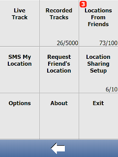
Sample Screens
Here are some more sample screens and their descriptions.
Main screen to show location, distance, travel time, speed, travel direction and GPS status
Live track
System menu
Location sharing security setup
Send a SMS to get remote phone's location information.
After receiving SMS for location information, display it in Google Maps. Kath is likely indoor and inside Guanyun Garden.
GPS track displayed in Google Maps.
Like it? Share with your friends!
If you got an error while installing Themes, Software or Games, please, read FAQ.
Supported operating systems:
Windows Mobile 6 Classic, Windows Mobile 6 Professional, Windows Mobile 6.1 Classic, Windows Mobile 6.1 Professional, Windows Mobile 6.5 Professional
Similar Software:
bliinGPSXS bliinGPSXS is a free and easy software that sends your GPS-location to the bliin servers so you can be positioned Live! on the map in real-time. On bliin, users can locate and follow friends on a map in real-time, upload media: "Shares" - photos, videos, audio and text to Google Maps or other mapping services. Shares are geo-tagged to the location of capture
PictureGPS PictureGPS allows you to tag pictures from your PocketPC camera in real time with a GPS stamp and view the distance of each picture via your current GPS. You can use the ruler to view the distance of each picture and also view the GPS stats for each picture with a Google.com map. The map service is provided by Google
Run.GPS Trainer UV Run.GPS Trainer is the perfect tool for sports like running, skiing and walking. It uses the Global Positioning System (GPS) to record all of your training parameters like speed, distance and altitude.
Run.GPS Trainer UV is the successor of of the award-winning Run.GPS Trainer software and has tons of new features
chtiGPS chtiGPS is intended to the sportsmen and to hikers, for their training (bicycle, rollers, ski...), but also to locate itself by knowing the distance and the direction from the closest cities. Geolocalization finally makes it possible to reassure its close relations at the time of great exits..
GPS Speedometer GPS Speedometer displays an attractive dash with both digital and analog display using GPS
amAze (Samsung) AmAze is a first of its kind free navigation and local search service. It is free to download and use and it contains wide coverage of maps including aerial photo in Europe, North America, Australia and parts of Asia and Africa
RulerPOIs RulerPOIs - RulerPOIs can be used to create named compact POI GPS point files. You can use the GPS on your PocketPC to create a file and view the other files via GPS distance. You can also select 2 GPS points and place them into the ruler to view the metric/imperial distance.
This program requires that you have both the 'BeanDLL
FON Access Points for Japan FON Access Points for Japan - FON offers you a new Points of Interest service (POIs). This allows you to download FONspots directly to your navigation device.
What does that mean? You can download a Points of Interest file directly to your navigation device
FON Access Points for Slovakia (Slovak Republic) FON Access Points for Slovakia (Slovak Republic) - FON offers you a new Points of Interest service (POIs). This allows you to download FONspots directly to your navigation device.
What does that mean? You can download a Points of Interest file directly to your navigation device
MyGPS_PDA MyGPS_PDA - MyGPS_PDA is a light MyGPS version for PocketPC systems. It reads the NMEA sentences coming from a GPS antenna connected to the PocketPC and shows your position on a MyGPS calibrated map. The program can also store on a file the track log together with specific waypoints created by the user
Other Software by developer «Ellpa»:
not found
Comments on GpsU:
Comments not found
If you noted an error or download link is broken, please, report it via this page or use comments.
GpsU is compatible with your device AnyDATA ASP-705W


")


")
