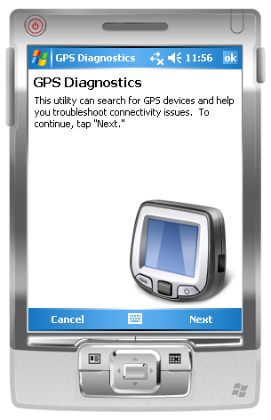
GPS Diagnostics 1.0 - These are the problems which users typically face when they're trying to get their GPS device to work:
1. Users' Windows Mobile 5.0+ devices frequently have incorrect GPS Intermediate Driver settings.
2. Users are unaware that Bluetooth is turned off, or do not know how to configure a virtual serial port for their GPS device.
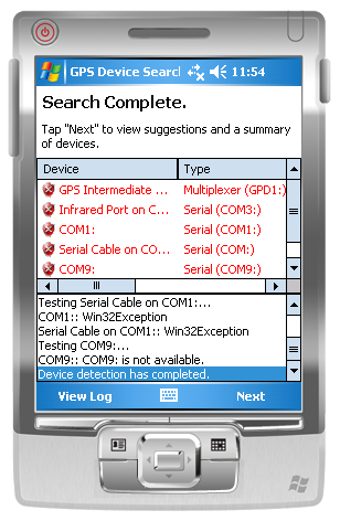
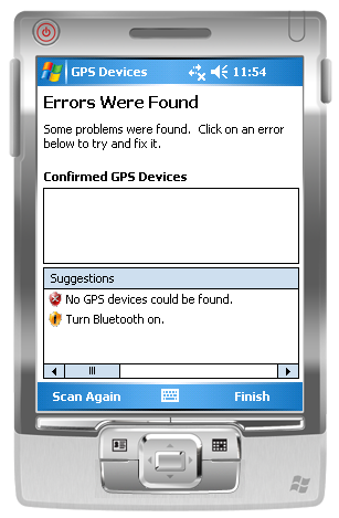
Built using GPS.NET 3.0, the utility will scan the local machine for GPS devices then make suggestions on what could be improved. Suggestions are in clear English and can be clicked to attempt a fix. This utility can:
1. Configure the GPS Intermediate Driver to correct COM: port and baud rate settings.
2. Detect when Microsoft Bluetooth is installed but turned off.
3. Suggest ideal COM: port and baud rate settings to use.
4. Recommend one device as "most reliable" when multiple devices are detected.
5. Generate log files which can (with some tweaking of code) be sent to you for further study.
Like it? Share with your friends!
If you got an error while installing Themes, Software or Games, please, read FAQ.
Supported operating systems:
Windows Mobile 2003, Windows Mobile 5.0, Windows Mobile 6 Classic, Windows Mobile 6 Professional, Windows Mobile 6.1 Classic, Windows Mobile 6.1 Professional, Windows Mobile 6.5 Professional
Similar Software:
myRadar myRadar is a location aware radar application that makes use of Wunderground and Accuweather US web services to show real-time, animated Radar Images of your local area regardless of where in the US you might be. This application requires myLocation services to function automatically.
The program will install to /Program Files/myRadar
GPS Tuner Essentials GPS Tuner Essentials is designed specifically for off-road use: its large buttons, selectable tool window size, multiple Compass views make it extremely user-friendly and reliable
ppc PhotoGeoTag ppc PhotoGeoTag - Take pictures with your mobile phone and incorporate the data of the geographical location. The application allows you to include in the photographs, data from the GPS receiver, along with a brief note. If you know the coordinates, not having the GPS receiver, you can also handwrite geographic data
uTrack uTrack - uTrack can be used to track mobile devices in a passive, non-intrusive way.
It can be used to publish the location of a Windows Mobile powered device to a widget that can be included in numerous websites including you're own. If a widget is not possible or more flexibility is required, uTrack can also be configured to publish directly to any website or webservice
QuickGPS Lite QuickGPS Lite can speed up the time for determining your GPS position by downloading the latest satellite data via an Internet connection (such as GPRS, ActiveSync, etc.).
For quickest connection use:
1. Mod Driver
2. QuickGPS Lite
3. GPS Test
It takes around 10 seconds from cold start to get 9 satellites and have a stable connection
amAze (Sony Ericsson) AmAze is a first of its kind free navigation and local search service. It is free to download and use and it contains wide coverage of maps including aerial photo in Europe, North America, Australia and parts of Asia and Africa
TravelGPSer TravelGPSer - TravelGPSer uses the GPS on your PocketPC to graphically view your GPS movement. You can adjust the slider for to view larger distances on the map. This uses "The Vincenty inverse formula for ellipsoids" (accuracy to within 0.5mm, or 0.000015").
This program requires that you have both the 'BeanDLL
gOmniTracker Wonder where was your teenager spending time last night? or when did they leave school, home, or tennis-practice? Or maybe it's granny you're concerned about whether she got back home from the park yet
FON Access Points for Bulgaria FON Access Points for Bulgaria - FON offers you a new Points of Interest service (POIs). This allows you to download FONspots directly to your navigation device.
What does that mean? You can download a Points of Interest file directly to your navigation device
ExerciseGPSes ExerciseGPSes - ExerciseGPSes uses the GPS on your PocketPC to graphically display your walking/running/riding speed on a moving graph. You can use this to keep your exercise pace. NOTE: The program does not display/graph 0 speeds.
This program requires that you have both the 'BeanDLL.dll' file ** and ** the runtime files for Visual Basic on your PocketPC computer
Other Software by developer «Jon Person»:
GPS.NET GPS.NET is a formerly commercial .NET component maintained by GeoFrameworks, LLC from 2004 to 2009. In 2009, Jon Person decided to release the full source code of GPS.NET to the public domain for the benefit of the open source development community. This version (3.0) is the latest release
GeoFramework GeoFramework - This project was formerly a commercial library maintained by the company "GeoFrameworks" for two components it sold (GPS.NET and GIS.NET) from 2004 to 2009. In 2009, Jon Person decided to release the source code for this library in order to assist the open source community


")


