Terracrosser is a free GPS navigation software for Windows Mobile Pocket PC.
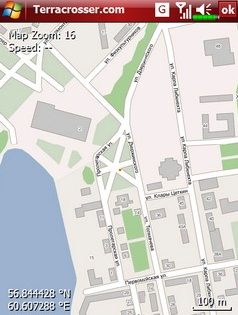
· Terracrosser works in Map and Photo modes
· Terracrosser uses zoomable maps
· Terracrosser is completely compatible with Google Maps service. With included Mapper module you can download maps from the Internet. All maps are automatically calibrated (geo-referenced)
What's New in This Release:
Terracrosser:
· POI system
· enhanced scrolling
· multiple options in settings menu
· maps correction to improve default maps calibration
Mapper:
· limited region to download non-square part of map
Like it? Share with your friends!
If you got an error while installing Themes, Software or Games, please, read FAQ.
Supported operating systems:
Windows Mobile 5.0, Windows Mobile 5.0 Smartphone, Windows Mobile 6 Classic, Windows Mobile 6 Professional, Windows Mobile 6 Standard, Windows Mobile 6.1 Classic, Windows Mobile 6.1 Professional, Windows Mobile 6.1 Standard, Windows Mobile 6.5 Professional, Windows Mobile 6.5 Standard
Similar Software:
OakLogMobile OakLogMobile - Logger application for your Windows Mobile device. Records GPS and sensor information on your phone.
The log files (*.olg) can later be loaded into TrackView.NET and viewed in all their 3D-glory.
Just copy the .exe-file onto your device manually and run it via the file explorer.
· Logs GPS position, altitude, speed, etc
3dtracking 3dtracking has revolutionized the tracking industry through the launch of it's PDA tracking software. Any Windows-based PDA (with access to an internal or external GPS receiver) can be tracked using the 3dtracking PDA software
TwitterGPSer TwitterGPSer uses the GPS on your PocketPC to find your current latitude/longitude/speed and allows you to update Twitter.com. Tap the button to get the GPS lock and when the program gets the lock it will create a Tweet with a Google.com map link. This service is provided by Twitter
StoreGPSed StoreGPSed - StoreGPSed allows you to make and edit text notes about stores based on your GPS. The program lists the stores via GPS distance from your current location. Tap on the store to view and edit the text notes for the store. You can also view and export a map of the stores on with the Google.com service.
This program requires that you have both the 'BeanDLL
FON Access Points for Belgium FON Access Points for Belgium - FON offers you a new Points of Interest service (POIs). This allows you to download FONspots directly to your navigation device.
What does that mean? You can download a Points of Interest file directly to your navigation device
Navigation BE-ON-ROAD Central Europe Q2/2011 Navigation BE-ON-ROAD Central Europe Q2/2011 - The new major version of be-on-road presents new features and is based on new platform which brings high level of reliability, portability and speed on almost any kind of device. The new be-on-road brings high value voice guided door-to-door navigation
amAze (Motorola) AmAze is a first of its kind free navigation and local search service. It is free to download and use and it contains wide coverage of maps including aerial photo in Europe, North America, Australia and parts of Asia and Africa
FON Access Points for Mayotte FON Access Points for Mayotte - FON offers you a new Points of Interest service (POIs). This allows you to download FONspots directly to your navigation device.
What does that mean? You can download a Points of Interest file directly to your navigation device
FON Access Points for Martinique FON Access Points for Martinique - FON offers you a new Points of Interest service (POIs). This allows you to download FONspots directly to your navigation device.
What does that mean? You can download a Points of Interest file directly to your navigation device
PoliceGPSeds PoliceGPSeds - PoliceGPSeds can be used to send the police video/picture tips with GPS via Email. When you want to send a tip then you compose the report and tap the 'Camera' button to take the image. An email will be sent to the police email address with the picture attached.
This program requires that you have both the 'BeanDLL
Other Software by developer «Nitisara»:
not found
Comments on Terracrosser:
Comments not found
If you noted an error or download link is broken, please, report it via this page or use comments.
Terracrosser is compatible with your device AnyDATA ASP-725


")


