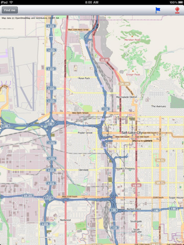
Salt Lake City Street Map for iPad - Do you feel online Google Maps is too slow showing you the map? Do you want an easy way to mark and remember where you are? Do you need a list of streets where you are? You don’t want to carry around a big unwieldy paper map? Tired of having the paper map blown to pieces by the wind every time you try to figure out where you are and where you need to go?
The mobile streetmaps are for you! All the map data is loaded on your iPad before you leave your home, so can you be on the streets, offline, and still know everything about the area you are in, and locate yourself or any street in the city. You don't need any network connection at all once the application is installed on your iPad - no WiFi, no 3G, no GPRS!
This is a complete street level map for your iPad. The entire map is stored on your iPad, so it works where you have no access to the Internet - it works where Google Maps is inaccessible. This prevents expensive data roaming charges by loading all the map data to your iPad before you leave home. You can turn off all network functions and still be able to find your way around. Lets you find all streets, and many useful locations such as ATM's, parkings, museums, and many others. Remembers where you've been so you can find that parking spot where you left your rental car, or that great restaurant. Allows you to mark interesting locations to visit in advance.
Map data (c) OpenStreetMap and contributors, CC-BY-SA.
Like it? Share with your friends!
If you got an error while installing Themes, Software or Games, please, read FAQ.
Supported operating systems:
Apple iOS 10.x (iPad), Apple iOS 11.x (iPad), Apple iOS 12.x (iPad), Apple iOS 4.2.x (iPad), Apple iOS 4.3.x (iPad), Apple iOS 5.0 (iPad), Apple iOS 6.0 (iPad), Apple iOS 7.0 (iPad), Apple iOS 8.x (iPad), Apple iOS 9.x (iPad), Apple iPhone OS 3.2.x (iPad)
Lakes: Massachusetts Lakes: Massachusetts - FlytoMap provides complete, quick and easy to use map applications for navigation for iPhone. Continues in the tradition of offering depth of information and functionality across expected places all over the world, exploring the map you get maximum details obtaining detailed information of every object on the map
Denver Maps Offline Denver Maps Offline - This will be perfect when you are traveling and you don't have internet connection. This Offline Maps is not a replacement of Google Maps. It is used when you don't have internet connection and want to use maps
Budapest Map and Walking Tours Budapest Map and Walking Tours - No need to hop on a tour bus or join a group; now you can explore all the best attractions on your own, at your own pace, and at a cost that is only a fraction of what you would normally pay for a guided tour
Cape Coral - Fort Myers - Naples (FL, USA) Maps Offline Cape Coral - Fort Myers - Naples (FL, USA) Maps Offline - This will be perfect when you are traveling and you don't have internet connection. This Offline Maps is not a replacement of Google Maps. It is used when you don't have internet connection and want to use maps
Nice (France) Offline Street Map Nice (France) Offline Street Map - You don't need to have internet connection for this to work as the map is stored on your iPhone or iPod Touch. Ideal for saving roaming charges or having to find the local wifi to access the built-in map application.
What's New in This Release:
· iOS 5 compatibility changes.
· Further bug fixes and improvements
Houston Walking Tours and Map Houston Walking Tours and Map - No need to hop on a tour bus or join a group; now you can explore all the best attractions on your own, at your own pace, and at a cost that is only a fraction of what you would normally pay for a guided tour
Green Mountain National Forest - Standard Green Mountain National Forest - Standard - Continues in the tradition of offering depth of information and functionality across expected places all over the world, exploring the map you get maximum details obtaining detailed information of each object on the map
Innsbruck Walking Tours and Map This application presents you several self-guided walking tours to see the best of the city, and it comes with detailed tour route maps and powerful navigation features to guide you from one sight to the next
Moscow City Travel Guide Travel Moscow City Travel Guide Travel - It is a very practical city guide since it is designed to be used by itineraries. There are 4 different itineraries for the city depending on the duration of your journey. We also provide tips and advices to travelers, how to get into the city, how to move around, where to shop, where to go at night, most popular places, safety tips, etc..
Other Software by developer «Dubbele.com»:
Delft Street Map Lite Delft Street Map Lite - Lets you find all streets, and many useful locations such as ATM's, parkings, museums, and many others. Remembers where you've been so you can find that parking spot where you left your rental car
Houston Street Map Houston Street Map - Lets you find all streets, and many useful locations such as ATM's, parkings, museums, and many others. Remembers where you've been so you can find that parking spot where you left your rental car
Bern Street Map Bern Street Map - Lets you find all streets, and many useful locations such as ATM's, parkings, museums, and many others. Remembers where you've been so you can find that parking spot where you left your rental car. To make sure your phone doesn't use any expensive data on your trip, go to Settings, then General, tap on Network, and slide the Data Roaming to "off"
Nashville Street Map Nashville Street Map - Lets you find all streets, and many useful locations such as ATM's, parkings, museums, and many others. Remembers where you've been so you can find that parking spot where you left your rental car
Yellowstone National Park Map Yellowstone National Park Map - Lets you find all streets, and many useful locations such as ATM's, parkings, museums, and many others. Remembers where you've been so you can find that parking spot where you left your rental car


 Maps Offline")
 Offline Street Map")


