Kyoto Street Map for iPad - Do you feel online Google Maps is too slow showing you the map? Do you want an easy way to mark and remember where you are? Do you need a list of streets where you are? You don’t want to carry around a big unwieldy paper map? Tired of having the paper map blown to pieces by the wind every time you try to figure out where you are and where you need to go?
The mobile streetmaps are for you! All the map data is loaded on your iPad before you leave your home, so can you be on the streets, offline, and still know everything about the area you are in, and locate yourself or any street in the city. You don't need any network connection at all once the application is installed on your iPad - no WiFi, no 3G, no GPRS!
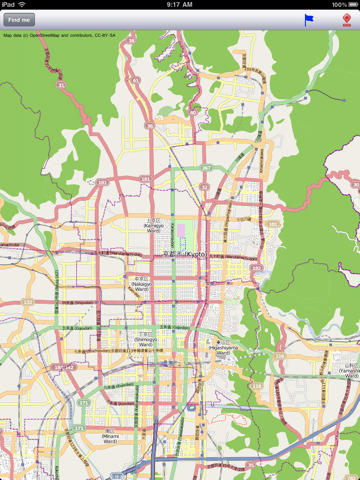
This is a complete street level map for your iPad. The entire map is stored on your iPad, so it works where you have no access to the Internet - it works where Google Maps is inaccessible. This prevents expensive data roaming charges by loading all the map data to your iPad before you leave home. You can turn off all network functions and still be able to find your way around. Lets you find all streets, and many useful locations such as ATM's, parkings, museums, and many others. Remembers where you've been so you can find that parking spot where you left your rental car, or that great restaurant. Allows you to mark interesting locations to visit in advance.
Map data (c) OpenStreetMap and contributors, CC-BY-SA.
Like it? Share with your friends!
If you got an error while installing Themes, Software or Games, please, read FAQ.
Supported operating systems:
Apple iOS 10.x (iPad), Apple iOS 11.x (iPad), Apple iOS 12.x (iPad), Apple iOS 4.2.x (iPad), Apple iOS 4.3.x (iPad), Apple iOS 5.0 (iPad), Apple iOS 6.0 (iPad), Apple iOS 7.0 (iPad), Apple iOS 8.x (iPad), Apple iOS 9.x (iPad), Apple iPhone OS 3.2.x (iPad)
Similar Software:
Donostia - San Sebastian Street Map Donostia - San Sebastian Street Map - Lets you find all streets, and many useful locations such as ATM's, parkings, museums, and many others. Remembers where you've been so you can find that parking spot where you left your rental car
Badlands National Park - GPS Map Navigator Badlands National Park - GPS Map Navigator - Continues in the tradition of offering depth of information and functionality across expected places all over the world, exploring the map you get maximum details obtaining detailed information of each object on the map
Dresden (Germany) Maps Offline Dresden (Germany) Maps Offline - This will be perfect when you are traveling and you don't have internet connection. This Offline Maps is not a replacement of Google Maps. It is used when you don't have internet connection and want to use maps
Miami Maps Miami Maps - software that helps you download and store the travel maps and plans you need. This super-handy app lets you download publicly available maps and store them on your iPhone or iPod Touch. You can download the maps when you have fast wifi connection - and then use any time in the future without delay
Dijon Offline Street Map Dijon Offline Street Map - You don't need to have internet connection for this to work as the map is stored on your iPhone or iPod Touch. Ideal for saving roaming charges or having to find the local wifi to access the built-in map application.
What's New in This Release:
· iOS 5 compatibility changes.
· Further bug fixes and improvements
Saint Martin - GPS Map Navigator Saint Martin - GPS Map Navigator - FlytoMap provides complete, quick and easy to use map applications for navigation for iPhone. Continues in the tradition of offering depth of information and functionality across expected places all over the world, exploring the map you get maximum details obtaining detailed information of every object on the map
Canyonlands National Park - Standard Canyonlands National Park - Standard - Continues in the tradition of offering depth of information and functionality across expected places all over the world, exploring the map you get maximum details obtaining detailed information of each object on the map
Vietnam Map Vietnam Map - This application enables you to use maps offline without internet connection. This includes maps street names detail. This will give peace of mind when traveling aboard knowing you will not be charged with roaming fee. So if you live or travel in that city, it will help you much in your life
The World by National Geographic The World by National Geographic - Exclusively designed to leverage features and functionality for the iPad, The World by National Geographic provides one-touch access to locations worldwide
Vancouver Map and Walking Tours Vancouver Map and Walking Tours - No need to hop on a tour bus or join a group; now you can explore all the best attractions on your own, at your own pace, and at a cost that is only a fraction of what you would normally pay for a guided tour
Other Software by developer «Dubbele.com»:
Innsbruck Street Map Innsbruck Street Map - Lets you find all streets, and many useful locations such as ATM's, parkings, museums, and many others. Remembers where you've been so you can find that parking spot where you left your rental car


 Maps Offline")


