Platforms: iPhone, iPad, iPod Touch, Apple iPhone OS
Categories: Travel & Navigation
Upload date: 21 Jul 12
Developer: Flytomap
License: Commercial
Price: 2.99 $
Downloads: 34
Hong Kong - GPS Map Navigator - FlytoMap provides complete, quick and easy to use map applications for navigation for iPhone. Continues in the tradition of offering depth of information and functionality across expected places all over the world, exploring the map you get maximum details obtaining detailed information of every object on the map.
FlytoMap processes different types of maps for navigation for different categories:
WATER MAPS (Marine):
Water map navigator is the new ‘Marine Navigator for iPhone’ contains embedded Electronic Nautical Charts (ENC) from NOAA compressed to a large coverage. You can now download the application and transform your iPhone in a chart plotter with best NOAA, ENC S57 cartography; which includes Anchoring areas, Fishing areas, restriction areas, obstructions, rocks, Buoys, Beacons, Lights, Depth contours with Values display on map, Spot Soundings and more. The only marine app available in the market with such huge information. Every effort is made to be as accurate as possible when presenting information for every destination.
PARK MAPS:
Park map applications are extremely advanced contains embedded electronic charts with all information collected from the National Park Service and local sources. The maps contain all multiple trails (Hiking, biking, Stairway trails, Bicycle trails, Equestrian trails etc.,) and Point of interests (POI) like Campgrounds, Eating places, Ranger Stations, Picnic areas, Boat/Canoe launching, Parking areas etc., which are provided depending on the relevant park areas they exist.
LAKE MAPS:
We offer high quality lake maps with detailed information and important features compressed to assure the larger coverage in USA region. Lake maps contain most important DNR lakes with detailed ‘Depth Contours, Boat Ramps, Fishing spots etc. Also includes Trails, Roads and Railways information.
TRAVEL MAPS:
These Maps treat you mostly with information of both Marine and terrain correspondingly. These are the most preferable Maps to travel especially for fascinating recreational voyages, map focus the best Beach spots along the Coast line, Major ports, Sailing, Fishing, Picnic areas, Parks, Hiking, Biking, Clubs, restaurants, Famous Hotels, Museums, Shopping areas, and much more.
· Use Latitudes and Longitudes to go to your favorite places
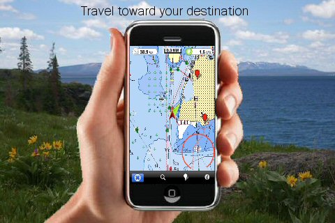
· Insert the target/destination 'Waypoint' and see in real time your speed, distance and direction to destination
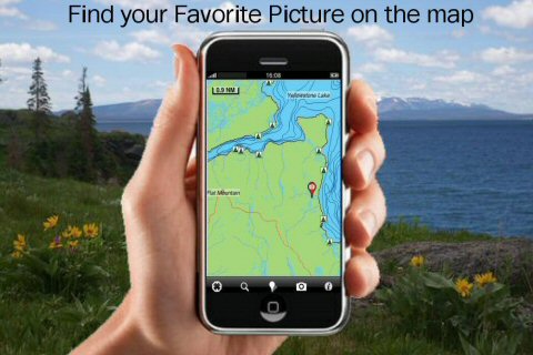
· Insert Unlimited Markers near favorite places on the map
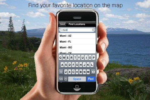
· Search your Favorite points directly
· Zoom, Rotate and Pan fast just by a finger touch
· Navigate and see your GPS position on the map
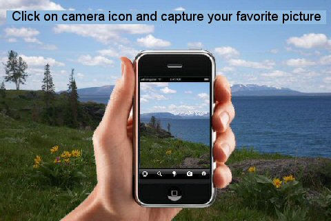
· Geo-Tagged photo management
· Set On/Off Elevation Contours if you feel data is cluttering
What's New in This Release:
· Display of FlytoMap Overlay
· Improved Track Collection when Walking
· Solved a Configuration Problem when Outdoor layer is active.
What's New in 2.5.1:
· Minor bug fixed
· Retina display management
Like it? Share with your friends!
If you got an error while installing Themes, Software or Games, please, read FAQ.
Supported operating systems:
Apple iOS 10.x (iPad), Apple iOS 10.x (iPhone), Apple iOS 11.x (iPad), Apple iOS 12.x (iPad), Apple iOS 12.x (iPhone), Apple iOS 4.2.x (iPad), Apple iOS 4.2.x (iPhone), Apple iOS 4.2.x (iPod Touch), Apple iOS 4.3.x (iPad), Apple iOS 4.3.x (iPhone), Apple iOS 4.3.x (iPod Touch), Apple iOS 5.0 (iPad), Apple iOS 5.0 (iPhone), Apple iOS 5.0 (iPod Touch), Apple iOS 6.0 (iPad), Apple iOS 6.0 (iPhone), Apple iOS 6.0 (iPod Touch), Apple iOS 7.0 (iPad), Apple iOS 7.0 (iPhone), Apple iOS 7.0 (iPod Touch), Apple iOS 8.x (iPad), Apple iOS 8.x (iPhone), Apple iOS 8.x (iPod Touch), Apple iOS 9.x (iPad), Apple iOS 9.x (iPhone), Apple iOS 9.x (iPod Touch)
Similar Software:
CoPilot Live Premium USA CoPilot Live Premium USA - CoPilot Live Premium is a voice-guided GPS navigation app. Designed with you in mind, a new approach to routing combined with a simple to use menu and exciting navigation features directly at your fingertips, CoPilot Live Premium gets you where you need to go, via the way that suits you best
NAVIGON France NAVIGON France - With the NAVIGON MobileNavigator you can transform your iPhone into a fully functional mobile navigation system that is every bit as good as the multi-award-winning personal navigation devices from NAVIGON in terms of its user-friendliness and features
Stuttgart (Germany) Map Offline Stuttgart (Germany) Map Offline - This will be perfect when you are traveling and you don't have internet connection. This Offline Maps is not a replacement of Google Maps. It is used when you don't have internet connection and want to use maps
Everglades National Park - GPS Map Navigator Everglades National Park continues in the tradition of offering depth of information and functionality across expected places all over the world, exploring the map you get maximum details obtaining detailed information of each object on the map
Sau Palo (Brazil) Maps Offline Sau Palo (Brazil) Maps Offline - This will be perfect when you are traveling and you don't have internet connection. This Offline Maps is not a replacement of Google Maps. It is used when you don't have internet connection and want to use maps
NAVIGON U.S. East With NAVIGON MyRegion you can transform your iPhone into a fully functional mobile navigation system that is every bit as good as the multi-award-winning personal navigation devices from NAVIGON in terms of its user-friendliness and features
Lancaster (CA,USA) Map Offline Lancaster (CA,USA) Map Offline - This will be perfect when you are traveling and you don't have internet connection. This Offline Maps is not a replacement of Google Maps. It is used when you don't have internet connection and want to use maps
Albuquerque GPS Guide The only thing we do, help you to move freely as an alien, by "Offline" & "GPS"
Nav4D Oman Nav4D Oman - Single intuitive menu gives the user all the information needed to begin a journey with confidence. Along the way take advantage of the automatic local and global search with rich contents.
Designed to attract everyone, the new interface concept makes usability and design a key point. Nav4D is the perfect navigation system for iPhone
Zanzibar - GPS Map Navigator Zanzibar - GPS Map Navigator - FlytoMap provides complete, quick and easy to use map applications for navigation for iPhone. Continues in the tradition of offering depth of information and functionality across expected places all over the world, exploring the map you get maximum details obtaining detailed information of every object on the map
Other Software by developer «Flytomap»:
Isola d'Elba - GPS Map Navigator Isola d'Elba - GPS Map Navigator - FlytoMap provides complete, quick and easy to use map applications for navigation for iPhone. Continues in the tradition of offering depth of information and functionality across expected places all over the world, exploring the map you get maximum details obtaining detailed information of every object on the map
Indiana Dunes National Park - GPS Map Navigator Indiana Dunes National Park - GPS Map Navigator - Continues in the tradition of offering depth of information and functionality across expected places all over the world, exploring the map you get maximum details obtaining detailed information of each object on the map
Phuket Island - GPS Map Navigator Phuket Island - GPS Map Navigator - FlytoMap provides complete, quick and easy to use map applications for navigation for iPhone. Continues in the tradition of offering depth of information and functionality across expected places all over the world, exploring the map you get maximum details obtaining detailed information of every object on the map
Trinidad & Tobago - GPS Map Navigator Trinidad & Tobago - GPS Map Navigator - FlytoMap provides complete, quick and easy to use map applications for navigation. Continues in the tradition of offering depth of information and functionality across expected places all over the world, exploring the map you get maximum details obtaining detailed information of every object on the map
FlyToMap GPS - All in One FlyToMap GPS - All in One - FlytoMap provides complete, quick and easy to use map applications for navigation for iPhone. Continues in the tradition of offering depth of information and functionality across expected places all over the world, exploring the map you get maximum details obtaining detailed information of every object on the map
Ashton Court Estate - (Bristol) - GPS Map Navigator Ashton Court Estate - (Bristol) - GPS Map Navigator - Ashton Court Estate is a wonderful Historical location a must visit place situated in Bristol. It is surrounded by 840 acres having a mixture of woodland and open countryside. There are steep grassy slopes, plantations of native and patterned trees and a deer park
Theodore Roosevelt National Park - GPS Map Navigator Theodore Roosevelt National Park - GPS Map Navigator - Continues in the tradition of offering depth of information and functionality across expected places all over the world, exploring the map you get maximum details obtaining detailed information of each object on the map
Agate Fossil Beds National Monument - GPS Map Navigator Agate Fossil Beds National Monument - GPS Map Navigator - Continues in the tradition of offering depth of information and functionality across expected places all over the world, exploring the map you get maximum details obtaining detailed information of each object on the map
US Rivers - GPS Map Navigator US Rivers - GPS Map Navigator - Continues in the tradition of offering depth of information and functionality across expected places all over the world, exploring the map you get maximum details obtaining detailed information of each object on the map


 Map Offline")

 Maps Offline")

 Map Offline")


 - GPS Map Navigator")


