Platforms: iPhone, iPad, iPod Touch, Apple iPhone OS
Categories: Travel & Navigation
Upload date: 9 Jul 13
Developer: Fasterre services-conseils inc.
License: Freeware
Downloads: 54
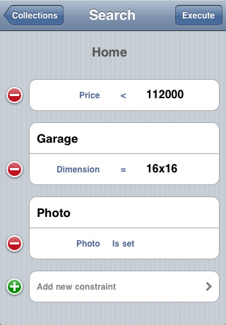
Terrapad Lite - Terrapad gives you the flexibility to enter, query, modify and export your geographic data, all from within your iPad, iPhone or iPod Touch. Driven by a powerful database engine, a unique and simple user interface, and flexible extensions, Terrapad can meet your most demanding needs.
Simple, yet powerful.
We've designed the Terrapad interface around what's most important: your data. That's why Terrapad's map takes up the entire screen. Without any distraction or interface clutter, you're free to pan around and zoom using standard gestures.
Infinitely extensible.
Extensions are to Terrapad what Apps are to the iPad/iPhone. By installing extensions, Terrapad may be configured to allow you to enter different types of information. Whether you're a bird watcher, a fishing afficionado or a frequent traveler, there's an extension made just for you.
We regularly publish new extensions to fit the needs of our users. However, if you need an extension that isn't yet available, let us know how we can help.
Perfectly integrated.
Terrapad takes advantage of every feature of your iPod Touch, iPhone or iPad: from using your device's GPS to sending email and browsing the web without ever leaving the application. Photos and audio recordings can be associated to your data, there's no need to type when you're out in the field!
Calls can be made simply by tapping a phone number field and directions are always available through the Maps Application.
Terrapad can also export your information as KML files for viewing in Google Earth on your computer or as CSV files for manipulation in spreadsheets and databases.
Information can be brought into Terrapad in SHP format.
Survey. Touch. Connect.
Terrapad has the ability to synchronize data between multiple devices within your organization.
Synchronization is a seamless, non-intrusive background process that happens behind the scenes while you are collecting data. Your modifications are sent over-the-air to the other devices sharing your extension, while you will receive everything your co-workers have been collecting.
What's New in This Release:
· Addressed a critical bug that would prevent extensions from being backed up via iTunes or iCloud.
What's New in 2.12:
· Restored support for jumping to a feature's location in an external mapping application (Google Maps and Apple Maps are currently supported)
· Added a button to control linking and unlinking Terrapad and Dropbox via the Wheel's "Application Tools" menu
· Files containing exported SHP data will now have the extension ".zip.terrapadSHPData" (they are regular zip files)
· Resolved a problem when editing an attribute of type list that has no default value and no empty value
What's New in 2.10.2:
· Updated KML export to be compatible with latest version of Google Earth.
What's New in 2.10.1:
· Minor changes to improve overall application stability.
What's New in 2.10:
· Added support for Open Street Map
· iOS 5 Compatibility
What's New in 2.9.2:
· Fixed a bug introduced in version 2.9 when zooming to Terrapad features
Like it? Share with your friends!
If you got an error while installing Themes, Software or Games, please, read FAQ.
Supported operating systems:
Apple iOS 10.x (iPad), Apple iOS 10.x (iPhone), Apple iOS 11.x (iPad), Apple iOS 12.x (iPad), Apple iOS 12.x (iPhone), Apple iOS 4.0.x (iPhone), Apple iOS 4.0.x (iPod Touch), Apple iOS 4.2.x (iPad), Apple iOS 4.2.x (iPhone), Apple iOS 4.2.x (iPod Touch), Apple iOS 4.3.x (iPad), Apple iOS 4.3.x (iPhone), Apple iOS 4.3.x (iPod Touch), Apple iOS 5.0 (iPad), Apple iOS 5.0 (iPhone), Apple iOS 5.0 (iPod Touch), Apple iOS 6.0 (iPad), Apple iOS 6.0 (iPhone), Apple iOS 6.0 (iPod Touch), Apple iOS 7.0 (iPad), Apple iOS 7.0 (iPhone), Apple iOS 7.0 (iPod Touch), Apple iOS 8.x (iPad), Apple iOS 8.x (iPhone), Apple iOS 8.x (iPod Touch), Apple iOS 9.x (iPad), Apple iOS 9.x (iPhone), Apple iOS 9.x (iPod Touch), Apple iPhone OS 3.1.x, Apple iPhone OS 3.1.x (iPod Touch), Apple iPhone OS 3.2.x (iPad)
Similar Software:
CoPilot Live Premium Italy CoPilot Live Premium Italy - CoPilot Live Premium is the essential voice-guided sat navigation app to get you where you need to go, by the way that suits you best.
Detailed street maps of Italy are stored on-board your iPhone so you don’t need to rely on your mobile connection for navigation or worry about losing directions in coverage dead spots
Adelaide GPS Guide The only thing we do, help you to move freely as an alien, by "Offline" & "GPS"
CoPilot Live USA CoPilot Live USA - CoPilot Live is one of the most highly acclaimed mobile GPS navigation applications available, widely recognized by the experts as the best blend of features and performance for an amazing price
Ndrive Hungary Ndrive Hungary - This app will turn your iPhone into a turn by turn voice navigation device.
WHAT YOU ARE BUYING
You are buying a lifetime license of the latest maps. There are no monthly fees or hidden charges.
No data plan is needed to run NDrive software and even when your phone is in roaming, your GPS Navigation from NDrive will run smoothly and uninterupted
Navitel Navigator (Ukraine) for iPhone/iPad Navitel Navigator (Ukraine) for iPhone/iPad - Navitel Navigator is a GPS travel assistant for iPhone, iPad and iPod touch. The app turns your phone into a personal navigation system
real Tide real Tide is able to calculate TIDE at YOUR GPS position! Flytomap's unique copyrighted algorithm is able to do it nicely!
Tidal flows are important for navigation, and significant errors in position occur if they are not accommodated.
The Tides, Currents, and Water Levels Map provides predicted times and heights of high and low waters
Mobile Maps Algeria & Tunisia GPS Navigation Mobile Maps Algeria & Tunisia GPS Navigation - Sygic Mobile Maps is the most complete turn-by-turn, voice guided navigation software.
Maps for Algeria and Tunisia provided by NAVCITIES are with you on your mobile phone.
NAVCITIES is the leading and most reliable cartography provider for Algeria and Tunisia
NAVIGON Brazil NAVIGON Brazil - With the NAVIGON MobileNavigator you can transform your iPhone into a fully functional mobile navigation system that is every bit as good as the multi-award-winning personal navigation devices from NAVIGON in terms of its user-friendliness and features
Washington GPS Guide The only thing we do, help you to move freely as an alien, by "Offline" & "GPS"
Rocky Mountain National Park - GPS Map Navigator Rocky Mountain National Park - GPS Map Navigator - Continues in the tradition of offering depth of information and functionality across expected places all over the world, exploring the map you get maximum details obtaining detailed information of each object on the map
Other Software by developer «Fasterre services-conseils inc.»:
Terrapad Pro Terrapad Pro gives you the flexibility to enter, query, modify and export your geographic data, all from within your iPad, iPhone or iPod Touch. Driven by a powerful database engine, a unique and simple user interface, and flexible extensions, Terrapad can meet your most demanding needs.
Simple, yet powerful


 for iPhone/iPad")


