Navigation gestures - is an application which will add navigation gestures to any Android device. With this program you will get more useful space of screen. Moreover, with the help of this utility you can set gesture functions and change appearance.
Game features:
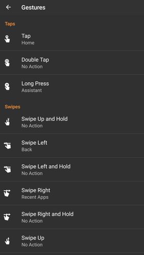
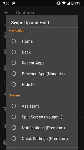
Support of different gestures
Variety of adjustable actions
Tablet mode
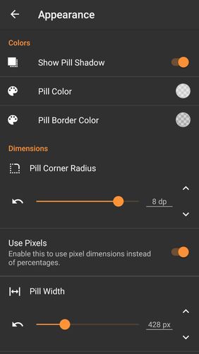
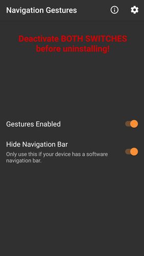
Handy and simple interface
Loading video...
Like it? Share with your friends!
Supported operating systems:
Google Android 10.x, Google Android 4.1, Google Android 4.2, Google Android 4.3, Google Android 4.4, Google Android 5.x, Google Android 6.x, Google Android 7.x, Google Android 8.x, Google Android 9.x
Similar Software:
Back2It Back2It is not just a car locator.
With one click, you may mark places like:
- parking lots
- favorite restaurants
- museums
- theaters
- public park
...
and 1 click to go back with GPS navigation on Google Map.
Switch to Google Map for route
GPS status & toolbox GPS status & toolbox - is a very useful program for working with GPS. This utility is aimed at viewing GPS condition and settings. It can display all data of a sensor and GPS: positions and satellite signal power, accuracy, speed, acceleration, height, step and even battery status
iTrack iTrack is an application for tracking your friend's location in real time. You and your friend must both install this application. Click menu to show current online users; Click your friend and make a request. Your friend will be notified and respond to your request. The map will be updated in real time if your friend allows tracking
MapMe MapMe allows mobile users to locate their position via GPS. If the users move beyond specific range or distance, the application will automatically display the location on a map
My.POI 3 000 000 POIs from Shturmann® database on your Android phone
Mobilex GPS Logger Mobilex GPS Logger - Overview ========================== The Android GPS Logger application captures GPS updates, and saves latitude and longitude coordinate fixes to text files on micro SD card. Supported Features inlcude: ============================== Google Maps. Satellite, Traffic and Street Views
POSIT POSIT (Portable Open Search and Identification Tool) is a Humanitarian Free and Open Source Software project to use the Google Android phone as a platform for mobile disaster management applications
BigTinCan Speed Proof Speed Proof logs your current speed, location and so on to a GPX file as fast as the GPS chip updates the system
Magellano Navigator GPS Magellano Navigator GPS - Magellan will lead you to your destination using the GPS of the smartphone and the engine of Google Maps (registered trademark from the rightful owner) or other application of road maps. You can set the destination by typing in the box or by speaking after activating the voice mode