Categories: Business & Profession, Travel & Navigation
Upload date: 27 Mar 12
Developer: Idea Matters
License: Freeware
Downloads: 17212 File Size: 587 Kb
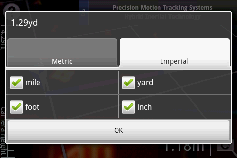
Surveyor - Measure distances with a single click on your Android phone!
All you need to do is point your phone to the object you want to measure, and select the point where it touches ground from the screen.
What's New in This Release:
· Use gyroscope to improve accuracy and smoothness of Augmented Reality result.
· Now support all gyroscope equipped devices (previously only Gingerbread).
What's New in 2.4.1:
· New aim mode for easier control and better accuracy
· Bug fixes
Like it? Share with your friends!
Supported operating systems:
Google Android 1.5, Google Android 1.6, Google Android 10.x, Google Android 2.0, Google Android 2.1, Google Android 2.2, Google Android 2.3, Google Android 3.0, Google Android 3.1, Google Android 3.2, Google Android 4.0, Google Android 4.1, Google Android 4.2, Google Android 4.3, Google Android 4.4, Google Android 5.x, Google Android 6.x, Google Android 7.x, Google Android 8.x, Google Android 9.x
GPS Status & Toolbox GPS Status & Toolbox - Be a GEEK: Get the most out of your phone. Raw GPS data at your fingertips.
Display your GPS and sensor data: position and signal strength of satellites, accuracy, speed, acceleration, bearing.
Tools included: compass with magnetic and true north, leveling tool, mark or share your location and navigate back later
GPSTest GPSTest - Program to show off the GPS capabilities of your Android device. Displays Satellite positions and signal strengths as well as speed, bearing and altitude values. It includes a world map with the day/night terminator overlayed as well as your current location and the suns position
Naver Maps Naver Maps - Smarter than ever! Experience Naver Map for Android. You can find the shortest way to get to your destination, using public transportation even it is far away. You can also search the information on the area around you easily and check whether you are heading to your destination correctly with GPS and compass
GeoLog GeoLog saves the sensors data (gps, accelerometer, magnetometer data, etc.) of your device to a log file and calculates the coverage of the site. The coverage is a ratio of the track covering area to the area of the site (expressed in percents)
Kompas Kompas is a small pocket tool for compass navigation
Epic Compass Epic Compass - When you are a traveler or lost in somewhere place, you must need a compass. Caompass can be used in outdoor and many activities you can do such as hiking, climbing, flying etc
Easy Compass Easy Compass - Easy Compass is a sensor compass for android devices ,with two different designs
Other Software by developer «Idea Matters»:
GeoRecorder The ONLY GPS logger app you'll ever need on the Android platform!
MemoDroid MemoDroid - Memory training tool for Android. Utilizes "spaced repetition" theory to manage intervals for every item based on your responses in previous repetitions in order to boost the efficiency of your learning.
Import SuperMemo data including learning progress
Sensor List Sensor List lists all sensors available on the device along with their current values and a plot to display their changes over time.
Including accelerometer, magnetic field, orientation, temperature, light...
Can be a handy tool for development or hardware testing purpose