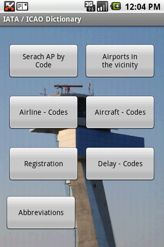
IATA / ICAO Dictionary -This application is an offline database for IATA / ICAO airport, airline, aircraft, delay codes and aircraft registration codes.
The airport database provides:
- Name
- Elevation
- Latitude and Longitude coordinates,
- timezone,
- runway and communication information (not every airport)
- Metar / TAF reports (not every airport)
- google map (not every airport)
- sunrise / set calculation
- find other airport in the vicinity of the selected airport or from your present position (GPS required)
- calculate the distance to the selected airport (GPS required)
The airline database provides:
- Name
- Country
- Callsign
- picture of the airline with airliners.net
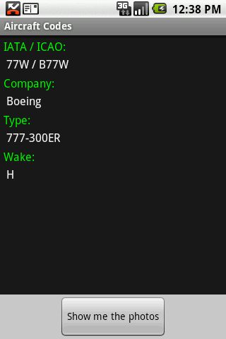
The aircraft database provides:
- Company
- Type
- wake category
- picture of the aircraft with airliners.net
Other functions are:
AC registrations; selection by
- country - registration
- registration - country
Delay codes
general aviation abbreviations
Like it? Share with your friends!
Supported operating systems:
Google Android 1.5, Google Android 1.6, Google Android 10.x, Google Android 2.0, Google Android 2.1, Google Android 2.2, Google Android 2.3, Google Android 3.0, Google Android 3.1, Google Android 3.2, Google Android 4.0, Google Android 4.1, Google Android 4.2, Google Android 4.3, Google Android 4.4, Google Android 5.x, Google Android 6.x, Google Android 7.x, Google Android 8.x, Google Android 9.x
Similar Software:
Parkade App This app will help users get info about the nearest parkade
CafeNavi "CafeNavi" is a useful gadget to search your nearby cafes in Japan. You can search cafes by current location or station name or center of the map. the cafes are displayed on a map and you can get more detail info such as address, TEL, business hours, Wi-Fi and more
Ski Eagle GPS Ski Eagle GPS - SkiEagle the most comprehensive tool for a day on the slopes. This free version contains full GPS tracking and mapping, Piste/Trail recognition, Satellite & Piste maps and live weather
Los Angeles Metro This app grants you fast acces to the last Los Angeles metro map, no internet connection needed once it has been installed. Full zoom controls. Fast, light and simple
Boston commuter rail This app grants you fast acces to the last Boston commuter rail map, no internet connection needed once it has been installed. Full zoom controls. Fast, light and simple
LA Metro Transit LA Metro Transit - Get real time departure information and vehicle tracking for LA Metro Transit.Real time predictions are provided by Next Bus.
Program Features:
-----------------
1) Track real time departures for LA Metro Transit agency.
2) Set up reminders for the earliest next departure for any stop, any route
Uçak Seferleri Uçak Seferleri - Yurtiçi, yurtdışı uçuş bilgileri bu uygulama ile elinizin altında
Hong Kong Metro This application grants you fast acces to the last Hong Kong city metro map, no internet connection once the app has been installed. Zoom controls added for better control. Fast and simple
Southwest Airlines Southwest Airlines- Southwest Airlines Wireless Access puts you closer to the travel information you need while you are on the road and away from your computer. You can access several key southwest.com features via your web-enabled mobile device
Otobüs Saatleri ve Takip Sistemi Bu uygulama sayesinde beklediğiniz otobüsün nerede olduğunu öğrenebileceksiniz! Ayrıca tüm seferlerin otobüs saatlerini kolayca takip ederek, hayatınızı kolaylaştırabilirsiniz.
Other Software by developer «Steve Dexter»:
Guess the X Guess the X - With this game you can guess a flag, a capital, a land and boundaries.
There are four input methods available to enter the answer: an autocomplete editbox, via a listview, multiple choice and a tap mode.
There are also options to change the color, size and font
Snowtam Decoder Snowtam Decoder - You have a snowtam in the metar report, you want to decode. Snowtam Decoder does it for you.
· Decoding of a snowtam in metar format
· Explanation of the items (A ,B , C, ..
Aviation Weather with Decoder Aviation Weather with Decoder - An easy way to receive metar and TAF reports from NOAA