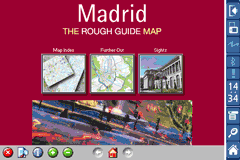
Rough Guides Map Madrid... These guides are a series of fantastic interactive maps.
Produced in conjunction with the premier travel publisher Rough Guides.
Discover and explore Madrid using full colour interactive linked maps, in this simple to use PDA version of The Rough Guides Madrid.
Find all the top tourist spots and key attractions with ease, information on the city and its sights can be quickly displayed with links to photographs and map locations. All in a superb easy to use interface.
If you''re travelling to Madrid, be sure you don''t leave home without this guide on your PDA.
The Rough Guide city maps includes:
Fully scrollable and interactive maps of the city.
Tap any location to display information and available links.
Intuitive navigation bar meaning you are never more than one click away from the information you require.
Map links allow you to directly link to other maps, photographs, or detailed views.
Categorised Find feature allowing you to quickly find any street, place of interest or station.
Categorised Information feature providing a wealth of information on the city, places of interest, etc.
1-Click Home feature, keeping the Home map always at hand.
Zoom function on all maps.
Hi Res & landscape displays supported.
Like it? Share with your friends!
If you got an error while installing Themes, Software or Games, please, read FAQ.
Supported operating systems:
Pocket PC 2002, Windows Mobile 2003, Windows Mobile 5.0, Windows Mobile 6 Classic, Windows Mobile 6 Professional, Windows Mobile 6.1 Classic, Windows Mobile 6.1 Professional, Windows Mobile 6.5 Professional
Similar Software:
amAze (Motorola) AmAze is a first of its kind free navigation and local search service. It is free to download and use and it contains wide coverage of maps including aerial photo in Europe, North America, Australia and parts of Asia and Africa
Travel Milan, Italy - illustrated travel guide, phrasebook, and maps Travel Milan, Italy - illustrated travel guide, phrasebook, and maps - An illustrated city guide, phrasebook, and maps. Indulge Yourself with a personal tour guide on Your PDA. FREE General Info, basic phrasebook and a map in the trial version.
Features
Fully illustrated.
Historical overviews.
Interesting facts
MapTexterer MapTexterer - MapTexterer allows you to create text based GPS maps. When you get a GPS lock then you can create a new map and enter text for the area. When you save the text the map is downloaded and the text and GPS is appended to the end of the map with current GPS.
This program requires that you have both the 'BeanDLL
WMM Wallpaper Map WMM Wallpaper Map locates the coordinates without the use of GPS (like Google Maps), downloads the map from GoogleMaps and sets it as background.
· Supports Today, Sense / TouchFlo, Co0kie's home
· Can change the map zoom and map type (4)
· You can view location marker
· Supported resolutions: SQVGA, QVGA, QVGA L, VGA, WVGA
GPSed Pro GPSed - Mapping Your Impressions
GPSed is a service for trip tracking from mobile. In real time tracks are traced on Google maps and stored in an online archive. With a simple geotagging feature it is possible to pin photos to a map precisely at a place they were taken
TravelMapperer TravelMapperer - TravelMapperer can be used when you travel and need to download offline maps via GPS. The program gets your GPS and downloads 100 maps north/south/east/west from your GPS from Google.com maps and places a GPS tag on them. You can view the maps offline via GPS distance.
This program requires that you have both the 'BeanDLL
Google Maps Mobile WM Street View on your phone, as well as business reviews and walking directions
Take the power of Google Maps with you on your mobile phone.
Real-time traffic — See where the congestion is, and estimate delays in over 30 major US metropolitan areas
MetrO Pocket PC Metro finds your way in public transport systems in more than 350 cities around the world (Paris, New York, London, Tokyo, any city with a subway & many more!).
FREE, FAST & ACCURATE
MapsAligner MapsAligner - MapsAligner allows you to download large maps based on your GPS or with custom latitude and longitude points that you enter. You can use this to compose maps for your GPS applications. The program uses the Google.com maps server for the maps.
This program requires that you have both the 'BeanDLL
Other Software by developer «Visual IT»:
Tube 2 Paris (UIQ) Tube 2 Paris (UIQ) - This map package for Tube 2 consists of a fully scrollable detailed map of the Paris metro and RER system.
Plan journeys on this system, list details of the quickest routes and see a superb animated display of your journey tracking around the system map
Tube 2 London Geo Tube 2 London Geo - This superb map package for Tube 2 is the ideal map for anyone who needs to get around London using the underground system and would like to know just exactly where they are.
The map geographically accurately locates the central London stations, overlaid onto a street map. Now you can easily see how these stations fit into the real world
Tube 2 New York City Pro (Palm OS) Tube 2 New York City Pro (Palm OS) - This map package for Tube 2 consists of a fully scrollable detailed map of the New York City MTA subway system and linked high quality street maps of Manhattan. Also included are additional reference maps of the rail systems surrounding NYC
London Bus for iPad by Zuti London Bus for iPad by Zuti - The new Zuti London Bus map has finally arrived, making it easy to travel by bus anywhere in central London. This clear and colourful map covers a detailed street level area of 6 miles by 4 miles and includes over 1300 bus stops and 189 bus routes
London Central Bus 10 London Central Bus 10 - The new Zuti London Bus map has finally arrived, making it easy to travel by bus anywhere in central London. This clear and colourful map covers a detailed street level area of 6 miles by 4 miles and includes over 1300 bus stops and 189 bus routes
London Visitors A-Z London Visitors A-Z - The London Visitors Map of central London is designed especially for the tourist. The principal feature of the mapping is the highlighting of places of interest, buildings open to the public, theatres, cinemas, selected shops and stores, main shopping streets, main line and underground railway stations and other locations of interest to the visitor
London Underground by Zuti London Underground by Zuti - "London Underground 10" is a superb map and route planner for the London Underground, Overground and Docklands Light Railway (DLR) services. So you can make a quick exit when you leave the train we have now added exit information for all stations on the London Underground
Tube 2 Budapest (Palm OS) Tube 2 Budapest (Palm OS) - This map package for Tube 2 consists of a fully scrollable detailed map of the Budapest metro system and HEV suburban railway.
Plan journeys on this system, list details of the quickest routes and see a superb animated display of your journey tracking around the system map
GB Major Road Atlas (UIQ) GB Major Road Atlas (UIQ) - This map package is an essential addition to your Tube 2 maps if you drive in and around Great Britain.
This reference map gives you a clear view of all the major roads in the whole of Great Britain, you can use the quick find feature to locate any of the 30,000 + GB towns and villages in the database
Tube 2 San Francisco Pro (UIQ3) Tube 2 San Francisco Pro (UIQ3) - This map package for Tube 2 consists of fully scrollable detailed maps of the San Francisco metro & rail systems and linked high quality street maps of central San Francisco


 Hi Res & landscape displays supported.
 ")


")

")


")
")
")