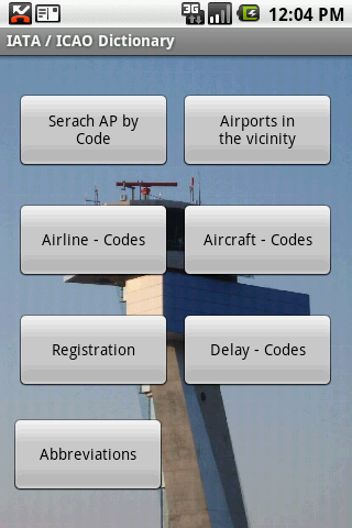
IATA / ICAO Dictionary -This application is an offline database for IATA / ICAO airport, airline, aircraft, delay codes and aircraft registration codes.
The airport database provides:
- Name
- Elevation
- Latitude and Longitude coordinates,
- timezone,
- runway and communication information (not every airport)
- Metar / TAF reports (not every airport)
- google map (not every airport)
- sunrise / set calculation
- find other airport in the vicinity of the selected airport or from your present position (GPS required)
- calculate the distance to the selected airport (GPS required)
The airline database provides:
- Name
- Country
- Callsign
- picture of the airline with airliners.net
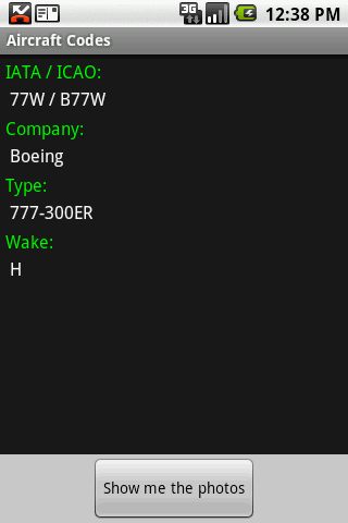
The aircraft database provides:
- Company
- Type
- wake category
- picture of the aircraft with airliners.net
Other functions are:
AC registrations; selection by
- country - registration
- registration - country
Delay codes
general aviation abbreviations
Like it? Share with your friends!
Supported operating systems:
Google Android 1.5, Google Android 1.6, Google Android 10.x, Google Android 2.0, Google Android 2.1, Google Android 2.2, Google Android 2.3, Google Android 3.0, Google Android 3.1, Google Android 3.2, Google Android 4.0, Google Android 4.1, Google Android 4.2, Google Android 4.3, Google Android 4.4, Google Android 5.x, Google Android 6.x, Google Android 7.x, Google Android 8.x, Google Android 9.x
Similar Software:
TrafficDroyd TrafficDroyd - real-time traffic information for the countries of Germany, Netherlands and Belgium.
Display traffic messages both in compact and full view:
· road name (e.g. "A8")
· road segment (e.g
Tokyo Metro This app grants you fast acces to the last Tokyo metro map, no internet connection needed once it has been installed. Full zoom controls. Fast, light and simple
Boston commuter rail This app grants you fast acces to the last Boston commuter rail map, no internet connection needed once it has been installed. Full zoom controls. Fast, light and simple
iCommuteLess Lite iCommuteLess Lite - How much time do you spend commuting? Daily, weekly?
Where are you losing time in traffic?
Which route should you take at a given time?
Would you like to know the answers to these questions?!
Try iCommuteLess. Track daily commutes and derive intelligent feedback
Wareham Forest Park Wareham Forest Park - In This app you will be able to book your next holiday with us and many other options including getting directions to the Park, look at ideas for days out, check the weather ahead and many other useful things. In the coming months we will be updating the app and adding more functionality, including a youtube feed and photos
CafeNavi "CafeNavi" is a useful gadget to search your nearby cafes in Japan. You can search cafes by current location or station name or center of the map. the cafes are displayed on a map and you can get more detail info such as address, TEL, business hours, Wi-Fi and more
Spain Hotels Search Spain Hotels Search
Want to go Spain?
Looking for a hotel in this city or nice hotels at lowest rates?
Los Angeles Metro This app grants you fast acces to the last Los Angeles metro map, no internet connection needed once it has been installed. Full zoom controls. Fast, light and simple
London Visit London Visit - As a global capital for business and tourism, London is busy year-round.
Find out how London Pass works.
Read about great shops, culture, events and nightlife.
Choose between the top London Attractions
Other Software by developer «Steve Dexter»:
Guess the X Guess the X - With this game you can guess a flag, a capital, a land and boundaries.
There are four input methods available to enter the answer: an autocomplete editbox, via a listview, multiple choice and a tap mode.
There are also options to change the color, size and font
Snowtam Decoder Snowtam Decoder - You have a snowtam in the metar report, you want to decode. Snowtam Decoder does it for you.
· Decoding of a snowtam in metar format
· Explanation of the items (A ,B , C, ..
Aviation Weather with Decoder Aviation Weather with Decoder - An easy way to receive metar and TAF reports from NOAA